-2")
VIDEO Analysis: Major Nor’Easter with Myriad of Impacts
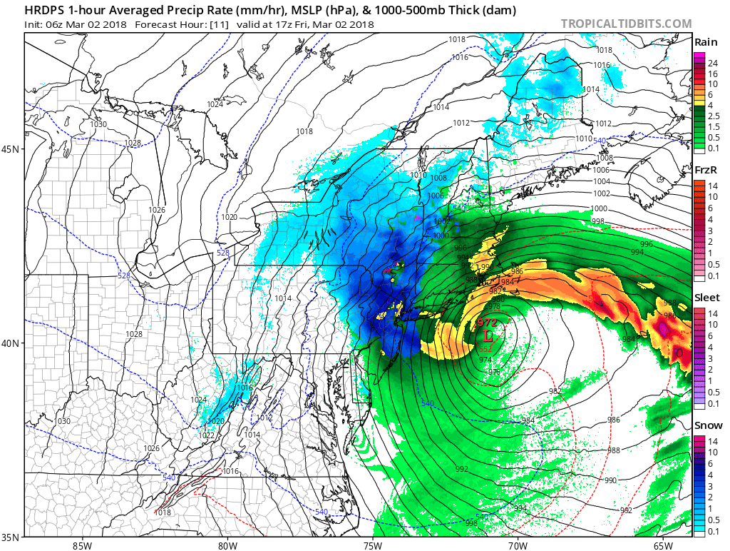
Good morning! Our latest video discussion details the formation and impacts of this major Nor’Easter that will impact the entire Northeast today. Heavy rain will change over to heavy wet snow, leading to significant localized accumulations, but varying precipitation types and temperatures just above freezing will prevent significant accumulations in many locations as well.
Later this morning and this afternoon, there will be multiple bands of heavy wet snow throughout a decent chunk of NJ, NYC, W LI, and the Hudson Valley — and when combined with wind gusts between 50 and 65 mph, blizzard conditions are likely. But areas in between these bands will have lighter precipitation and thus rain, and nailing down these specifics is extremely challenging.
Thus, we want to emphasize the impacts rather than the actual snowfall accumulations. The strong winds combined with heavy precipitation with already quite moist top soil will lead to some tree damage and power outages. Coastal flooding is also likely, as the low-level jet rams into some coastal areas — especially for coastal New England. Surprises are in store as well, as some locations are going to receive a lot more snow than expected, but other locations very close by may not receive much snow at all!
Trackbacks & Pingbacks
2appointment
Comments are closed.