VIDEO Analysis: Potential Heavy Snow on Wednesday
The very active pattern for early March will continue, as we are tracking yet another potential major storm system that would impact the area on Wednesday. The large -NAO blocking pattern will continue, which will force multiple potent, dynamic disturbances to our south, and with the airmass a bit colder this time around compared to the Friday’s storm, snow — potentially heavy — is a much bigger threat for the NYC area.
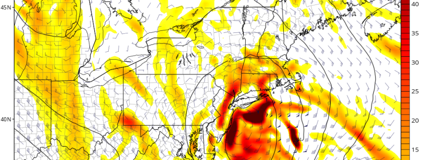
In our latest video, we discuss Sunday’s 12z ECMWF (Euro), Sunday’s 18z GFS, and Sunday’s 18z NAM. The Euro is the furthest east solution, which would only give significant snow for Long Island and Southern New England, the GFS is the furthest west solution, which would give the immediate I-95 suburbs a significant snowfall, but areas further southeast more rain and subsidence, while the NAM is the snow-lover’s ideal “in between”, which hits the entire NYC Metro region with a heavy snowfall. Not only is the NAM model “in between”, but it is also the most dynamic of the three solutions, maturing its mid-level centers earlier. If this were to occur, the storm would slow down just off the coast, and bring in a heavy band of snow for a long period of time.
This storm is an interesting case, because it could track very close to the coast, which would normally mean a rain event. However, with the circulation very compact and dynamic, more northerly winds would “rush” in towards the center of the storm than is usual, so the banding could be more compact and stronger closer to the coast, and temperatures could also be much colder than what is “typical” for a storm track of this nature.
We also discuss why each model is portraying the scenarios they are, as well as which we believe is most likely to occur in this pattern.


Trackbacks & Pingbacks
3erudition
Comments are closed.