-2")
Another storm possible Monday, but impacts less certain
On the heels of two significant Nor’Easters, one of which many are still recovering from after heavy snow downed trees and brought travel to a halt in the suburbs on Wednesday, forecast models are suggesting the potential for a third storm system late this weekend and Monday across the Mid Atlantic and Northeast states. The pattern in the mid and upper levels of the atmosphere, however, remains a bit convoluted and crowded – and confidence is quite low in how the system evolves.
The overall synoptic evolution in the atmosphere features multiple important areas of energy. First, a disturbance drops down from Canada and situates itself over the Tennessee River Valley this weekend. It then begins to move towards the US East Coast. At the same time, another area of energy over Canada will drive southward towards the Great Lakes. How these two disturbances interact will be critical – a phase between the two could form a big storm, while less interaction or limited interaction will allow the storm to track well out to sea.
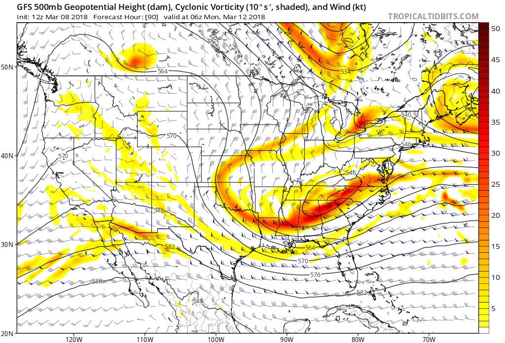
GFS model with 500mb vorticity and heights for Sunday
The pieces are certainly all there for a big storm – a big high latitude block is still sitting in Canada after emerging from Greenland last week. This means the atmosphere in the North Atlantic is a backed up traffic jam of sorts, with disturbances moving slowly and in directions that they usually dont (this was one of the reasons that the big storm on Wednesday tracked where it did). But the two pieces of energy that we would need to see interact in order to get a significant storm on Monday aren’t aligned properly.
Both of them are set up too far east initially – on current ensemble guidance, we should note – so that interactions and any phasing occurs out to sea. Model guidance has followed suit with the idea that the low pressure center will move towards the Tennessee Valley and then re-develop offshore. But without an impetus to move up the coast, it simply slides eastward into the Atlantic Ocean. Impacts would still be possible in the Mid-Atlantic states if that initial disturbance trends a little stronger and can push precipitation northward towards areas like Washington, D.C.
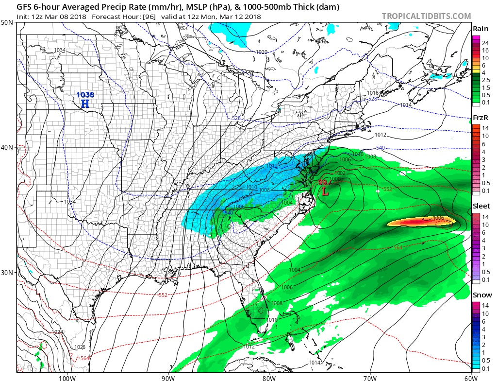
GFS model show a significant winter storm for parts of Mid-Atlantic region
Still, as it currently stands, our confidence is highest that the storm will track well to the south and east of the majority of the Northeast states. While it’s still certainly possible the disturbances interact and phase to bring the system up the coast, we aren’t hedging toward that scenario occurring. If it did occur? Wintry impacts could be widespread as snow would again spread northward up the coast.
Stay tuned over the next few days for more details as we continue to analyze the very latest data, observations and information.
Trackbacks & Pingbacks
3contribution
Comments are closed.