-2")
VIDEO Analysis: Light to Moderate Snow Likely, Some Changes Still Possible
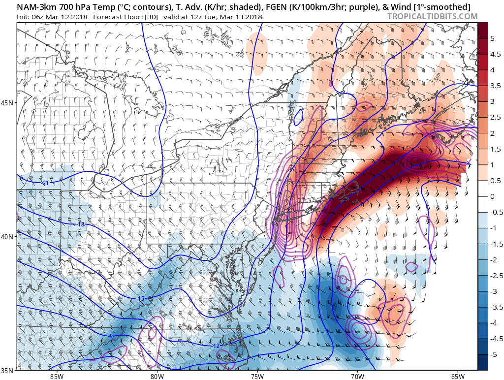
Good morning! Our latest video elaborates on the evolution of our snowstorm for tonight into Tuesday. It will become quite a powerful Nor’Easter and bring a blizzard for Southern New England, but most of the heavy snow will ultimately not affect our area. We explain why that is the case, but also why there is enough volatility to this setup such that small, and still possible short term changes with the evolution of the storm could have a vast impact on the track of the storm.
We also take a look at current observations to check how it compares to some of the models. We can automatically give more credence to a model that appears to be simulating the current atmosphere correctly, but any vastly snowier outlier that already has the pattern in the 5:00am – 8:00am timeframe wrong will only have that error compounded with time, and thus needs to be discarded. But again, given the volatility, there is still a chance that a model that initialized correctly can still output a snowier solution.
Regardless, however, the partial interaction between a polar shortwave and a potent southern shortwave will allow some light to moderate snow in our area, perhaps bringing quite the slick Tuesday AM commute.
Trackbacks & Pingbacks
2conscript
Comments are closed.