-2")
NYC Area Forecast: Improving conditions lead us to midweek
Okay, take a breath.
Three weeks removed from a large-scale pattern change which featured the development of a classic Greenland Block, we have experienced three Nor’Easters, all of which have been impactful in the Northeast states. As we move towards midweek, much of the Northeast states will finally catch a break. The departing Nor’Easter will leave blustery conditions with a few snow showers and squalls expected, but overall conditions will improve as high pressure builds in.
Temperatures will remain well below normal, and that will be the theme of the next several days – Cold. Much of this can be attributed to the re-development of another Greenland Block during the next few days, as forecast models suggest the pattern will begin to reload. Greenland Block’s are, in their nature, ridges of high pressure over Greenland and the higher latitudes of the Arctic that dislodge cold air further south into Canada and the Northeast States.
And so the pattern is expected to March on (ha!) into the middle part of the week and weekend. It does appear that we will experience a brief period of moderation during the weekend ahead, which will obviously be welcomed with open arms. Forecast models suggest temperatures will moderate to near and above normal values for a period of time as ridging builds and extends into the East.
Looking ahead to a future that looks similar to the past
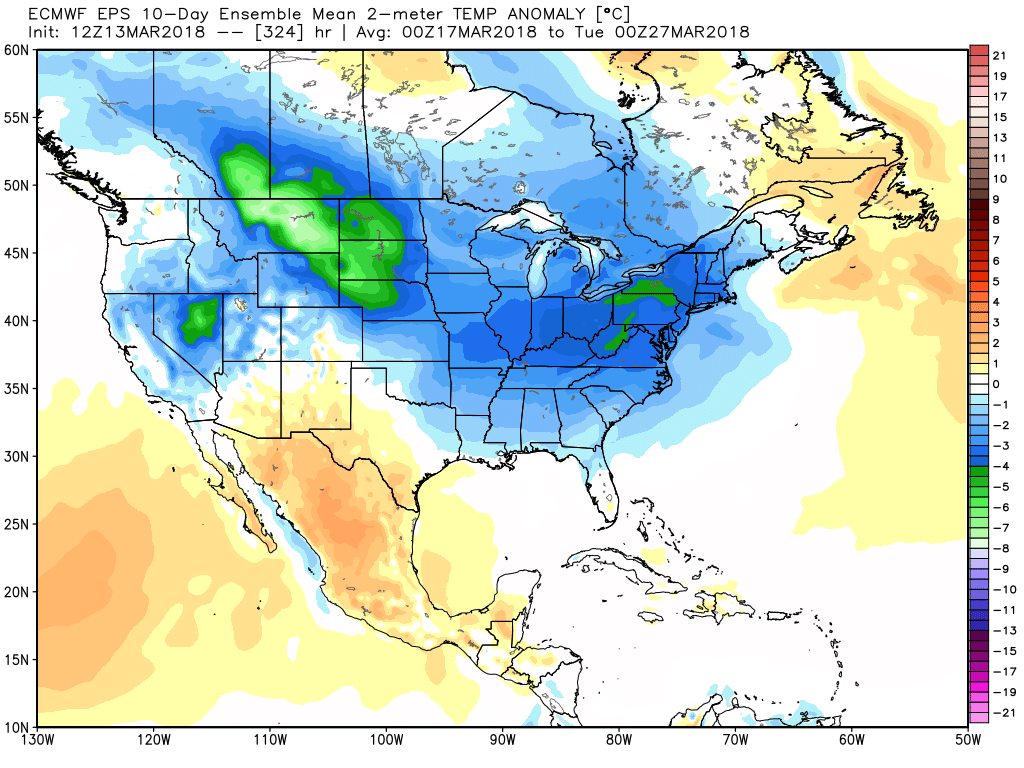
European Ensemble showing much colder than normal air across the USA in late March.
A look ahead to the next week or so brings us to a very similar conclusion – the weather pattern is expected to remain cold, it is expected to remain stormy, and it is expected to feature the potential for wintry weather. Forecast models are already beginning to hone in on the next series of potential events which could begin as early as next Tuesday. Another Greenland Block is expected to develop in about 5 days time – and as we have mentioned before, these features are quite important.
They serve to build ridging into the higher latitude regions of the Atlantic and Northern Canada. Air that typically resides in those regions is shifted around, often moving south towards Canada and the Northeast States. The atmospheric pattern is also completely re-shuffled, with disturbances having a much higher percentage chance than normal to impact the Northeast States significantly.
As the cold air and jet stream is displaced south from the higher latitudes, cold air almost always results. The European model and its ensembles are set on temperatures averaging several degrees below normal over 5 and 7 day periods, which is quite an impressive signal for such a long duration as we move through the middle and towards the end of March. In fact, this cold air stretches from the Northern Plains into the East!
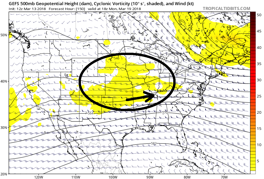
GFS Ensembles showing the development of a potentially impactful system next week.
As a Greenland Block redevelops, a disturbance is forecast to cut underneath our region and move into the Tennessee Valley and Mid-Atlantic states. To varying degrees, forecast models suggest the potential for another low pressure developing off the Mid Atlantic states with wintry precipitation impacting the Mid-Atlantic and Northeast.
The details, at this point, remain insignificant. We’ll continue to monitor the overall threat period as the spread of potential solutions remains quite high at this range. Stay tuned over the next few days for further updates as this threat period approache.s
Trackbacks & Pingbacks
3improvement
Comments are closed.