-2")
NYC Area Forecast: Chilly Weather into the Weekend, Blocking Returns by April
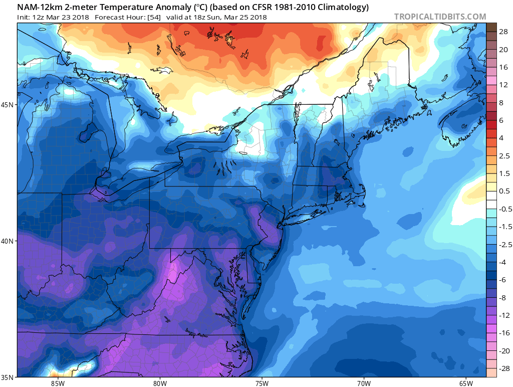
Happy Friday! Partly sunny skies and chilly conditions are expected overall across the region today. But a shortwave trough with some instability will be moving through the region this afternoon and evening. A few isolated rain or wet snow showers and some gusty northwest winds are possible, as it moves through. High temperatures will be in the middle 40s. Later tonight, skies will be clear to partly cloudy. Temperatures will drop overnight into the mid-upper 20s over the Interior to lower to middle 30s over NYC and urban areas.
For the weekend, mostly calm weather conditions are expected, as a another winter storm system is forced well to our south by strong confluence around a larger upper-level trough over the Northeast US. But a more potent polar shortwave rotating around this trough, may produce some isolated rain or wet snow showers again, as moves through region Saturday night or Sunday. Otherwise, high temperatures will be in the lower to middle 40s with some clouds and sunshine each day. These temperatures are still several degrees colder than normal for this time of year.
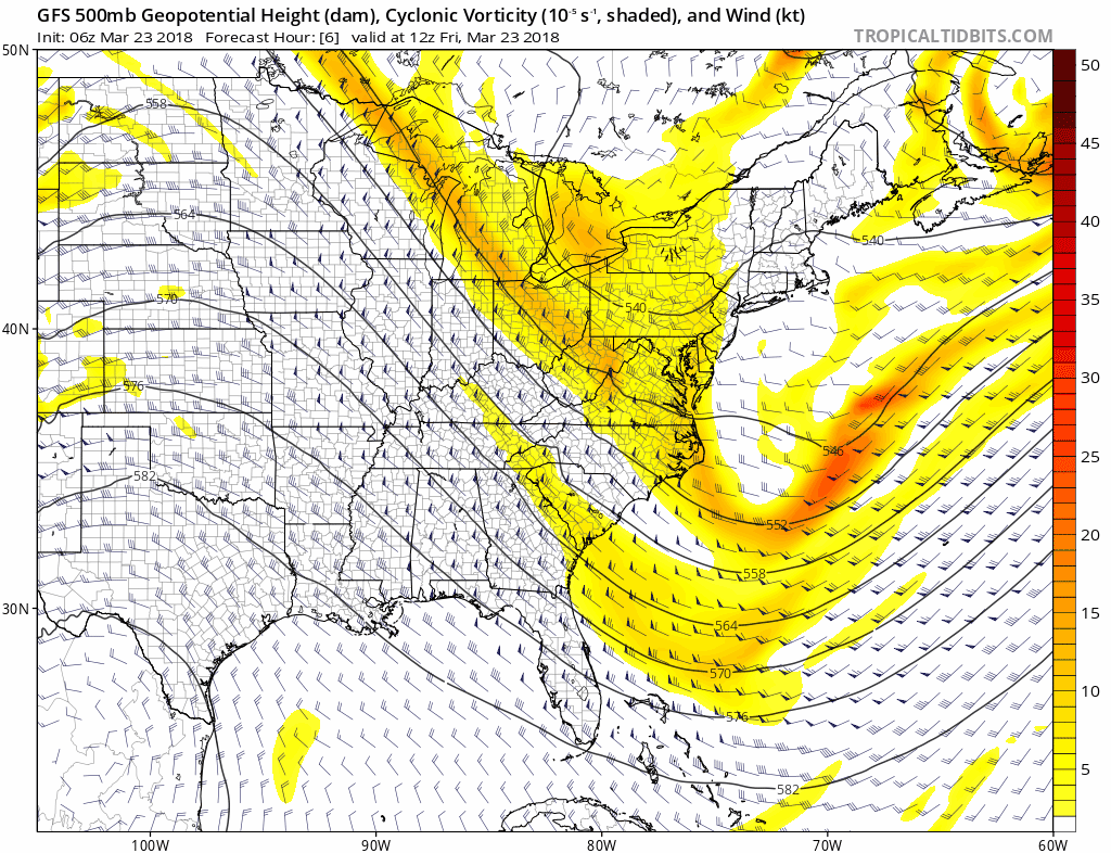
GFS model showing shortwave troughs rotating around upper-level trough over the Northeast through this weekend.
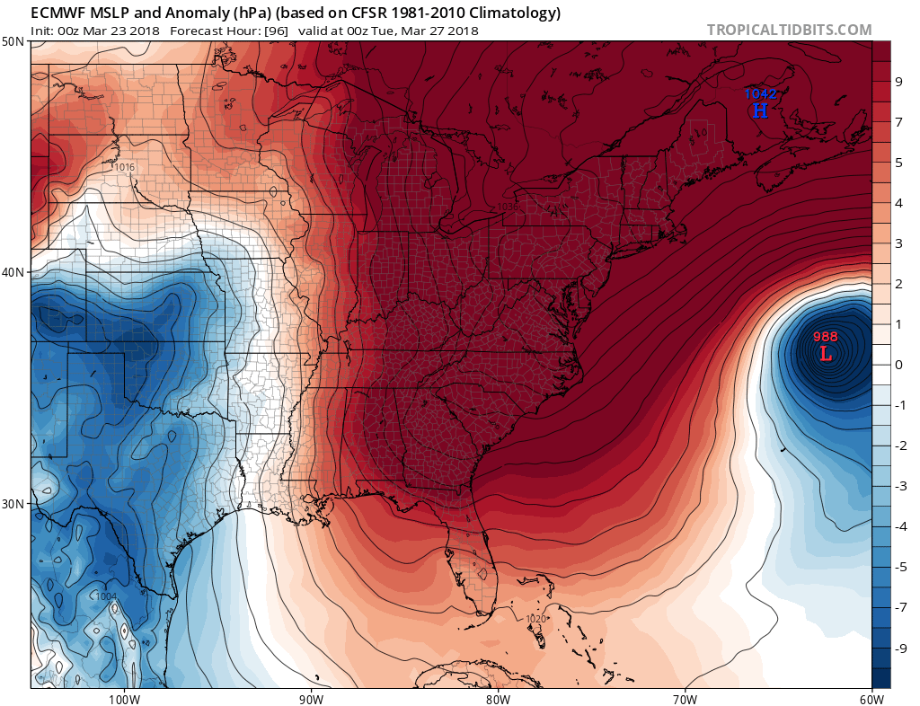
For Monday and Tuesday, strong high pressure will become situated from the Canadian Maritimes into the Northeast US, as large storm develops well out over the Western Atlantic. High pressure will keep that storm away and provide more calm weather with temperatures remain somewhat cooler than normal in the local region. Then later in the week, temperatures may start moderating closer to normal, ahead of an approaching large upper-level trough and a frontal system that could also bring more significant rainfall.
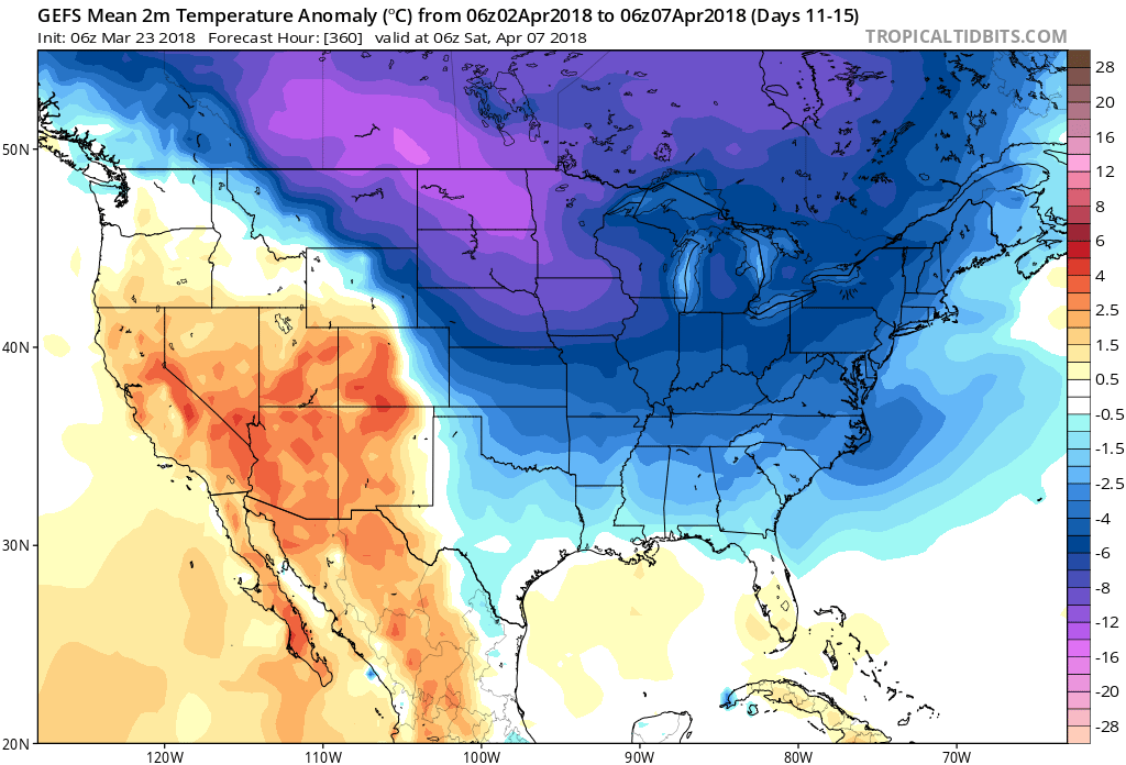
However, high-latitude blocking is expected to return with a -NAO ridge building near Greenland and -EPO ridge building near Alaska. This will allow for a cross-polar flow and more cold air to dislodge from Canada into the much of the Central and Eastern US. Temperatures will once again return to below seasonal normal levels, especially from over Northern Plains to the Northeast.
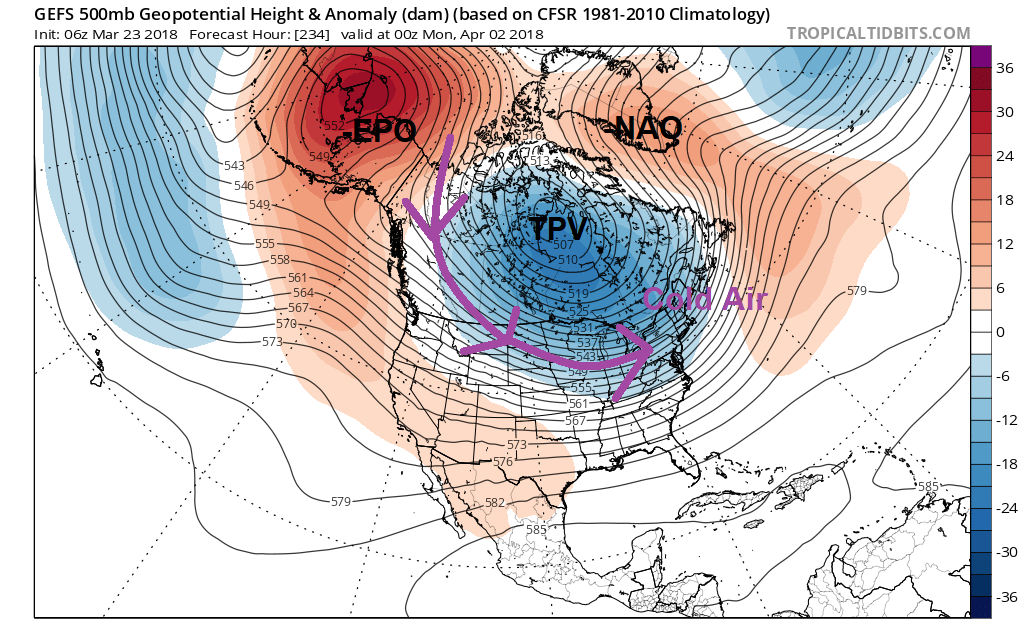
GFS ensembles showing high-latitude blocking establishing a cross-polar flow of colder air into the Central and Eastern US during early April
An active pacific jet may also result with in more storm threats with some wintry precipitation, as we move into the first week of April, especially for the Interior areas. So with all this being said, it doesn’t appear we will be seeing too much Spring-like weather over next few weeks at least. Stay tuned more updates on the long-range pattern over the next several days. Until then, have a great weekend!
Trackbacks & Pingbacks
2thunderstruck
Comments are closed.