-2")
Storms and gusty winds today, more snow ahead?
I suppose that sometimes you have to throw your hands up and say “fine”. That’s exactly what we’ll be doing this week as we track another potential winter weather event. But lets get to the weather at hand first – it’s stormy, dreary, windy and mild. Showers this morning will give way to cloudy and drizzly conditions during the late morning and early afternoon as a warm front moves northward. Southerly winds will pick up as the warm front moves towards the NYC Area near noontime.
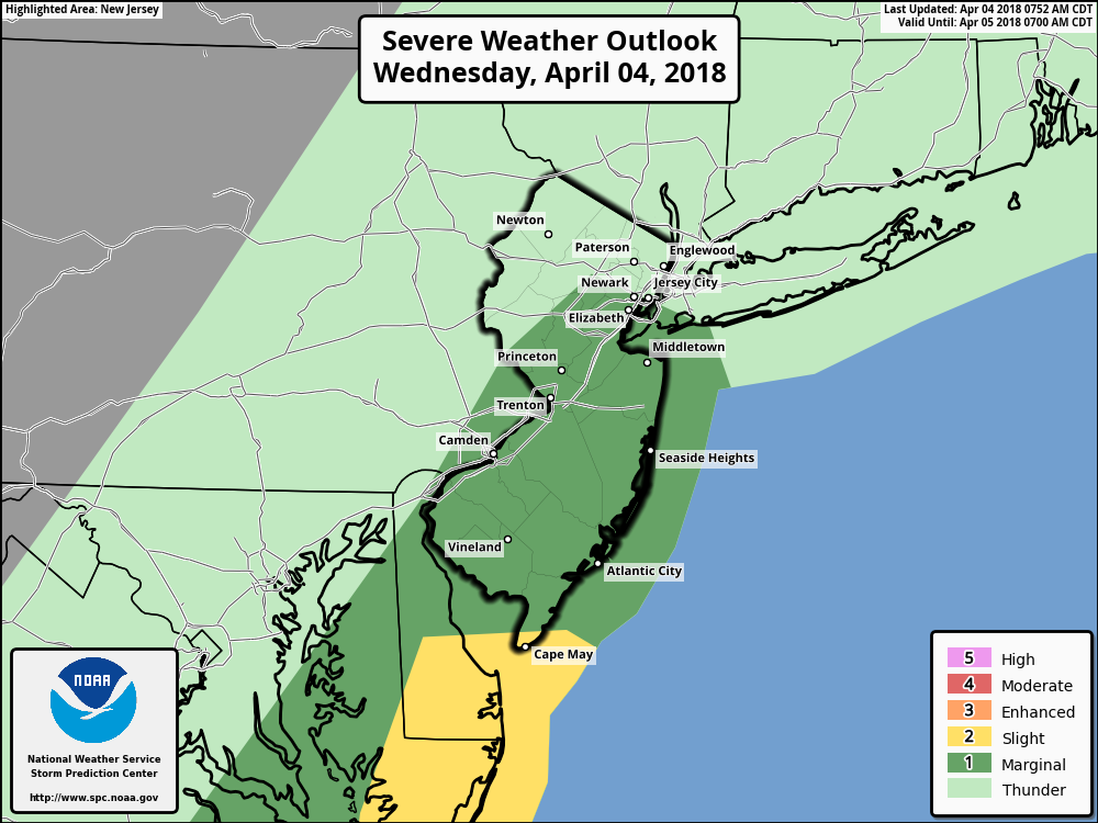
After a lull in precipitation, showers will increase in intensity again as a cold front approaches during the afternoon hours. In fact, strong forcing in the atmosphere for heavy precipitation (aided mostly by a mid level shortwave and jet stream energy) will aid in the development of some thunderstorms as well. Marginal instability in the atmosphere will mostly limit the threat for severe weather, but favorable kinematics – mostly characterized by a strong low level jet – will lead to the potential for a few stronger storms. The Storm Prediction Center has placed most of the area in a Marginal Risk for severe thunderstorms.
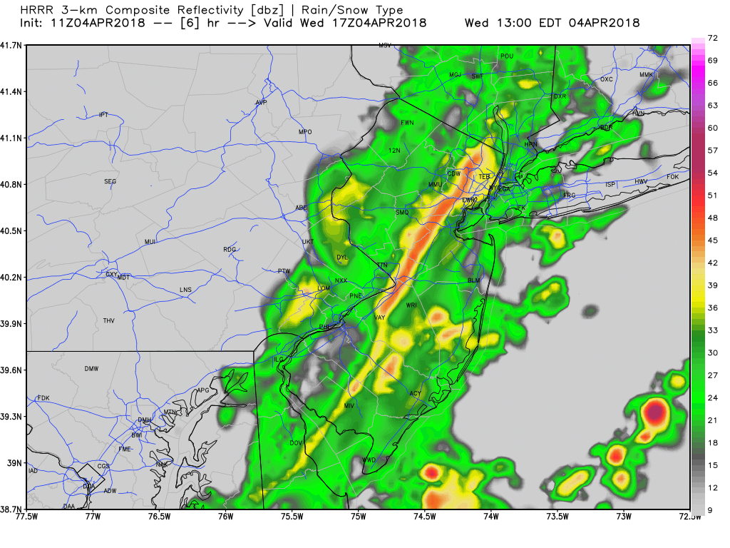
Latest HRRR model showing a line of showers and thunderstorms moving through parts of New Jersey and NYC area early this afternoon
Skies are expected to clear later this afternoon with sunshine returning. Despite the passage of a frontal boundary, the atmosphere will remain quite warm, and the sun will allow for warming temperatures into the lower and middle 60’s. Wind gusts, however, will continue, as the strong jet dynamics remain overhead. The potential exists for 50-60kt winds to mix down to the surface even behind the frontal boundary.
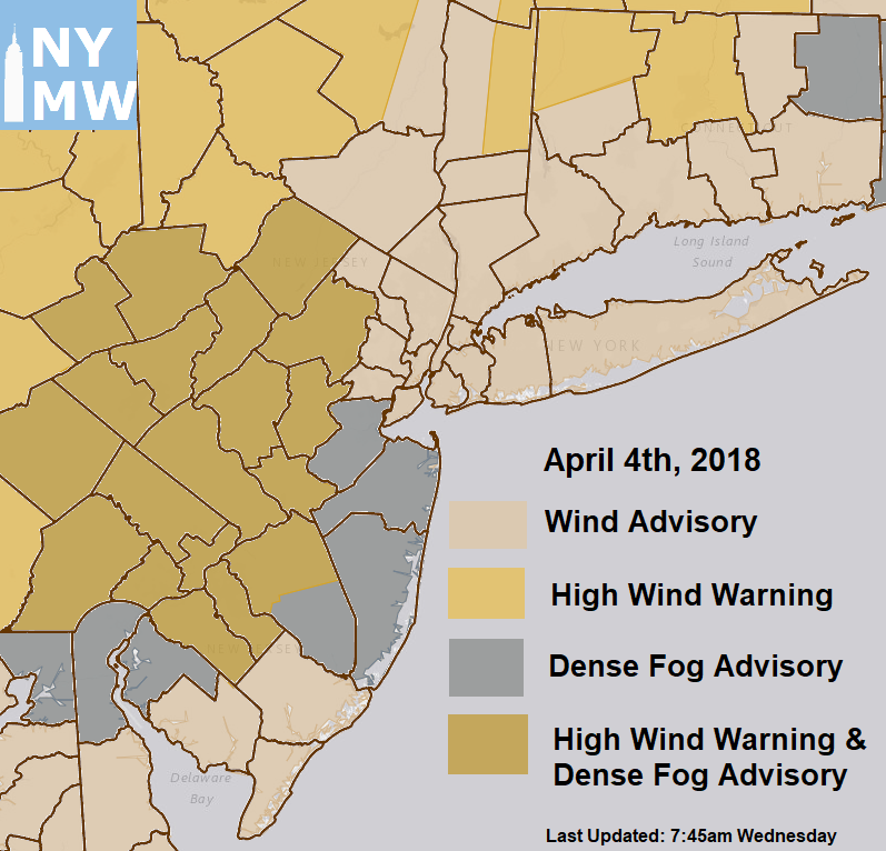
Accordingly, the National Weather Service has issued Wind Advisories or High Wind Warnings for a large majority of the region. Again, these are for winds behind the thunderstorms, after clearing has occurred and the atmosphere begins mixing. Some of these gusts could be strong – but the good news is that temperatures will be quite warm and the afternoon should be mostly enjoyable.
And that’s right about where the enjoyable stuff ends.
Blustery winds arrive later tonight and a much colder airmass sweeps in. Temperatures will fall into the mid to upper 20’s in many areas and a strong northwest flow develops on Thursday. Despite high pressure in control and mostly sunny skies, temperatures will be several degrees below normal for this time of year with high temperatures struggling to reach the middle to upper 40’s. Another frontal system will be moving through, with possibly a light wintry mix for parts of the region, sometime late Thursday night into Friday morning. Then another reinforcing shot of cold air follows behind that system for later Friday afternoon and night.
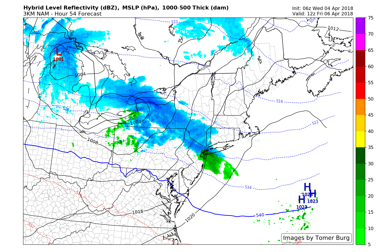
3km NAM model showing light wintry mix of snow and rain early Friday morning
We will be keeping a eye on that system for the Friday morning commute. But things may get worse this weekend, as cold air still lingers to our north and another disturbance approaches the area from the Tennessee Valley. Forecast models are keying in on the potential for a low pressure development on a frontal boundary sagging to our south – and its development could help snow overspread the Mid-Atlantic and parts of the Northeast states on Saturday.
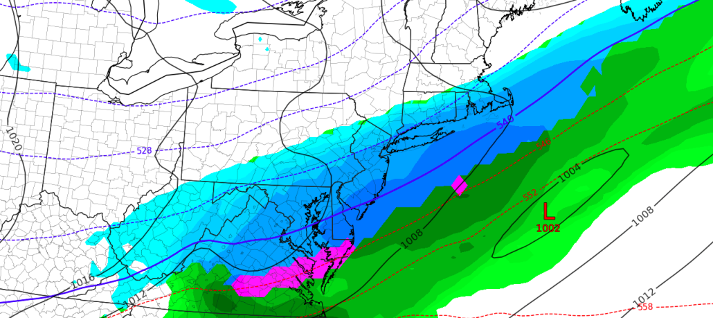
The ECMWF EPS, in particular, suggest the low pressure development could be more significant. Probabilities of snowfall over 3″ are up near 70% across much of the Mid Atlantic towards New York City including much of New Jersey. The GFS remains slightly more progressive with the system as a whole.
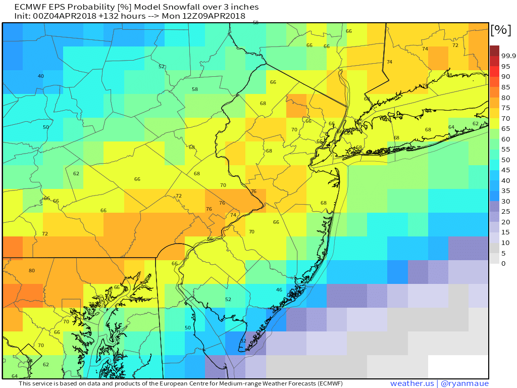
ECMWF EPS showing 60>% probabilities for snowfall greater than 3″ over the region.
The storm system itself remains progressive and somewhat weak, but the potential does exist for snow to develop if the mid level disturbance is as strong as the GFS and ECMWF indicate. Snow would likely spread northward into the Mid Atlantic on Saturday and continue its movement northward through the day. While marginal temperatures would limit accumulations overall, the impacts from the storm system would largely depend on the track of the storm and potential for any heavier bands of snow.
We will continue to monitor the latest available guidance and data over the next 24-48 hours, with additional updates on winter weather impacts and potential hazards during that time frame.
Trackbacks & Pingbacks
3concluded
Comments are closed.