-2")
Spring weather finally on the way later this week
At long last.
Forecast models have come into agreement on a pattern evolution that will support Spring-like weather throughout the Eastern part of the United States later this week and into this weekend, as a strong storm system develops in the Northern Plains states and then ejects northeastward towards the Great Lakes. A frontal boundary will shift eastwards into the Plains and eventually the Mississippi River Valley, but the amplified storm to our west will draw in Southerly winds and bring warm, moist air northward.
It won’t come without the need for some patience, as the beginning of this week has already started off very cold. Temperatures are well below seasonal averages and will remain there for the next few days with a cold high pressure overhead. A weak disturbance shifting by on Tuesday may even prove sufficient to produce rain and snow showers across the region – with snow particularly possible in the interior and higher elevations of New Jersey, Pennsylvania, and New York.
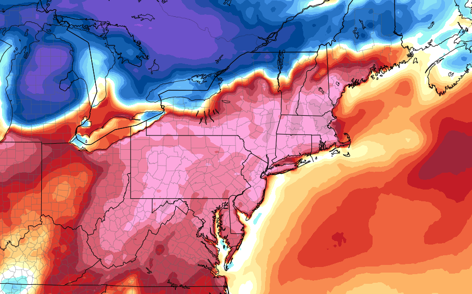
As that system departs, though, the pattern will begin to undergo the changes that we discussed. High pressure builds in to the Northeast states again on Wednesday, but this time the return flow that develops around it will be much warmer. This is a stark contrast to the weather we have experienced for the past month or so, which has largely been dominated by a northwesterly wind that has drawn in cold air from Canada.
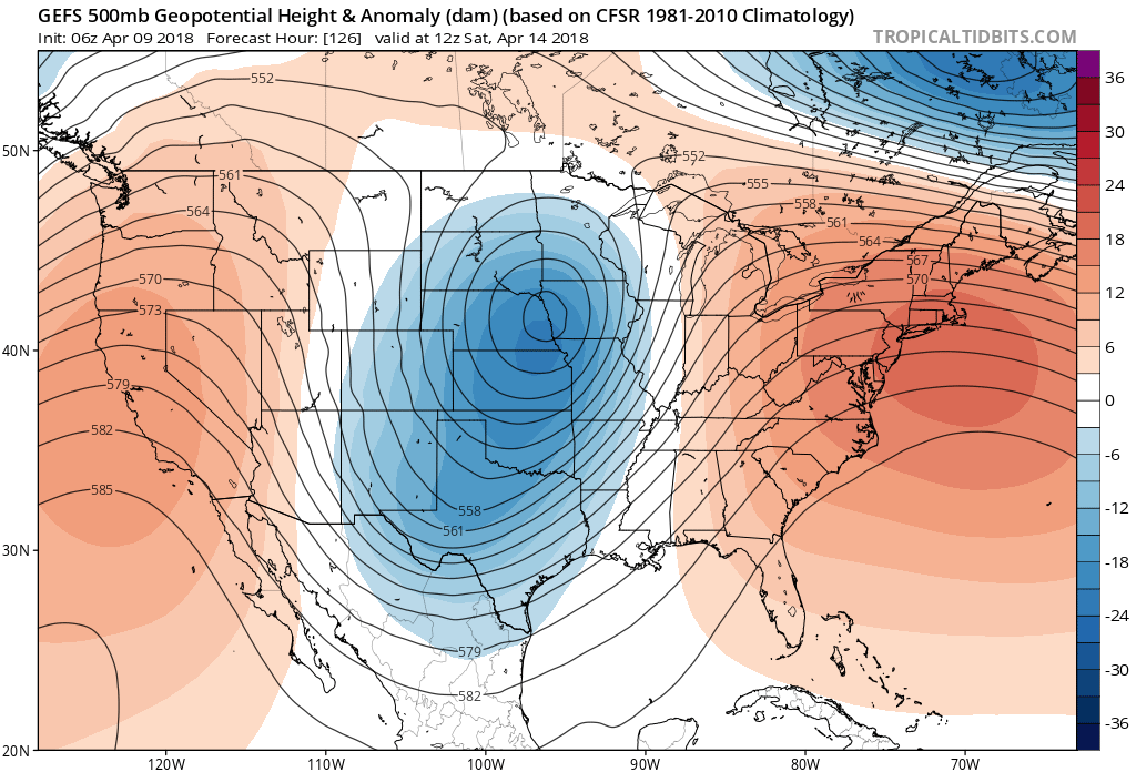
Large, deep upper-level trough/low associated with very powerful storm storm system over the Plains, pumps the ridge over Eastern US by late week
A weak storm system will pass through New England on Thursday morning, right along a warm front that will be situated near or north of the New York City area. Showers and a few storms will be a distinct possibility as it moves through Southeast Canada and into New England, but the storm system will also serve to mark a change in the airmass overhead, as south/southwesterly winds will really begin to draw in the warmth. Although Wednesday will feel “Warmer” for sure, it is Thursday and Friday when the difference will really become apparent.
By Friday, a powerful storm system is expected to develop in the Central Plains, and this will further amplify the weather pattern – putting the final icing on the cake of a warmup that we have struggled mightily to obtain here in the Northeast states. Nevertheless – forecast models are suggesting the potential for temperatures that will feel downright balmy – in the mid to upper 70’s across a huge stretch of the area – on Friday and Saturday.
Things get a bit more complicated on Sunday, as the atmosphere starts to fight back. There are still lower heights located to our northeast, and the low level flow suggests the potential for the dreaded “backdoor cold front”. These fronts are typical in Spring around the Northeast states, as they “back” southward from New England and bring cooler, maritime air back into the area and push the warmth away. The GFS and ECMWF have already suggested this potential.
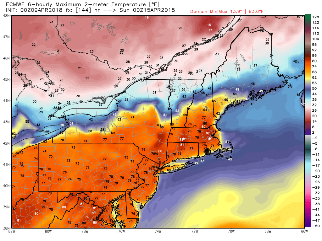
ECMWF model forecast high temperatures in the upper 70s to near 80 in parts of the Northeast on Saturday!
Nevertheless – this storm system to our west slowly crawls eastward, and by next Monday the potential looks heightened for unsettled weather. Plentiful moisture will advect along the frontal zone, suggesting the the potential for torrential rainfall in the Northeast states. The news gets even worse thereafter – as widespread cooler than normal air comes surging in behind the storm system from Days 7-14 on almost all forecast model guidance.
But, lets digress. It appears increasingly likely that widespread warmth will finally overspread the region – albeit briefly – from Friday into Saturday. After the month or so that we’ve had, I think we will all take it. More to come this week!
Trackbacks & Pingbacks
2advisors
Comments are closed.