-2")
Warmer Today, Then Cooler & Unsettled Weather Returns
Happy Tuesday! Today will be much warmer and more humid than yesterday. More upper-level ridging with subsidence builds into Northeast today. This will cause low clouds again this morning, to clear for more sunshine by the afternoon hours. Southwest winds will also help temperatures rise well into the 80s across the region. Along the south-facing shores, sea-breezes will keep temperatures in the 70s.
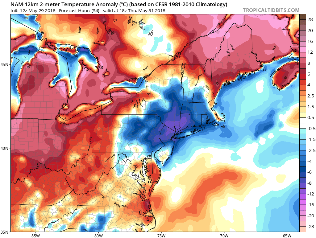
Then as high pressure sets up just off New England, it will cause a backdoor cold front to push south into the region by late tonight. A few isolated or widely scattered showers or thunderstorms are possible, ahead of this front, later this afternoon and evening. More onshore winds will support more low-level moisture to increase, with some low clouds and patchy fog to develop across the region again. Temperatures will only fall in the 60s tonight in the suburbs, perhaps just lower 70s around New York City and urban areas with more humidity.
On Wednesday, any low clouds and patchy fog around early in the morning, should gradually clear again for more sunshine during the day. This occurs as subsidence from high pressure begins to nose more into the region. But this will still support a maritime airmass with southeast winds off the cooler Atlantic ocean. So expect high temperatures to still be a little cooler today–in the upper 60s near the coast to the middle 70s further inland.
On Thursday and Friday, a frontal system associated with a shortwave trough will begin approaching from the Great Lakes. This system will begin to force the backdoor cold front to return north as a warm front. But exactly how quickly the warm front moves northward, as models have shown differences with frontal timing. On Thursday, we see currently high pressure will only be slowly departing east of New England. So more southeast winds, ahead of the front, are likely to result in a more marine airmass with mostly cloudy skies again over much of the region, through at least Thursday night. Lift and some weak elevated instability, from warm-air advection aloft, may also lead some scattered showers, isolated thunderstorms or just some drizzle, for parts of the local region.
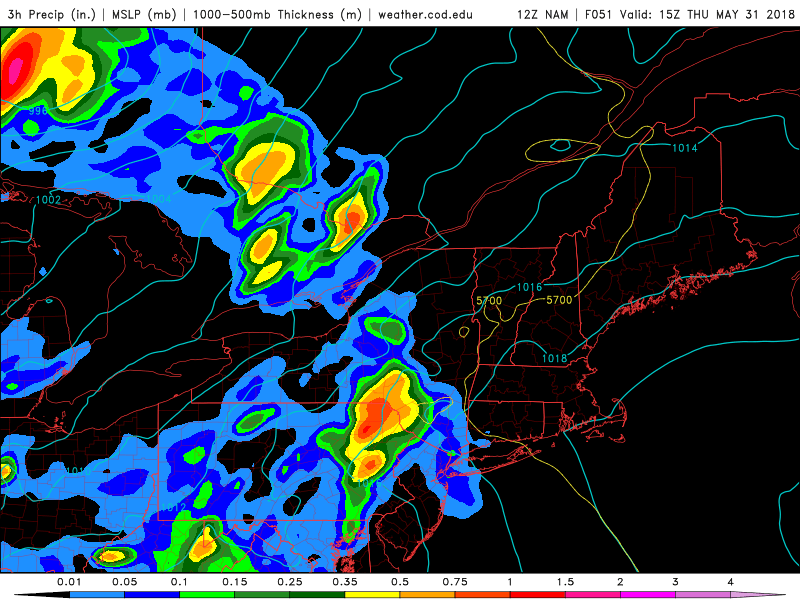
NAM model showing showers ahead of the approaching warm on front in parts of the Northeast on Thursday
By Friday, much of the model guidance, shows the warm front making the most progress northward, over parts the region. Thus more sunshine with southwest winds will help temperatures rise into the upper 70s to 80s. Except parts of Long Island and Coastal Connecticut, may somewhat cooler in upper 60s to middle 70s. If the warm front lifts through faster, temperatures could warmer. However, a cold front with frontal system will begin approaching. Increasing warmth and humidity with cause instability ahead of this front, resulting in showers and thunderstorms that could develop during the afternoon or evening hours, especially over the Interior. Severe weather doesn’t appear likely with weak wind-fields or shear. But this frontal system will have also absorbed Subtropical Storm Alberto’s remnants or moisture over the Southeast. So will have to monitor potential for some heavy rainfall out of showers or thunderstorms both Thursday and Friday.
Over the weekend another shortwave trough moving out the Great Lakes and then begin to dig into Northeast and Mid-Atlantic, on the downside of ridging over the Midwest. Some Western Atlantic ridging appears to cause this energy to slow down and even hang bang in larger upper-level low over parts of the Eastern US, this weekend and early next week. There will be a lot of sub-tropical moisture still streaming northward over the Eastern US. Thus more unsettled weather, with more chances for some heavy rainfall, is expected to continue this weekend, into early next week.
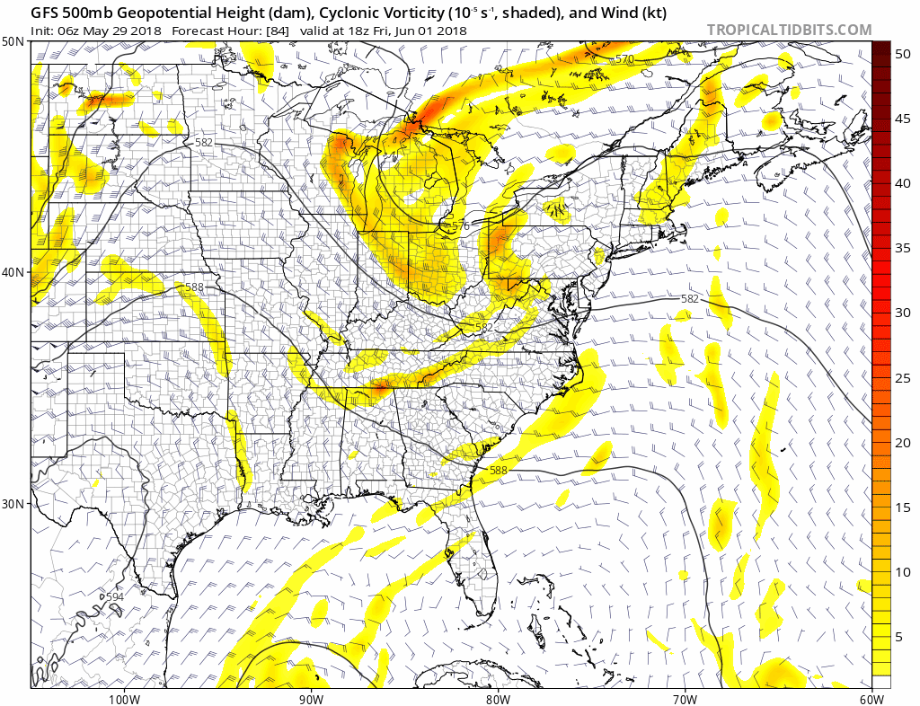
GFS model showing an active pattern with shortwave trough digging into the Northeast and Mid-Atlantic.
However, uncertainty is higher right now, on exactly each chance of rain evolves. There will probably be some drier periods, especially given how disorganized shortwave energy is appearing with this system now. Also the flow appears somewhat progressive over the East, despite some high-latitude blocking showing up over the North Atlantic by next week. So it will not be surprising to see the models trend somewhat drier or faster with each system, as we move closer. Check back for more updates on our forecast blog or dashboard, as details with rainfall chances over the next 7 days become clearer.
Trackbacks & Pingbacks
2disquiet
Comments are closed.