-2")
Weekly Planner: Strong T-Storms & Heavy Rainfall Likely Later Today
Good morning! There is increasing potential for some heavy rainfall and strong to severe thunderstorms later this afternoon and evening, as a cold front approaches. Before that though, it will be just be hot and humid with high temperatures reaching the mid-upper 80s or lower 90s over the urban I-95 corridor, with more sunshine into at least early this afternoon. It will be a little cooler, with sea-breezes later, closer to the shore. But southerly winds will continuing to transport tropical moisture into the area, with dewpoints in the lower to middle 70s. This will lead to heat index values in the middle or upper 90s, again this afternoon. Thus a heat advisory continues for Northeast NJ and NYC for today.
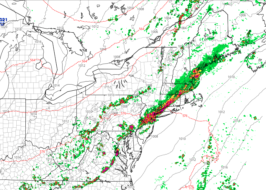
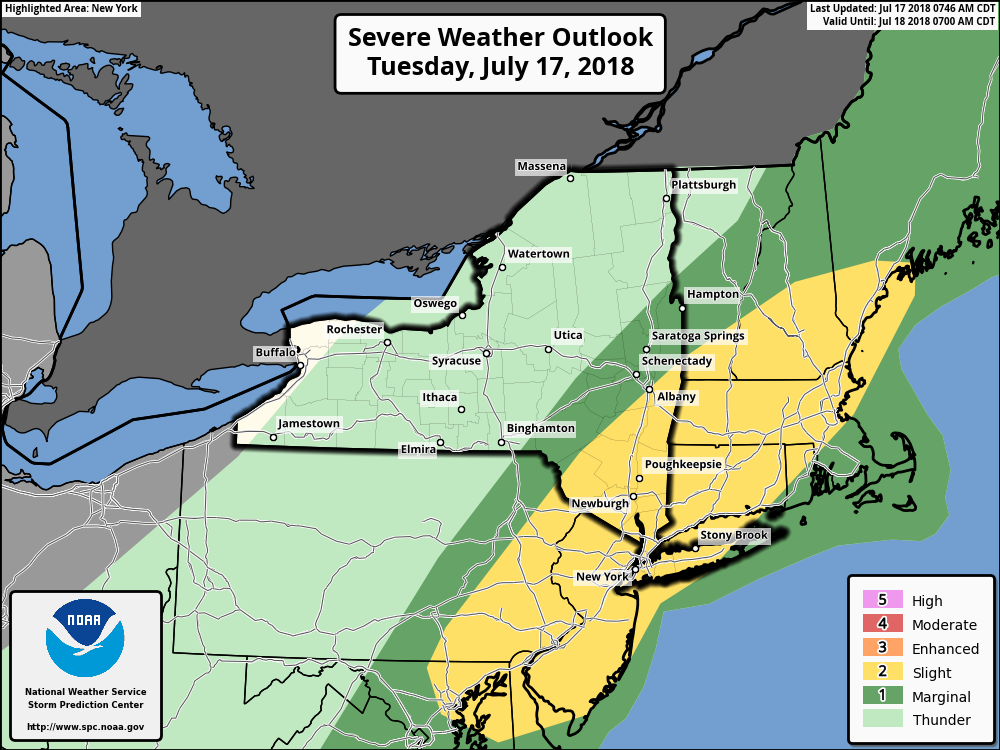
However, some scattered showers and thunderstorms will begin developing during the mid-afternoon hours, with very high instability with no atmospheric cap preventing storms from forming. By this early this evening, as shear and forcing increases with the cold front, showers and thunderstorms, are likely organize into a line and move through the urban I-95 corridor. Initially there will be a slight risk for some strong to severe thunderstorms ahead and along of the front. These storms may will be mainly capable of producing some strong wind gusts and large hail. But a very warm moist atmosphere will support weaker mid-level lapse rates, which will reduce for potential somewhat for stronger updrafts with more widespread or significant severe weather.
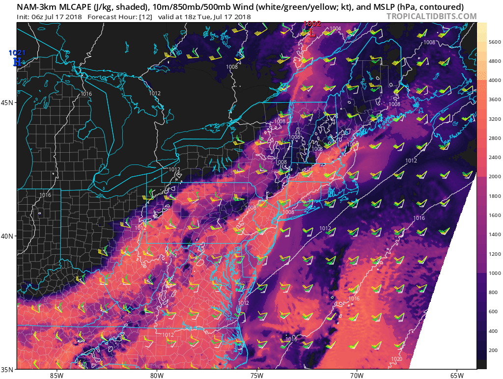
3km NAM model with over 2000 J/k MUCAPE and 20-30kts of 0-6km bulk shear over parts along the urban I-95 corridor this afternoon.
Heavy rainfall and flash flooding will also be a threat with thunderstorms by this evening. While showers and thunderstorms will be moving steady with a modest flow, mostly unidirectional shear vectors parallel to the front, may cause thunderstorms to train in some areas, with some torrential downpours for a few hours. Precipiatable water values between 2.00 to 2.50″ are around 2 to 3 standard deviations above normal for this time of year. Thus rainfall totals could exceed 2.00″ in spots where thunderstorms do train later today. Thus Flash Flood Watches are now in effect for later today, over parts of the urban I-95 corridor. Regardless, any travel during the late afternoon and evening rush may become difficult for many areas with heavy downpours.
Showers and thunderstorms should begin tapering off later in the evening, from west to east, as the cold front passes through the area. Then high pressure from Canada, builds into the region, for more pleasant weather, with lower humidity, for the rest of work week. High temperatures with plenty of sunshine Wednesday through Friday will still be very warm in the middle 80s, which is close to normal for this of year. Then more unsettled weather is become likely over the weekend and early next week. Model and ensemble guidance indicates a large upper-level trough or low positioned back west over the Great Lakes/Ohio Valley regions, will be slow to lift out to the east.
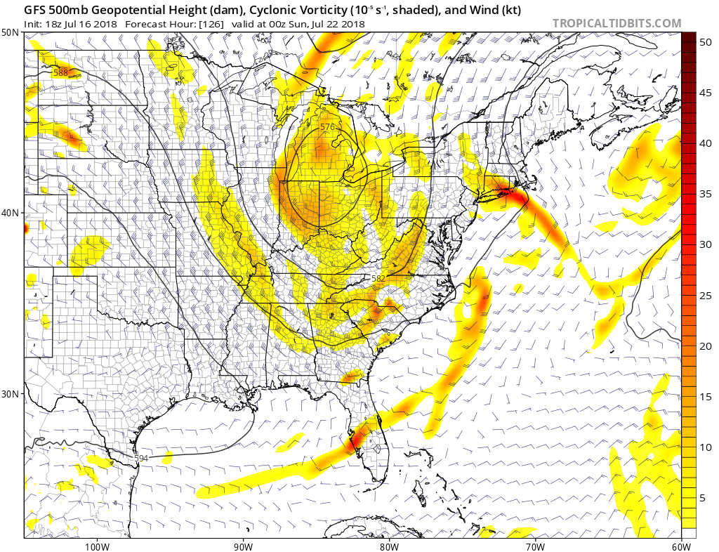
GFS model with a large closed upper-level low over the Ohio Valley, supporting more unsettled weather over Northeast this weekend into early next week.
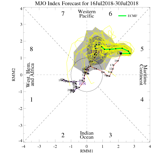
Some models indicate, a wave of low pressure may develop along the warm slowly lifting north with more heavier rainfall and t-storms on Sunday. Overall, there will be multiple frontal boundaries or disturbances rounding the trough, that may coincide with instability and plumes of sub-tropical moisture resulting in a chance for some showers or thunderstorms with some heavy downpours, into early next week. Right now, too early say if any day will be complete washouts, with much confidence. But another period of some cooler and wetter, can be contributed to the MJO propagating into phase 6, which will support even cooler than normal temperatures over the Northern Plains and Midwest, next week. More updates to come this week!
Trackbacks & Pingbacks
1altruistic
Comments are closed.