-2")
NYC Forecast: After the heat, strong storms possible Friday
Update [500pm]: The SPC has upgraded Friday’s severe weather threat to a Slight Risk (Level 2 on a scale of 5) in parts of New England including Northern NJ and Southeast NY. The main threats with severe storms will be lightning, gusty winds and heavy rain. We’ve got more below. Previous post follows:
Another day, another Heat Advisory! If it hasn’t been the heat lately, it has been flooding rains and lightning. So we’ll take the quiet, hot days while we can get them I suppose. Thursday will be another one of those, with temperatures into the 90’s during the afternoon hours and heat index values getting up there as well.
The NWS has issued another Heat Advisory through Thursday night (there have been a lot of those this summer), and an Air Quality Alert is also in effect. Translation: Take it easy out there. Limit outdoor exposure if you can, and be sure to remain hydrated if you’re outdoors for a prolonged period. As always, keep a close eye on children, the elderly, and pets.
The heat will continue into Friday as a front approaches. Moisture increases throughout the Northeast states as southwest winds increase and draw in an airmass that is warmer and more moist. Dew points will climb and so will the humidity. You’ll also probably notice increasing cloud cover during the morning hours as the frontal system approaches. As it draws closer, instability is expected to increase through the afternoon hours.
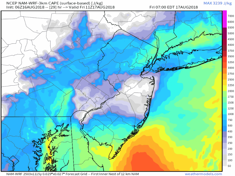
Instability increases across the Northeast and Mid-Atlantic on Friday – fuel for the development of storms.
During the early to middle afternoon, lift is expected to increase near a frontal boundary in Eastern Pennsylvania and Southeast New York. This will help develop showers and thunderstorms, some of which will be strong and severe. They’ll gradually shift eastward during the middle afternoon and are expected to approach New Jersey, the NYC Metro Area, Southeast New York and Connecticut by late afternoon and early evening.
There are a few factors that will act to mitigate a larger severe weather threat (wind fields, lapse rates, amongst other things) but we still anticipate strong thunderstorms and decent coverage of storms at that. Any storm will be capable of producing gusty winds, lightning and of course torrential rainfall. This potential will likely be maximized in parts of the Northern Mid Atlantic states from New Jersey into Western New England. The Storm Prediction Center has placed parts of the region in a Slight Risk for severe weather on Friday.
We do it all again on Friday in the Northeast, as the ridiculously active pattern continues. Most thermodynamic/kinematic fields suggest any organized severe threat will be limited – but storms capable of lightning, wind, heavy rain still expected. #njwx #pawx #nywx #ctwx pic.twitter.com/h5DbOZQaOn
— John Homenuk (@jhomenuk) August 16, 2018
All in all, expect increasing chances for showers and thunderstorms on Friday afternoon, and a good likelihood of storms impacting your location from the late afternoon into the early evening. Some areas will get stronger storms with locally frequent lightning, torrential downpours and gusty winds. As always, stay tuned for the latest watches and warnings.
A few more isolated storms are possible on Saturday, but the weather is largely slated to improve during the weekend. Drier air moves in and high pressure takes the reigns. It will be a welcomed relief after several days of heat, humidity, and active weather. The longer range forecast looks to feature – surprise – more heat and humidity with the potential for storms through the end of the month. But we’ll circle back on that later. Enjoy your Thursday!
Trackbacks & Pingbacks
2flowers
Comments are closed.