-2")
NYC Area Forecast: Beautiful weekend, heat returns next week
Ah, Friday morning. Windows open, the sun shining through your window. Birds are chirping and you hear the calm, serene sounds of summer as you make your way to grab your morning coffee.
Okay, that’s probably not how anybody’s morning went (and if it did, cheers to you). But at least the weather was cooler and much less humid – and perhaps your windows were open. We’ve got plenty of sunshine for you this morning – it’s here, and it’s lovely.
Temperatures today in the Northeast will average several degrees below normal. It will still reach into the lower 80’s in the New York City area, but with dew points so much lower than they have been over the past several weeks, the airmass will continue to feel downright refreshing. No risk of showers today, only a few fair weather clouds are anticipated. It’s about as close to a 10/10 day as you can get in August.
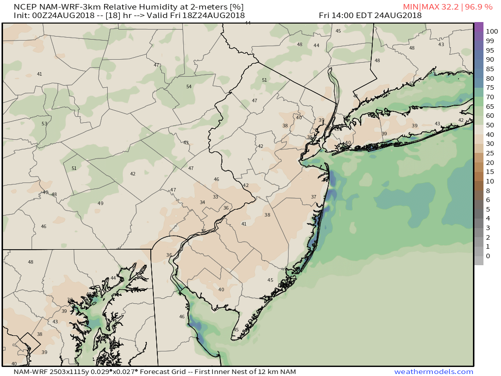
Relative humidity values are very low to start Friday morning.
The nice weather will continue this weekend, especially during the first half. High temperatures on Saturday will still only reach the lower 80’s as a northerly wind component continues to keep the airmass drier and cooler than it has been recently. High pressure is expected to remain anchored nearby and so we aren’t expecting any risk for precipitation. In fact, this will be the first weekend in quite some time where we’ll be able to take a bit of a break – yeah, we’re humans too!
If you’re hitting the beach this weekend, make sure to check our our ShoreCast page for the latest information on water temperatures and surf conditions.
That’s about where the good news ends.
As we move into the early and middle part of next week, a large and expansive ridge will begin to build towards the Northeast states from the Western Atlantic. That’s bad news for two reasons; a ridge will foster the development of a warmer southerly flow, and its origins in the Atlantic suggests it will bring moist and humid air with it. Just the kind of thing we were enjoying a break from!
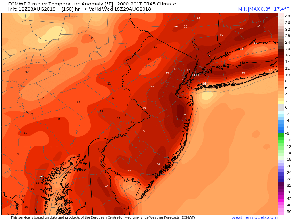
By next Wednesday, temperatures could average 15 degrees above normal.
From Monday to Wednesday, forecast models suggest things get dialed up several notches. The European and GFS models both suggest that temperatures will exceed 90 F in the NYC Metro Area from Monday to Wednesday of next week, with Heat Index Values perhaps approaching or exceeding 100 F on all three days. Yes – All. Three. Days. In fact, that idea suggests the stretch could qualify as an official heat wave.
The warmth looks to stick around even into the tail end of the week, with the opportunity for showers and thunderstorms steadily increasing as the back half of the week approaches. It’s a bit too far out now to determine the exact timing of individual disturbances, but we’re confident that they will be there with an increasing presence as the week goes on.
So buckle up – enjoy the cool air today, take it all in, and don’t put away your bathing suit or shorts just yet. Summer still has some punch left in it.
Testing our new comments system.