-2")
Beautiful weather continues, until it doesn’t
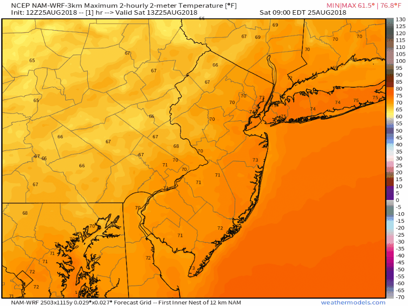
High pressure is providing a large majority of the Northeast states with beautiful weather conditions today – even despite the presence of some mid and and high level clouds. Low dew points and low relative humidity values have kept the air quite comfortable, and a warm late-August sun has kept the summer-like feel in the air. It’s a classic beach, pool, or backyard day and quite frankly, not one that we often see in the dog days of summer where humidity and storm chances often rule the forecast.
While the pleasant weather is expected to continue into Sunday, the unfortunate truth is that the weather will snap back to reality, and a little bit beyond it, as we approach the beginning of next week. A trough that has been overhead for the past few days, providing the cooler weather, is already on the way out and a ridge will replace it. As the low and mid level winds change, a new airmass will enter the picture – and it will not be as pleasant as the one we are experiencing now.
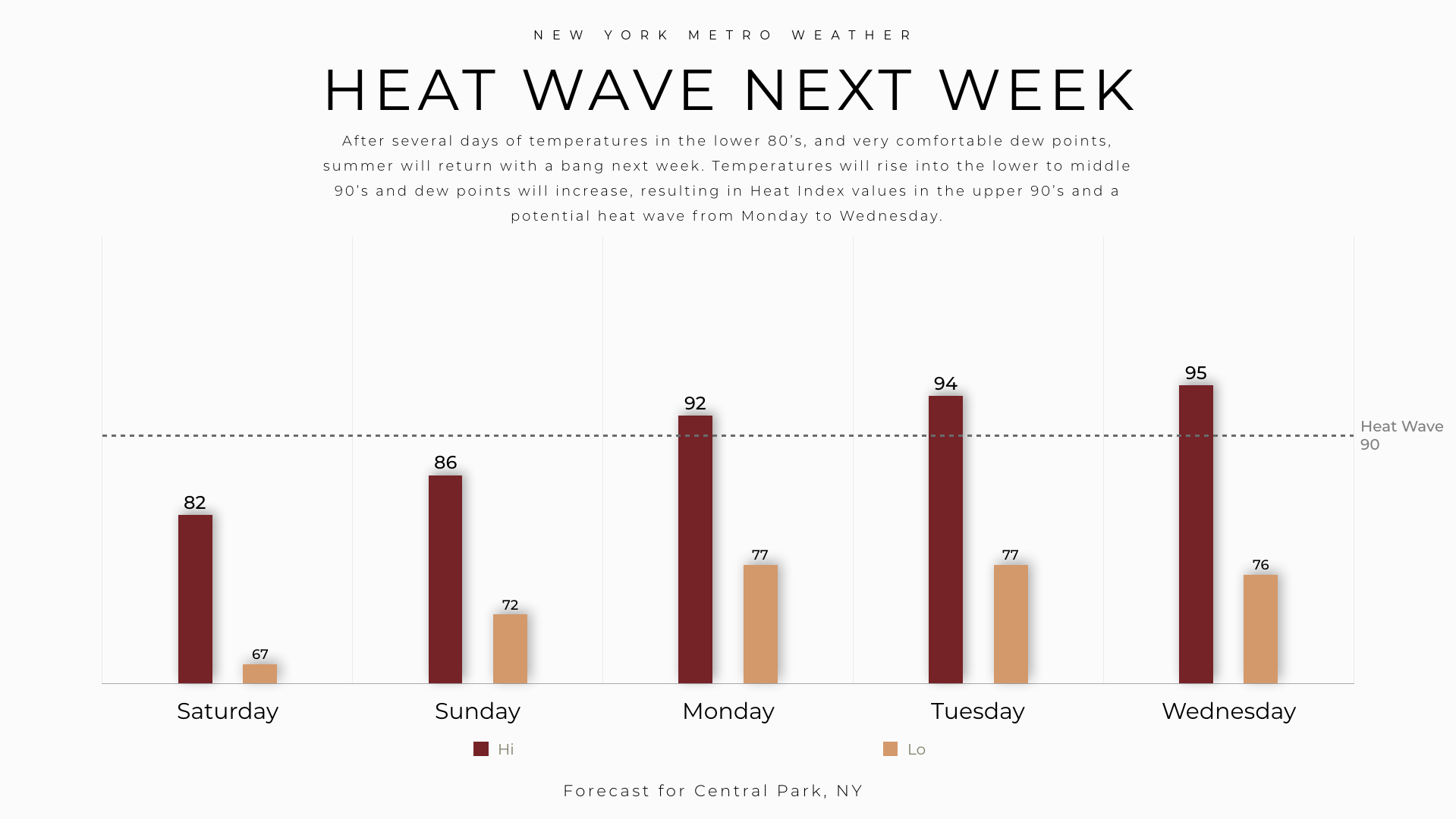
Watch as temperatures increase each day to start the week.
As ridging builds in the atmosphere, southerly winds will replace the cooler northerly wind component. This will draw in warmer, more humid air. You’ll start to feel this as early as Sunday, when temperatures warm a few degrees and the relative humidity values increase, owing to higher dew points. The real change will come on Monday in the Northeast states, when temperatures reach the upper 80’s to lower 90’s and Heat Index values approach the middle 90’s in the NYC Metro Area.
The weather will continue to trend warmer during the middle of the week, with temperatures in the lower 90’s on Tuesday and Wednesday in the urban corridor from Philadelphia to New York City and Heat Index values easily in the middle to upper 90’s during the afternoon hours on those days. In short – summer is going to return this week.
As the week goes on, chances for clouds, showers, and thunderstorms are expected to increase as well. Multiple disturbances will traverse New England during the middle part of the week, and frontal zones should slowly sink southward towards the Mid-Atlantic states. The best chances for storms may come on Wednesday in the interior, and then on Thursday in the Mid-Atlantic and closer to the coast.
Temporarily cooler weather looks likely to return to the Northeast again next weekend, but it remains to be seen to what degree that is. Models suggest Thursday’s cold front sinks southward, resulting in cooler air in New England and a bit of a relief from the heat and humidity. But exactly how far south that front gets will have a huge impact on how pleasant (or unpleasant) next weekends weather really is.
We’ll be tracking that as this week goes on – but for now, enjoy the rest of your pleasant (and very not humid) Saturday afternoon. Talk to you guys soon.
Trackbacks & Pingbacks
2licence
Leave a Reply
Want to join the discussion?Feel free to contribute!