-2")
PM Update: Heat continues, to be followed by more heat
Temperatures soared into the middle and upper 90’s today throughout the New York City area and, in fact, a large majority of the Northeast states. The heat was good for some records during the day (daily record at Islip, NY) and at night (many record warm overnight low temperatures were set). The temperature wasn’t even the real issue with the uncomfortable air – it was the dew point, which hovered in the low to middle 70’s.
Not much improvement is expected through the evening. Temperatures will remain very warm and dew points will remain very high, leading to another uncomfortably warm evening. Through tonight, a blend of weather models suggests the temperature will only fall into the upper 70’s or lower 80’s in and around the New York City metro area, which suggests record warm overnight low temperature records will be broken for the day again.
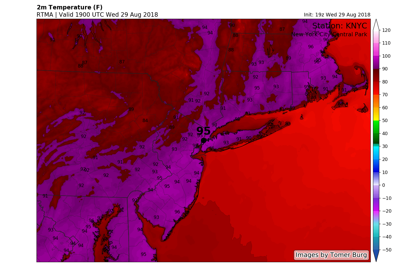
Temperatures were in the middle 90’s as of early Wednesday evening.
The weather continues to look very hot through Thursday. In fact, the National Weather Service has extended the Heat Advisory for the New York City metro region until 5:00pm on Thursday afternoon, after previously suggesting it would expire today. Heat Index values are again expected to reach near or over 95 F during the afternoon hours on Thursday throughout the area.
A brief respite expected this weekend
A frontal boundary shifts southward this weekend and brings a much needed, and much welcomed, cool down in temperatures throughout the atmosphere. In the mid levels, temperatures will cool by as much as 10-15 F, which is associated with a changed airmass and more northerly wind component. This is great news, because it means that cooler air will funnel into the Northeast states.
The bad news is that it will come with a bit of a price – the weather will turn more unsettled later this week. After the opportunity for a few scattered showers or storms on Thursday, clouds are expected to increase from Thursday into Friday. On Friday in particular, showers and thunderstorms look increasingly likely throughout the Mid-Atlantic states with temperatures in the upper 70’s.
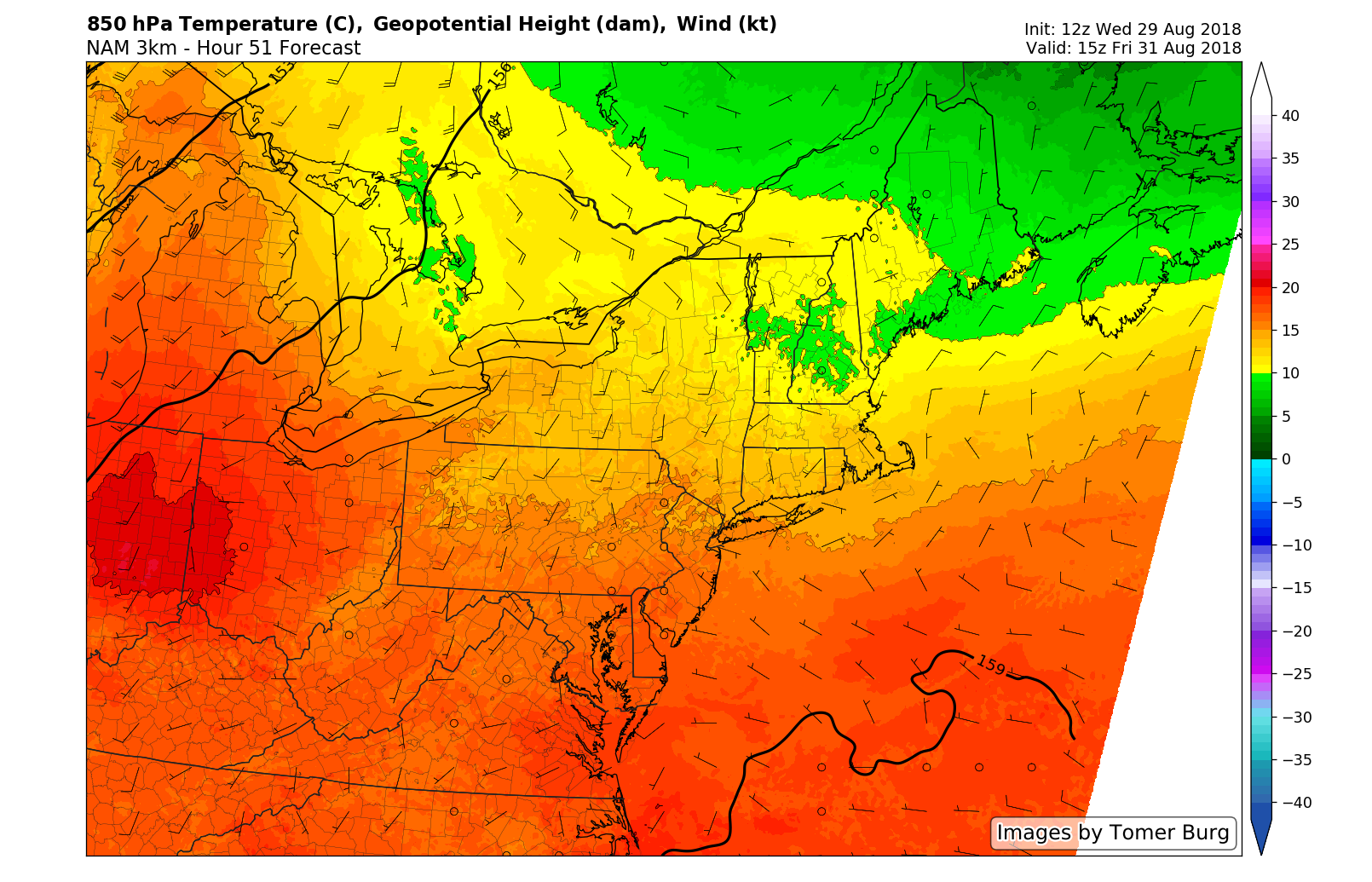
Temperatures in the mid levels of the atmosphere fall quite a bit this weekend, leading to cooler weather.
Saturday and Sunday look to be marginally improved – temperatures will remain cooler (or at least reasonable, in the 80’s) with the chance for a few scattered showers and storms
…And then the heat returns
After the brief hiatus, heat returns with a vengeance next week. Forecast models are in great agreement that a large ridge will expand again across the Eastern United States. This will lead to increasingly noticeable southerly winds, rising humidity and – you guessed it – anomalous warmth. Temperatures again look to average well above normal starting on Tuesday.
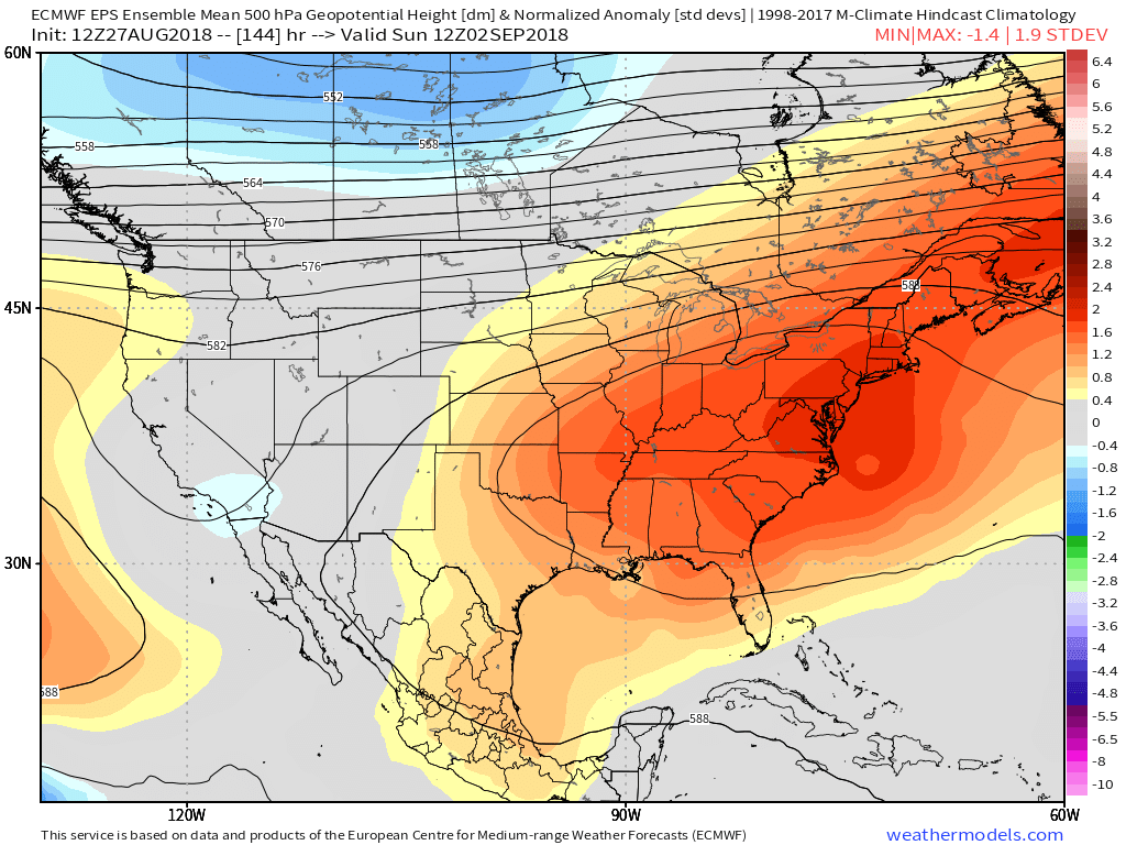
Another surge in heat is expected next week as this large ridge expands.
The ridge looks likely to stick around at least until the middle or end of next week with temperatures several degrees above average. Thereafter, the opportunity for some cooler and stormier weather returns. Our suggestion? Don’t put away the shorts and hold off on the grande pumpkin spice lattee with extra whipped cream for now.
We’ll have more updates as the week continues. Be sure to check out our blog page for the very latest and to follow our social media accounts for up to the minute info.
Trackbacks & Pingbacks
3concert
Leave a Reply
Want to join the discussion?Feel free to contribute!