-2")
NYC Area Weekly Planner: Heat & Humidity Returns This Week
Happy Labor Day! We hope you have been enjoying the last holiday weekend of the summer. We saw a break from the heat and oppressive humidity over the last few days, but heat will return again early this week as another strong ridge builds over much of the Eastern US. Although the heat and humidity won’t be quite as oppressive, it will still be uncomfortable. For more details, read on!
Today and Tonight
Any low clouds or fog still around this morning will burn off and then give way to mostly sunny skies for this afternoon. 850mb temperatures between 18 to 19 C and southwest winds will support high temperatures in the lower to middle 90s throughout much the region. Humidity will be high with dewpoints in the upper 60s to near 70. This will lead to heat index values in the upper 90s and possibly near 100 F. Thus, the National Weather Service has issued a heat advisory for almost the entire area, including the immediate NYC Metro.
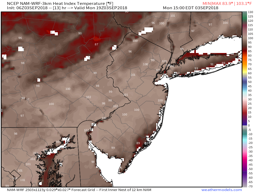
3km NAM model forecasting heat index values in upper 90s to near 100°F this afternoon
A weak disturbance passing to the north may help touch off some isolated showers and thunderstorms over the Interior areas this evening. Otherwise, clear to partly cloudy skies are expected tonight. It will remain warm and humid with lows generally in the 70s throughout the region. NYC and urban areas may struggle to get down much below 80 tonight.
Tuesday and Wednesday
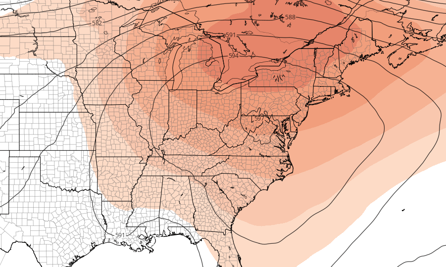
Tuesday will be another hot day with mostly sunny skies. Additional subsidence and light northwest winds underneath the 594dm ridge may result in slightly lower humidity tomorrow, but also warmer high temperatures compared to Monday. Highs will be in the middle 90s over much of New Jersey and the NYC metro. Humidity could still be high enough to support heat index values in the upper 90s, so a Heat Advisory will likely also remain in effect for much of the region.
As high pressure shifts east into New England, a weak backdoor cold front with some onshore southeast winds will approach on Tuesday night or Wednesday. This may lead to slightly cooler high temperatures on Wednesday, especially for Long Island and Connecticut. However, much of New Jersey, into the NYC metro will still likely rise into the upper 80s to lower 90s, with a mix of sunshine and clouds. The backdoor cold front may also trigger a few isolated showers and thunderstorms around the region.
Thursday through next weekend
By late week, a trough coming out of the Plains will likely break down the strong ridge over the East. A stronger cold front associated with this trough will likely move through Northeast as well. But more southwest flow ahead of this front will likely cause temperatures to rise into the low to mid 90s. Some scattered showers and thunderstorms are also possible as instability builds ahead of this front on Thursday afternoon and evening.
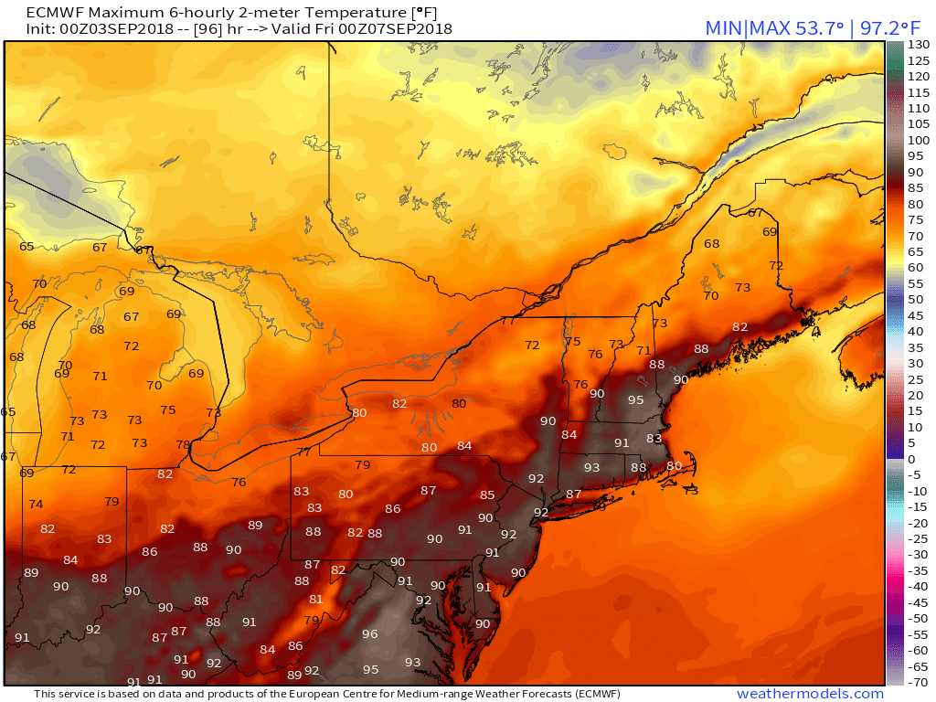
ECMWF model forecast high temperatures in the Northeast US on Thursday
It will turn cooler again, behind this front on Friday. High temperatures will likely be closer to normal — in the upper 70s to lower 80s. Some pleasant, cooler weather will likely continue into the weekend. But we will have to watch another storm system coming out of the Ohio Valley that may cause more showers return at some point late in the weekend or early next week. We will have more updates in the coming days!
Leave a Reply
Want to join the discussion?Feel free to contribute!