-2")
Florence rapidly intensifying, expected to approach Carolinas this week
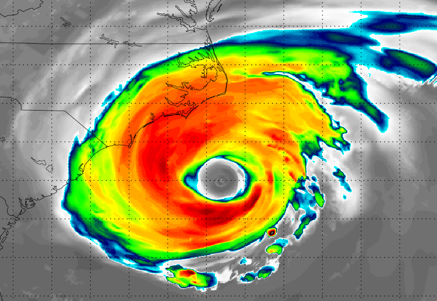
12:30pm Update: Florence has strengthened into a powerful Category 4 hurricane with maximum sustained winds of 130mph. Additional rapid intensification is expected today, as the upper-level atmospheric environment becomes more favorable over the system. Shear, which has inhibited the systems development thus far, will be greatly reduced, allowing for improved upper-level outflow ventilation as the storm moves over warmer waters.
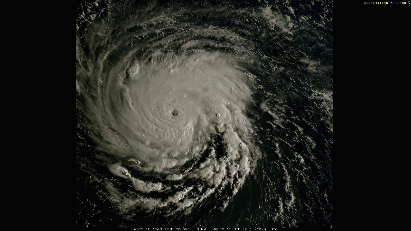
Latest visible satellite imagery of Florence as of Monday morning.
Florence will continue moving over the warmest waters of the Atlantic Ocean, with temperatures of 28 C to 29 C, over the next few days. With reduced shear and abnormally warm waters, Florence should have a little issues continuing to strengthen. There is an outside chance that Florence could briefly strengthen to a Category 5.
The latest set of forecast model guidance continues to suggest that a very strong, anomalous ridge will develop over the Western Atlantic and extend into the Northeast US early this week. This ridge will steer Florence underneath it towards the Southeast US, and also block the storm from recurving out to sea. This ridge is on the outer edges of climatology – in other words, it is exceedingly rare.
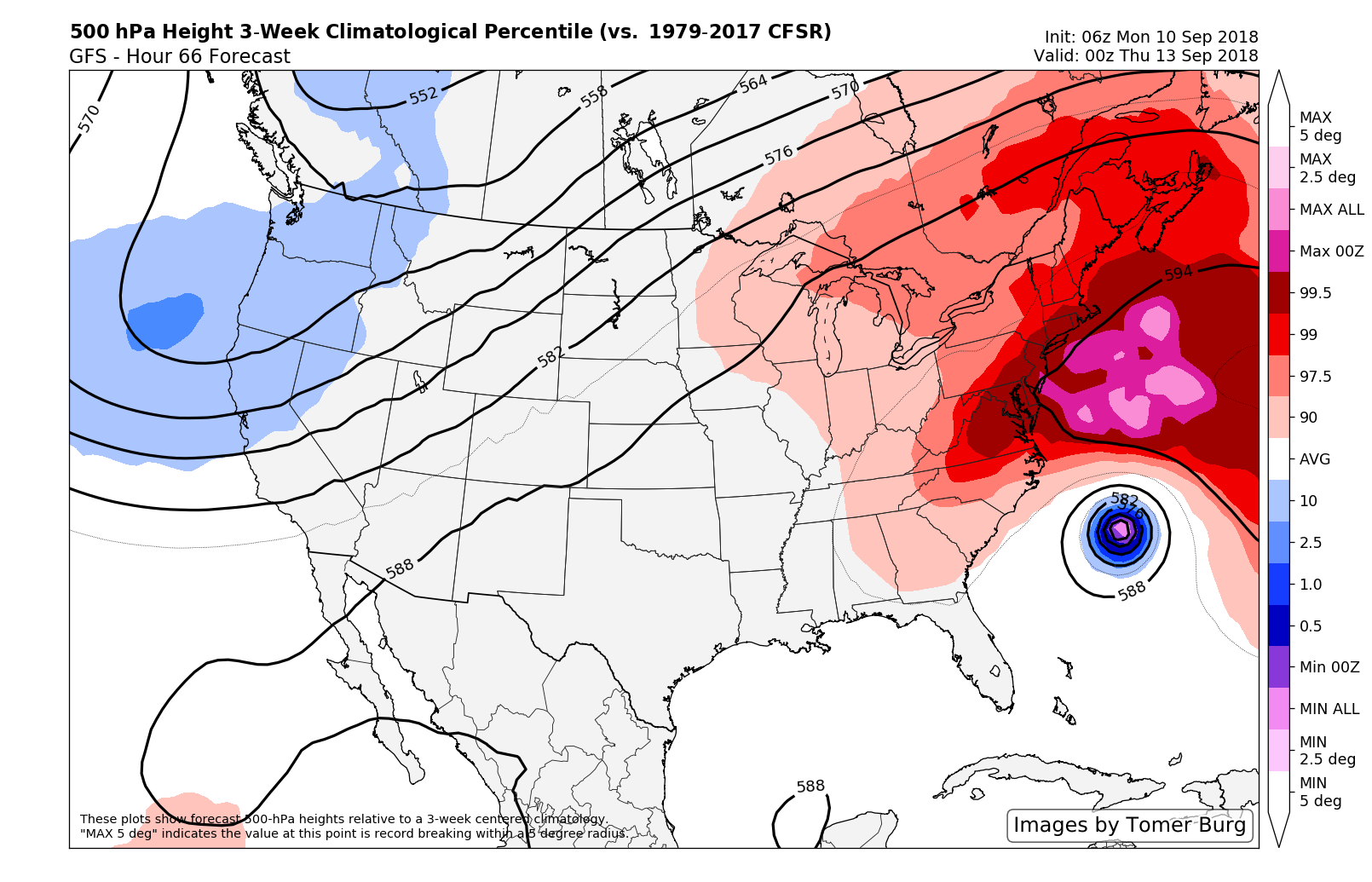
An anomalous ridge develops north of Florence and is expected to force her towards the Carolinas.
The exact positioning of the ridge itself was a major question for several days, but forecast models have since come into better agreement about the exact positioning of the ridge. The main question that still remains stems from a weakness which exists underneath the ridge, just east of the Carolinas.
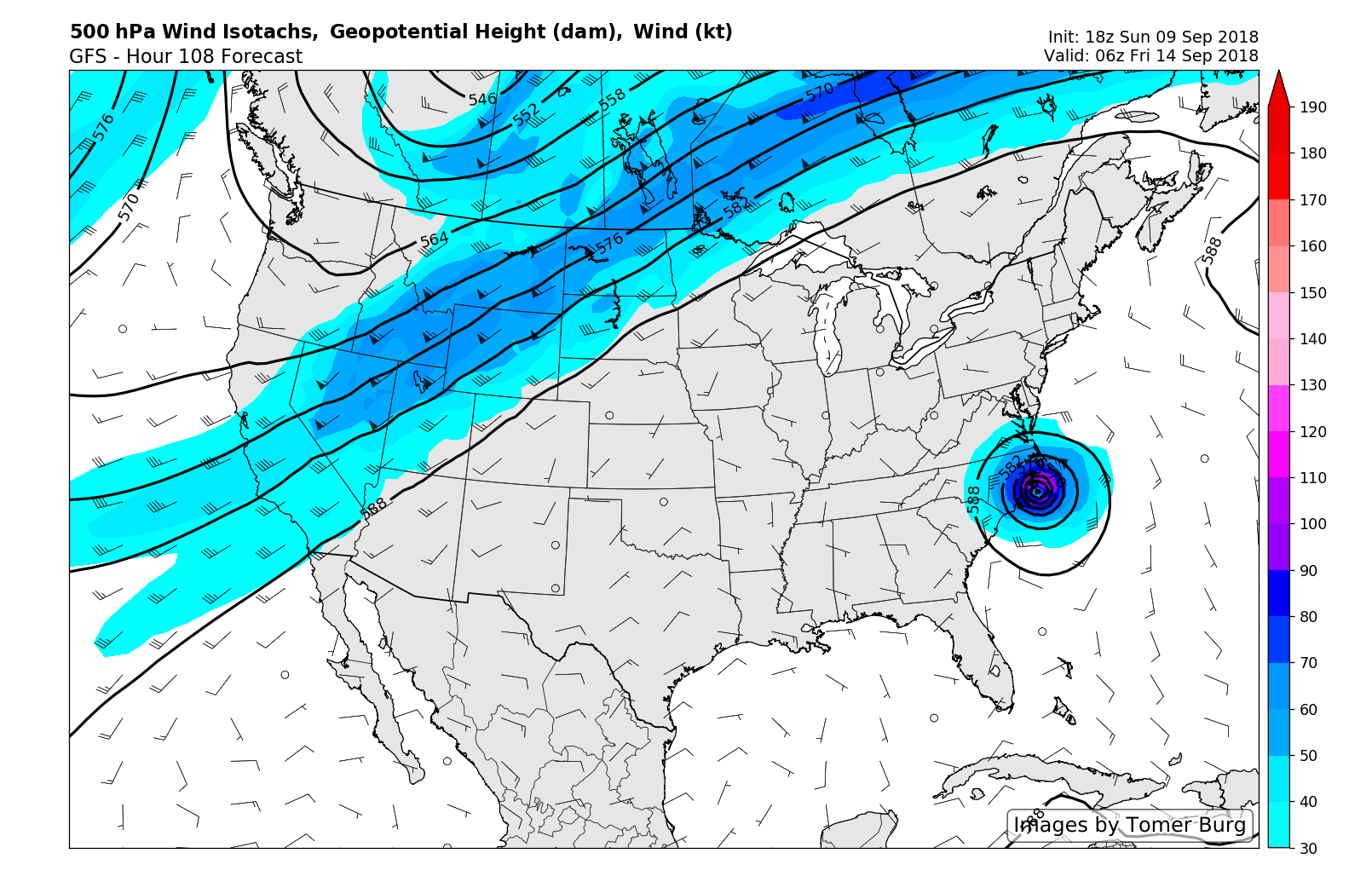
Forecast models are split in handling this feature. The GFS shows a larger weakness in the ridge off the coast of the Carolinas that could cause Florence to track further north and then stall or meander near the coast for a few days. This solution remains a possibility, as steering currents weaken around Florence. The overall pattern over the United States contains a deeper trough over the Northwest US and a massive ridge over the Central and Eastern US, forcing the jetstream further north into Canada. With that in mind, if we see the core of the Western Atlantic ridge weaken faster, there will be little or no forcing mechanism to keep Florence moving further inland over the Southeast US.
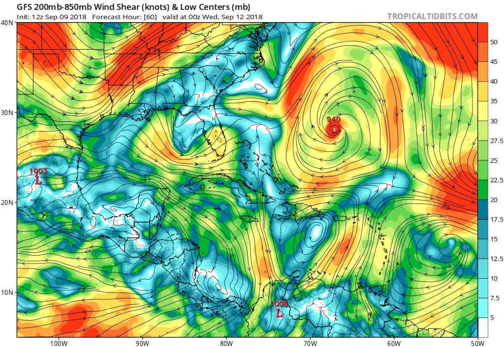
GFS model showing upper-level anticyclone with 250-850mb shear decreasing and outflow expanding in all quadrants over Florence.
The ECMWF, UKMET and GGEM models have generally shown less of a weakness in the Western Atlantic ridge over last few days. We tend to favor these solutions over the GFS idea – with a more effective mid level steering flow propelling Florence into the Carolinas Regardless, heavy tropical rainfall is likely as the system slows down near and after landfall, with the potential for over 10″ of rain in many places from the Southeast US into the Mid-Atlantic.
At this time, it appears that the Carolinas to the Virginia coast are at highest risk for major hurricane impacts. All of the latest operational models have made a shift toward showing a landfall near the North Carolina coast – but there remains some spread in regards to individual ensemble solutions. A middle ground forecast takes the storm into the North Carolina coast, which matches nicely with the latest thoughts from NHC.
NEW: ECMWF #Florence "super ensemble"
The super ensemble consists of 312 members averaged over the last 6 model runs.
It shows a landfall over Horry County, South Carolina (Myrtle Beach within). pic.twitter.com/2CRQtRM9ja
— Ben Noll (@BenNollWeather) September 10, 2018
Preparation, Readiness and Evacuations
If you live or have interests in the Carolinas, it is time to start preparing for a major hurricane. Hurricane preparations should be well underway at this time. This includes, but is not limited to:
- Hurricane preparation all buildings (windows, doors, etc)
- Securing of all outdoor loose objects (chairs, tables etc)
- Emergency preparation of generators, power supplies, emergency/first aid kids
- Contact with relatives in the area, especially elderly or those unfamiliar with hurricanes
- Acquisition of a hurricane kit – available at most local retailers such as Home Depot or Walmart
- Stocking of essentials such as water, bread and canned food in the case of power loss
- Contact with local officials for understanding of evacuation routes, latest evacuation information, etc.
Regardless of landfall location – very strong winds, major coastal storm surge, high surf and rip currents are anticipated in the Carolinas. High surf will additionally spread northward along the Mid Atlantic and Northeast coasts despite the system likely making landfall well to the south, with rip currents and high surf likely from Maryland to New Jersey.
Stay tuned over the next few days for the very latest information.
If you are in need of emergency help, consulting, or more, we are offering free services for those in the Carolinas over the next four days. Please contact us for more information.
Trackbacks & Pingbacks
3distil
Leave a Reply
Want to join the discussion?Feel free to contribute!