-2")
Michael strengthening, damp and dreary weather continues
Monday has arrived without much fanfare – in fact, quite the opposite of fanfare. It has been dark, damp and dreary throughout the Northeast states and those conditions are largely expected to continue. You can thank low clouds and moisture trapped near the surface for that. We don’t expect the clouds to move much today, and drizzly conditions may very well continue through the evening hours as well.
The synoptic weather pattern doesn’t change all that much on Tuesday. Much of the Northeast will start the day with foggy conditions and drizzle, with temperatures still hovering in the upper 60’s and lower 70’s. It won’t be until the afternoon that higher pressures will begin to aid in some clearing, with some breaks of sun. Improving conditions are finally expected by Wednesday.
The latest on Michael
Hurricane Michael is becoming an increasingly notable story as it strengthens in the Northern Carribean and begins to angle its approach towards the Gulf of Mexico. For several days, our best forecast model and ensemble guidance has offered clues that the system may develop and strengthen. But here it is – and today the storm is beginning to look much more organized, developing an organized inner core.
The system is expected to continue to track northward into the warm waters of the Gulf of Mexico over the next few days. Forecast model guidance is a bit uncertain on exactly how it will do that, but most have converged on a track that will take the system into the Eastern Gulf of Mexico early this week.
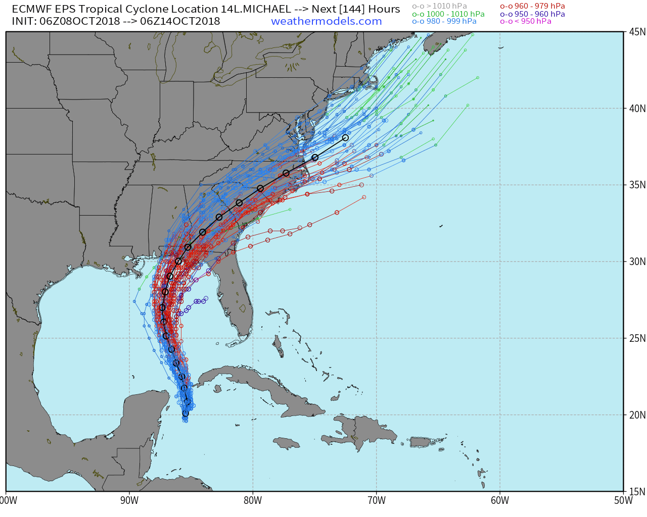
ECMWF EPS forecast tracks for Hurricane Michael.
Meanwhile, atmospheric shear will begin to weaken. The system had been fighting notable shear in the mid and upper levels, but that has weakened quite a bit and is forecast to continue to do so over the next 24 hours. Dry air still exists on the storms western side, and that may inhibit rapid intensification, but gradual intensification of the storm is still anticipated. Some guidance suggests the system will become a Major Hurricane in the Gulf of Mexico later this week.
Thereafter, the storm is likely to bend toward a northward and then northeastward trajectory as it moves around the western periphery of a Bermuda high pressure and associated ridge axis. Most forecast models agree that this will take Michael near the Florida Panhandle, but the exact landfall location remains a tremendous uncertainty. Residents along the Florida Panhandle as a whole should already be beginning hurricane preparation steps.
After Michael’s Landfall
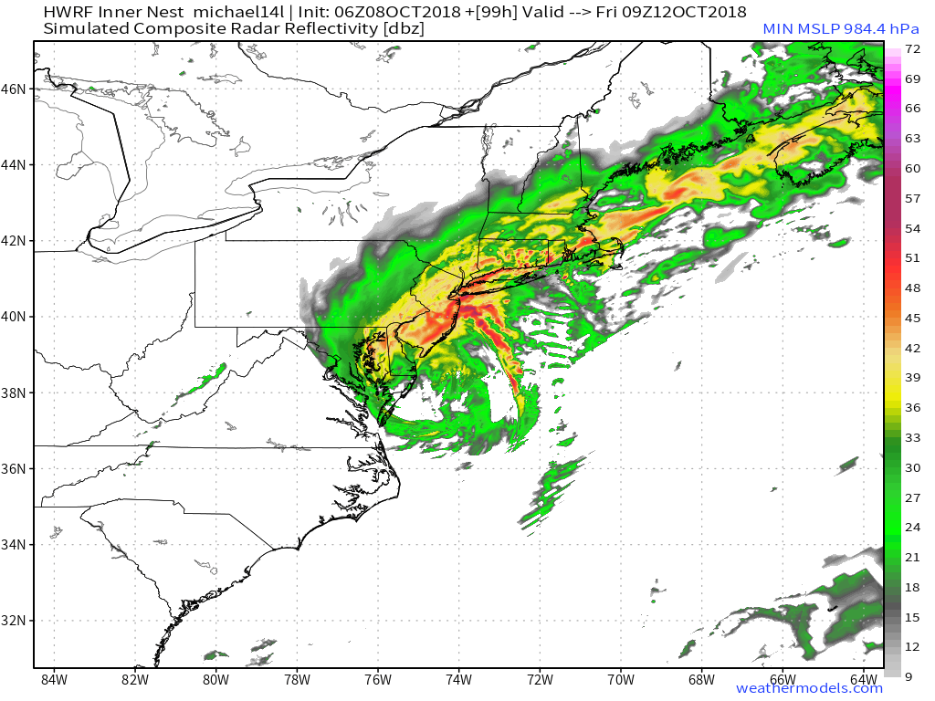
After the system makes landfall – somewhere near the Florida panhandle – most forecast model guidance suggests a synoptic weather pattern favorable for the storms moisture surging quickly northeastward into the Mid Atlantic and perhaps parts of the Northeast. It remains to be seen exactly how the synoptic pattern evolves, but the western periphery of the mentioned Bermuda high could serve as a “highway” for the remnants of Michael to quickly surge northeastward.
Some forecast model guidance also suggests interaction with a trough to the west over the Ohio Valley, which could enhance dynamics and allow for a swath of very heavy rainfall. It remains to be seen exactly how things will shake down – but confidence is very high that unsettled conditions with the potential for torrential flooding rains will move into the Mid-Atlantic
Thereafter, the weekend forecast currently looks cooler, drier and calmer. In fact, some guidance suggests some of the coolest air of the season with very pleasant sunny conditions. I think we will all take that!
Trackbacks & Pingbacks
2bulldog
Leave a Reply
Want to join the discussion?Feel free to contribute!