-2")
NYC Area Forecast: Michael impacts Thursday, improving weekend
As a potentially catastrophic Hurricane Michael churns in the Northern Gulf of Mexico, the weather in the Northeast remains relatively quaint. Low clouds and fog are again present in the NYC Metro area this morning, a common theme over the past few days. What’s been causing it? An inversion – basically, a temperature change in the atmosphere that “traps” moisture near the surface, leading to fog and drizzle. This has been present almost every morning since Sunday.
The good news, in the short term, is that these low clouds are finally expected to burn off today. Partly sunny skies should become common during the afternoon hours in the Northeast and Mid-Atlantic states today as higher pressures and some sinking air do their work to reduce moisture content. After a relatively pleasant afternoon and evening, the forecast will take another unsettled turn.
Thursday into Friday
As Hurricane Michael makes landfall and moves inland, moisture associated with the storm will spread northward along a frontal zone into the Mid-Atlantic and Northeast. Forecast models suggest that periods of showers, including some areas of steady and heavy rain, are likely across the Mid-Atlantic and Northeast states from Thursday afternoon into Thursday evening. Most of this will occur despite the fact that Michael will still be hundreds of miles south in the Southeast States.
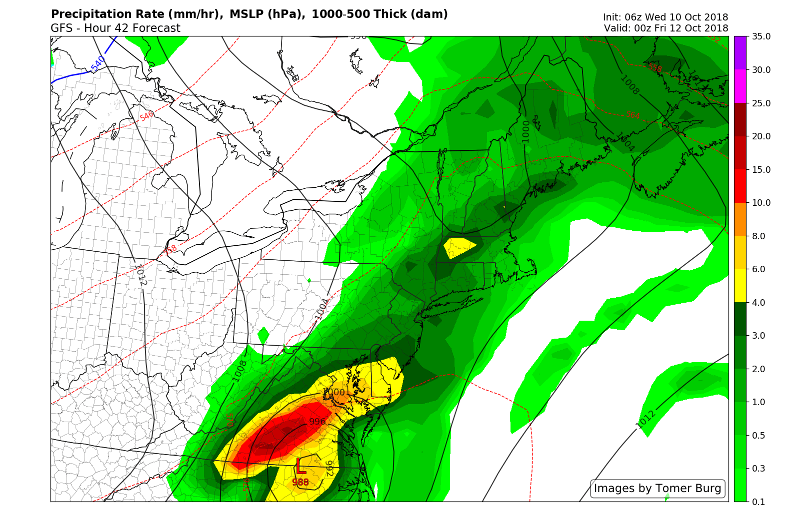
Rain is likely on Thursday as moisture from Michael streams northward.
The potential exists for some strong to isolated severe thunderstorms as well. Marginal instability will develop within an environment characterized by tropical moisture and some shear. Any stronger storms will be capable of producing torrential rainfall, strong winds and perhaps even an isolated tornado or two.
Moisture will eventually sink south of the NYC area on Friday morning, and it remains to be seen how far north the most intense remnants of Michael will track. Forecast models have increased confidence in the past 24 hours that these impacts will remain generally south of the NYC Area, tracking along a frontal boundary from the Mid-Atlantic states off the coast. In this scenario, heavier rainfall could still impact parts of Southern New Jersey and Long Island through Friday.
We will be closely monitoring the latest trends, as any northward movement in the remnants of Michael would lead to a much more rainy forecast in the NYC Area on Friday.
The Weekend
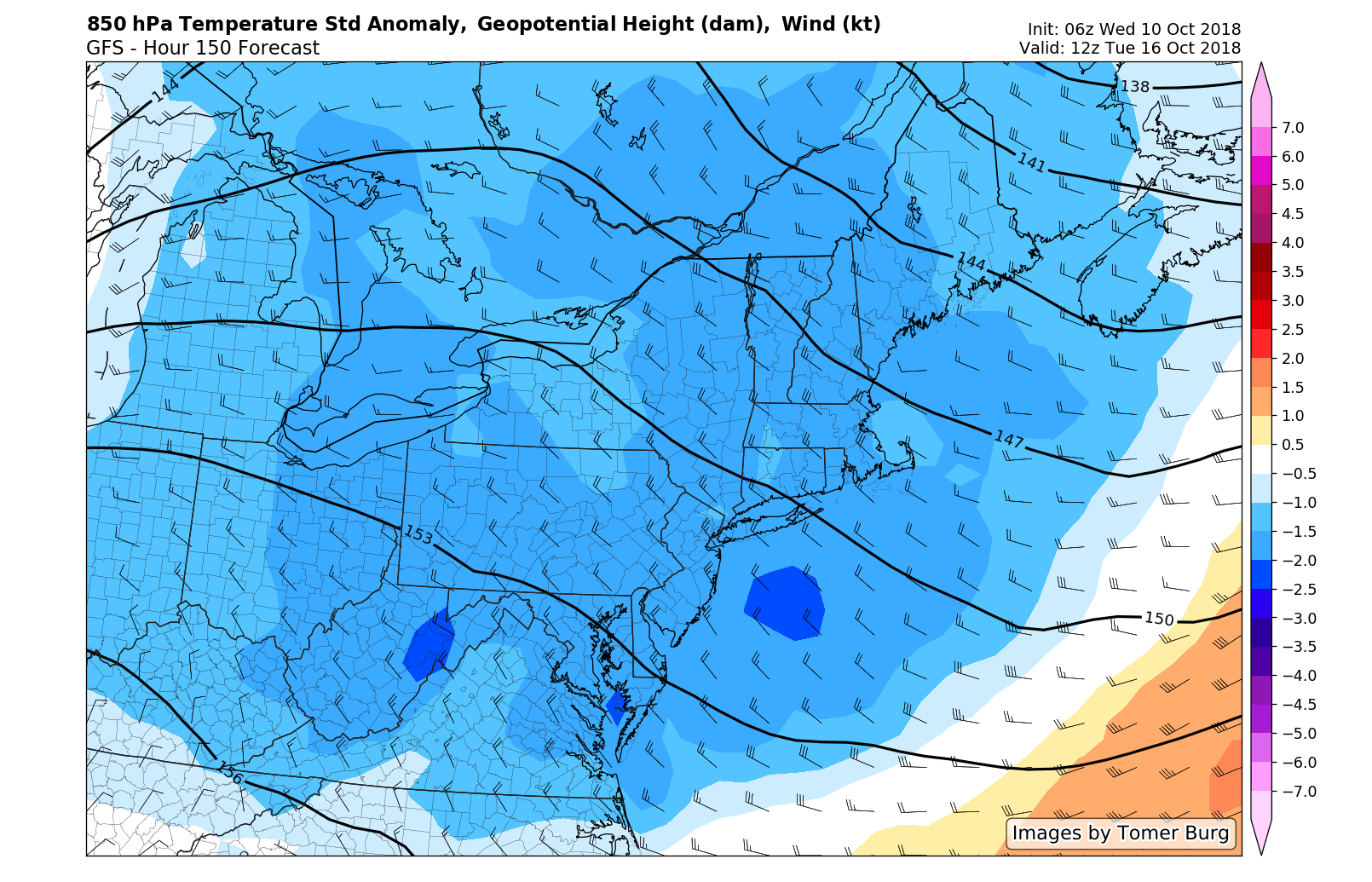
Cooler temperatures are likely from this weekend into early next week.
After the remnants of Michael track offshore, the forecast turns cooler and the weather pattern turns more progressive. Cooler air is likely this weekend, with temperatures sinking near or even slightly below normal. Other than the potential for a few showers on Saturday, the weekend looks particularly pleasant, especially on Sunday. High temperatures are generally expected to average in the lower to middle 60’s and humidity will be quite low.
The cooler air looks likely to continue into next week, as persistent troughing moves into the Northeast US. It appears increasingly likely that our first prolonged stretch of Autumn weather is on the way.
Leave a Reply
Want to join the discussion?Feel free to contribute!