-2")
NYC Area Forecast: Freeze watches issued as coldest air of season arrives
The coldest air of the Autumn so far is set to arrive in the Northeast US later tonight through Thursday, as a piece of the polar vortex swings through New England. The anomalously cold airmass will only deliver a parting shot, but it will be sufficient to temporarily usher in the coldest air of the season to date. Temperatures will fall into the 20’s and 30’s throughout the Northeast states, with wind chill values in the 20’s even in the NYC Area.
The National Weather Service has issued Freeze Watches and Freeze Warnings for parts of the interior that have not yet received a hard freeze or ended their 2018 growing season. Blustery winds are expected to preclude or inhibit the formation of frost, but wind chill values in the 20’s will create harsh conditions for any remaining vegetation.
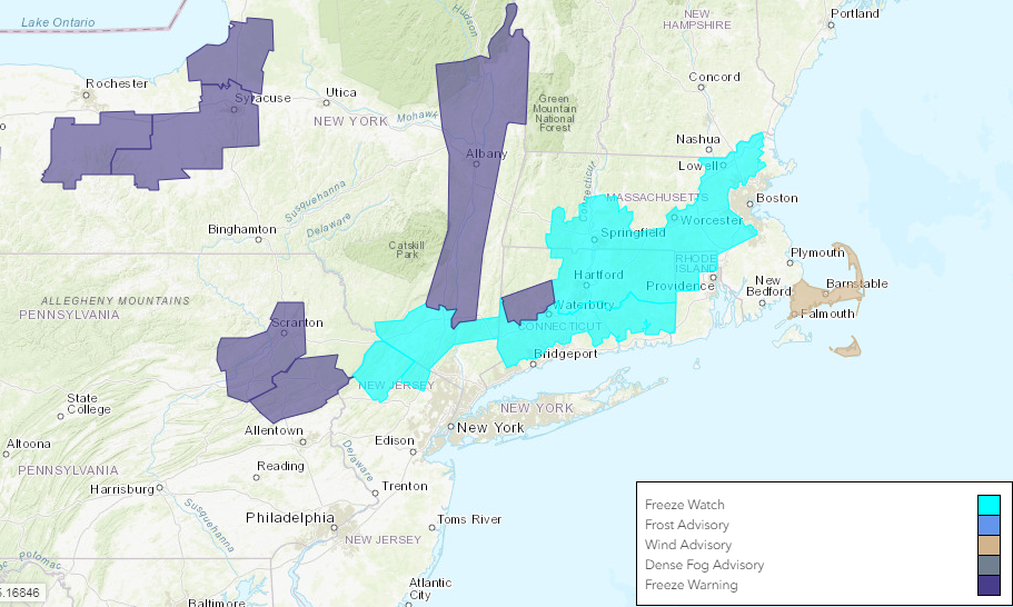
The National Weather Service has issued Freeze Watches and Warnings for interior parts of the Northeast tonight.
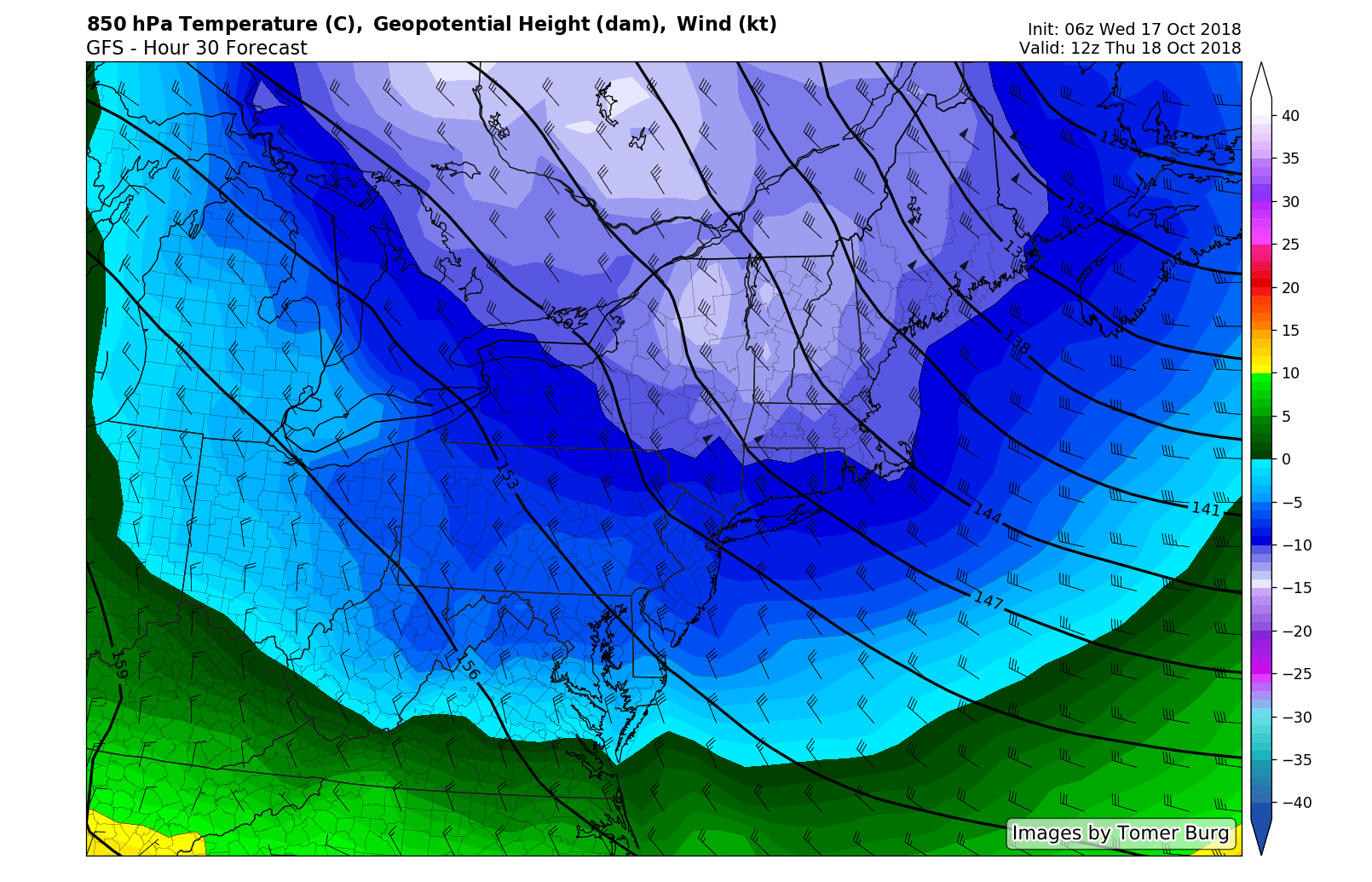
The airmass entering the Northeast states later Wednesday evening in to Thursday is associated with a piece of the polar vortex, which is temporarily speeding through New England. It is doing so as a result of a highly amplified pattern in the higher latitudes of the Pacific Ocean and Canada – and this is just the very beginning of it.
Forecast models are in good agreement that wind chill values on Thursday morning will fall into the 20’s area-wide, and will be even colder in parts of Interior New England (to be expected this time of year). High temperatures on Thursday may only barely reach into the 50’s throughout much of the Northeast states.
This is well below normal – by over 10 degrees across a very wide area. Blustery northwest winds will make things quite a bit worse. All things considered, it will feel like a winters day on Thursday with wind chill values in the 20’s to start and only into the upper 30’s/lower 40’s during the afternoon hours. A brief moderation in temperature is then expected again for a 24-48 hour period starting Friday.
Another piece of Northern Canadian/Polar airmass is forecast to surge northward into the Northeast states later this weekend and during the early part of next week, with another very cold airmass expected to slide through. This pattern will become common over the next 10 to 14 days, with temperatures running well below normal throughout the Northeast States and even parts of the Mid Atlantic.
You can thank an anomalously strong, poleward reaching ridge in British Columbia for that. Both the ECMWF and GFS agree that multiple ridges will form in this region, disrupting the weather pattern in the higher latitudes and causing the southward movement of colder than normal air. This feature appears to be a common theme in the weather pattern through at least the early part of November.
In addition to bringing cold air, the British Columbia ridge will also allow for a more amplified weather pattern – and the potential for storms. In fact, forecast models are already hinting at the potential for a more notable storm system during the 10/25 – 10/30 time frame. With a highly amplified weather pattern and colder than normal airmass in place, the forecast could get very complicated very quickly.
We’ll have more on that storm system later today. For now, enjoy the rest of your Wednesday morning!
Trackbacks & Pingbacks
2correlative
Leave a Reply
Want to join the discussion?Feel free to contribute!