-2")
PM Update: Calm, cool weather ahead of weekend Nor’Easter
Generally calm and cool weather is expected to continue over the next few days, with plenty of sunshine throughout the Northeast states and temperatures solidly below normal for this time of year. Building clouds on Friday will be the first sign of an impending storm this weekend, with a significant Nor’Easter expected to develop from late Friday Night into Saturday. Heavy rainfall, strong winds and moderate coastal flooding are all expected in the Mid-Atlantic, with even some wintry precipitation on the front end of the storm in the higher elevations of New England.
The system is forming several days after the potential for its development was first discussed. A highly anomalous pattern in the atmosphere, including the presence of blocking ridges of high pressure in Canada, set the stage for the storm. For meteorologists, these “warning signs” are important to catch, as they can provide enhanced lead time for storm development.
The system will gradually organize on Friday as a disturbance in the mid and upper levels of the atmosphere reaches the Southeast US coast. A weak low pressure will form there, with rainfall spreading northward into the Mid-Atlantic on Friday and Friday evening. Gradually, the system will begin to organize further.
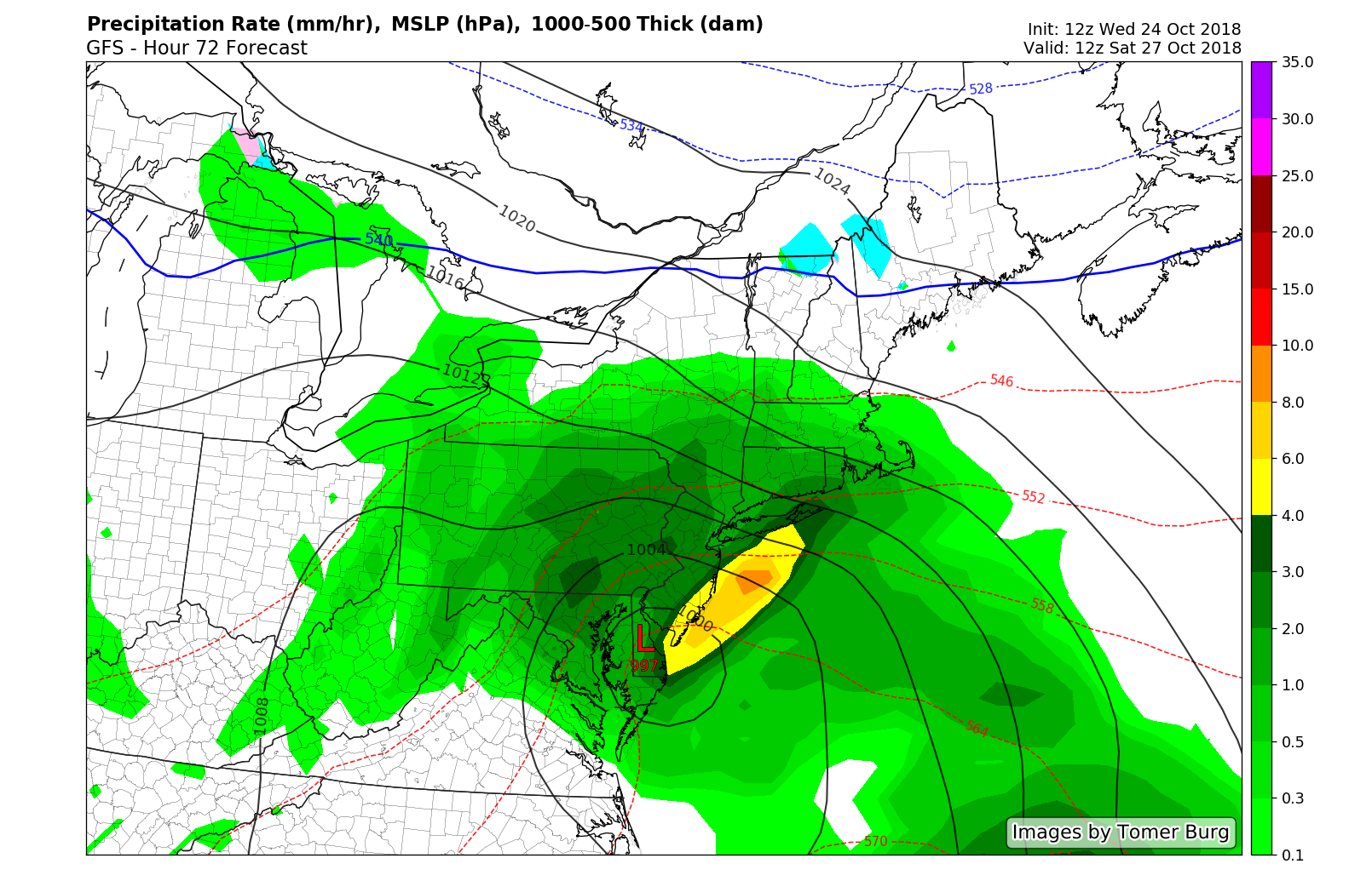
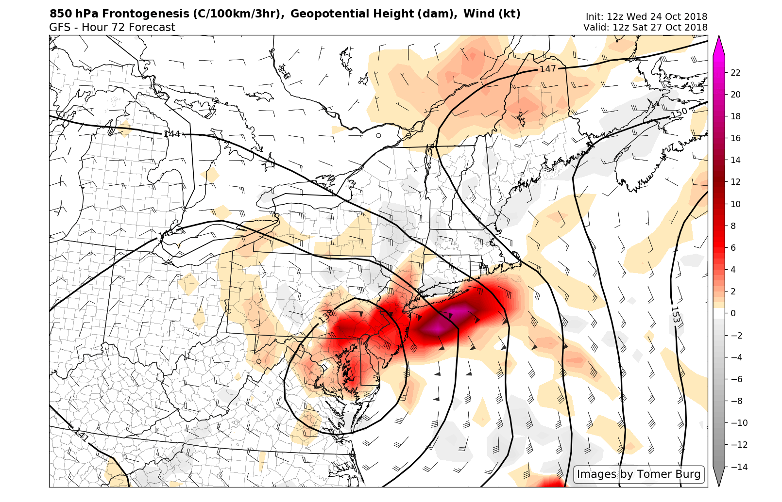
In the mid levels of the atmosphere, amplification and strengthening dynamics are expected to help boost the systems organization. Late Friday Night into Saturday, as the storm turns further northward up the coast and towards the Chesapeake region, a strong low level jet, or an area of stronger winds in the lower levels of the atmosphere, is forecast to develop.
This low level jet and associated lift/forcing for precipitation will lift northward from the Delmarva region towards Pennsylvania, New Jersey and New York from late Friday Night into Saturday morning. As a result, heavier rainfall is expected during that time. In addition, strong onshore winds may lead to moderate coastal flooding, 30-40+mph wind gusts, and perhaps some beach erosion.
Rainfall is expected to continue throughout the Northeast states on Saturday, with periods of drizzle and some periods of more steady, moderate rain. Regardless of the precipitation intensity, it will be a nasty, raw day – a washout in most senses – with some areas receiving over an inch of rainfall and localized flooding a distinct possibility.
In the higher elevations of the Northeast (especially New England), the potential exists for some wintry precipitation on the front end of the storm. This is most likely from Friday Night into Saturday morning in the higher elevations of New York, Vermont, New Hampshire and Maine. Forecast models suggest that the airmass will warm up quite quickly, with many areas changing to plain rain, but the distinct possibility exists that some higher elevations and ski areas will see some additional snowfall or wintry mix before that.
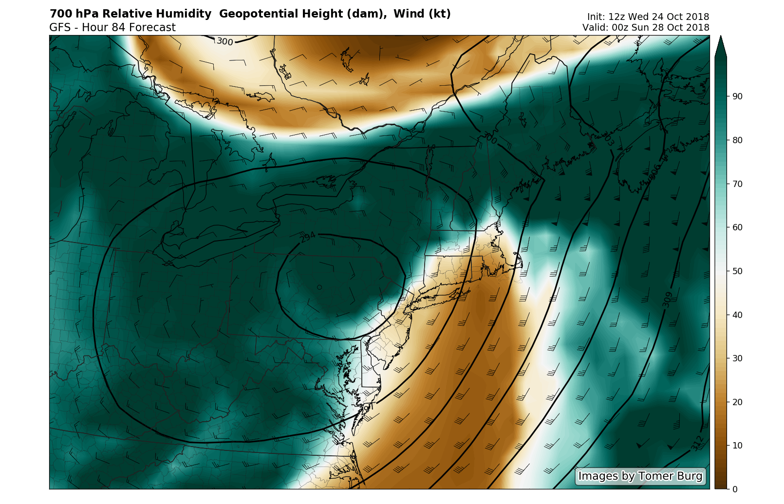
The system strengthens but begins to pull away on Saturday Night as a dry slot moves northward into New England. This will lead to drizzly conditions through the evening along the coast, but no real steady rainfall. Things begin to improve fairly dramatically by the time Sunday rolls around – although outdoor activities may still struggle as a result of the prolonged rainfall from Saturday.
Stay tuned over the next day or so as we continue to hone in on the details of the storm, including the potential for hazardous weather in more specific locations.
Leave a Reply
Want to join the discussion?Feel free to contribute!