-2")
NYC Area Forecast: Transitional weather continues, more rain late week
Remember this past Spring, when it seemed like we had settled into a pattern which brought us rain every single weekend? It looks like we might be back there again.
Forecast models are settling in to the idea that another storm system will impact the Northeast states from late Friday into Saturday, delivering multiple rounds of rainfall and no shortage of cloudy, dreary weather.
Luckily, there is plenty to enjoy until then! Temperatures are expected to gradually warm over the next few days, well into the 50’s on Wednesday and then into the 60’s on Thursday. This will come as a welcomed change, after several days of temperatures below normal.
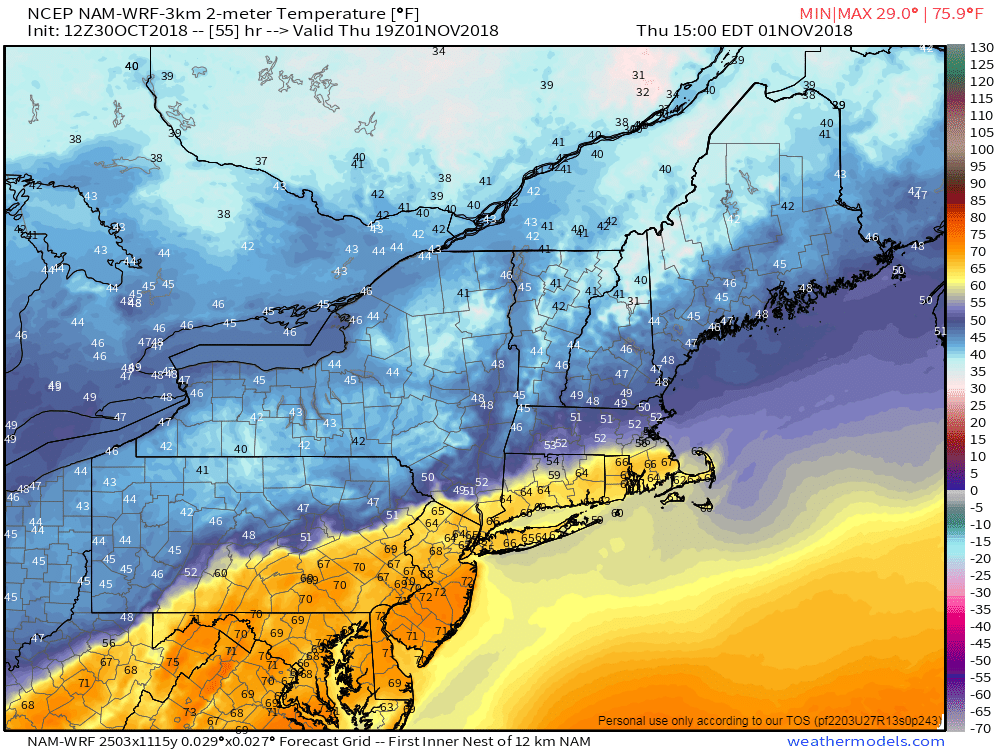
The forecast looks complicated on Thursday in particular, as the first arc of the storm system approaches the region. A warm front is forecast to lift northward from the Mid-Atlantic states into New England, settling near New England during the afternoon hours. Forecast model guidance has been shaky in regards to the fronts exact position.
Most guidance suggests that a warm front centered from Albany to Massachusetts will support warmth across the Mid-Atlantic and Southern New England, with temperatures well above normal (into the 60’s and perhaps 70’s in some areas!) on Thursday afternoon. But a few models still suggest the front will get hung up further south, limiting the warmth. Our current forecast continues to call for abnormally warm weather in NYC on Thursday.
Thereafter, the forecast turns unsettled and dreary. By Friday morning, a strengthening and organizing storm system is expected to lift northward into the Ohio Valley. This should send bouts of rainfall northward into the Northeast states, impacting the area essentially through Friday afternoon and early evening.
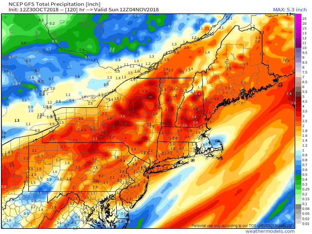
After a brief break, another low pressure system may develop along the same frontal boundary on Saturday. Additional showers and rainfall could shift northward into New England yet again, keeping the weather rainy and cloudy essentially through Saturday afternoon.
With plenty of moisture available, and plenty of lift in the atmosphere as multiple disturbances move through, model guidance is suggesting 1-2″ of rain over a large area through Saturday. Localized flooding will be possible yet again – but much less coastal flooding and wind issues are expected with this storm.
The good news is that Sunday looks particularly pleasant. Brisk winds are likely to move in behind the storm system, which will push off to the north of the region. Drier and more comfortable air is likely to move in, and we’re expecting a generally pleasant Autumn day.
Trackbacks & Pingbacks
1colored
Leave a Reply
Want to join the discussion?Feel free to contribute!