-2")
NYC Area Forecast: Active start to the week with multiple storms
An active weather pattern, which has gripped the Central and Eastern United states over the past week, will continue into the early part of the week ahead. Multiple storm systems will impact the Northeast states, with the opportunity for heavy rainfall on Monday and then strong to severe thunderstorms a distinct possibility on Tuesday. Temperatures, meanwhile, will be running several degrees above average throughout a large majority of the area.
The pattern remains quite amplified across the country, and has been essentially since the weekend Nor’easter from 10 days ago – when flooding and onshore winds left the New Jersey and New York coasts battered. After a pleasant second half of the weekend, things will begin to take a turn for the worst on Monday morning, as another low pressure system develops near the coastal plain.
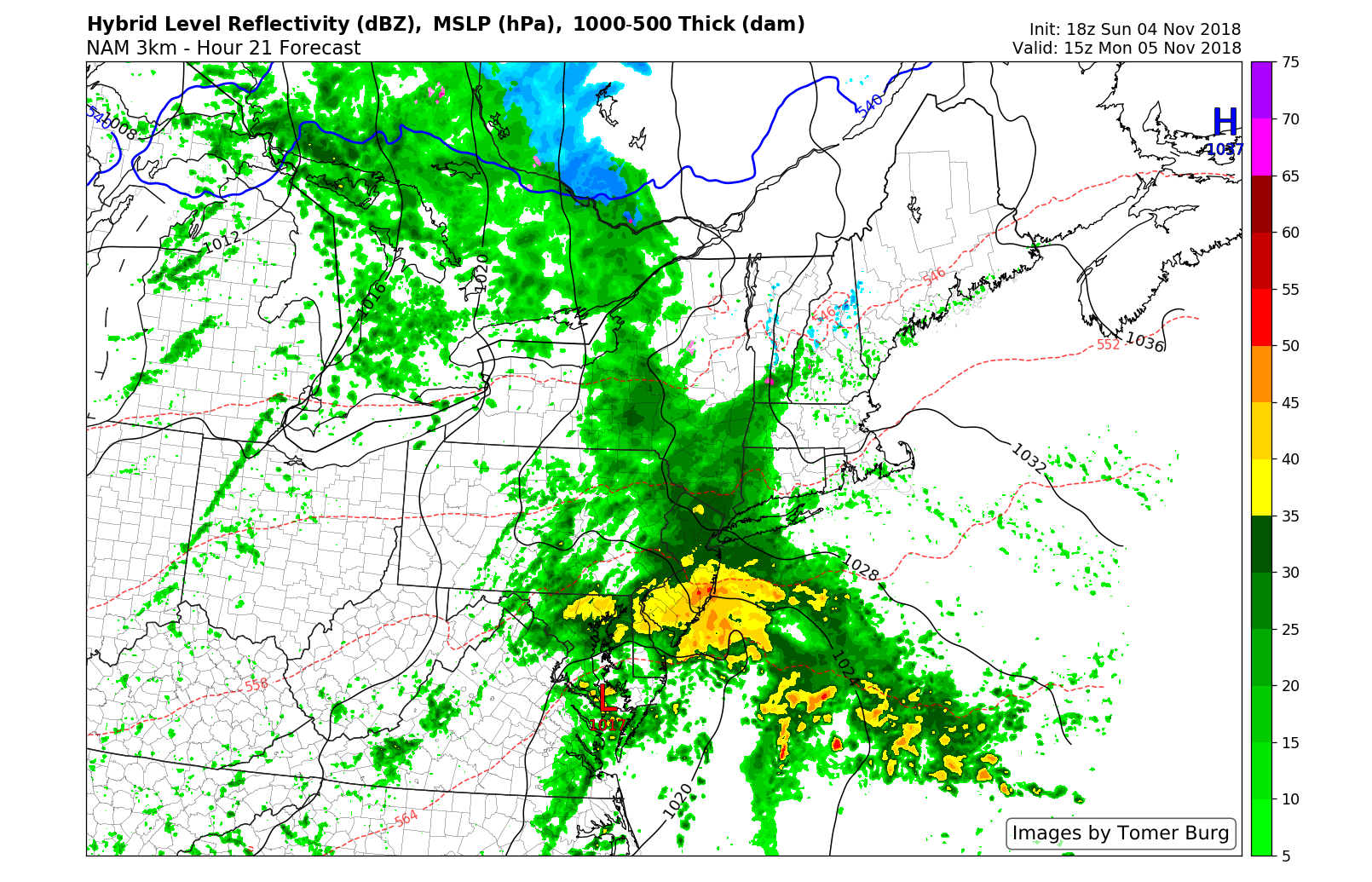
Models suggest the potential for heavy rain on Monday morning.
Rain is expected to shift northward during the morning hours from the Mid-Atlantic into the Northeast, first reaching the DelMarva and then shifting northward into parts of Pennsylvania, New Jersey and New York. Short term forecast model guidance is split on the development of the storm – mainly in the northward extent of heavy rainfall.
With a high pressure nosing in from the north over New England, the system will encounter some resistance on its approach. But moisture should increase and lift should lift far enough northward to allow for steady rainfall at times in the aforementioned regions. It won’t be a total washout, but it surely won’t be a pleasant day. The good news? The heaviest rain looks likely to remain just offshore. Throw that one into the folder for “it could have been worse”.
Tuesday’s severe weather potential
A stronger storm system is expected to develop in the Central United States on Tuesday. In fact, it will begin developing Monday, when a severe weather outbreak is possible across the Southeast States and parts of the Mississippi River Valley. The system will shift northeastward towards the Great Lakes, and a cold frontal boundary is eventually expected to move from the Appalachians towards the East Coast.
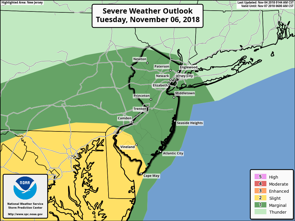
Storm Prediction Center has issued a Marginal and Slight Risk of severe weather in parts of the Northeast on Tuesday.
Tuesday will be a warmer day as a result, with southerly winds ushering in abnormally warm air. The atmosphere will also become slightly unstable from the Mid Atlantic to New England. As the front approaches, scattered strong to severe thunderstorms may develop within this unstable environment – and enough wind shear exists for them to organize.
Accordingly, the Storm Prediction Center has placed parts of the Mid Atlantic and Northeast states in a Slight Risk for severe thunderstorms, with a Marginal Risk for severe thunderstorms extending northward into New England. The main threat with these storms will be strong, damaging wind gusts during the afternoon and evening hours.
The pattern beyond…
A notable shot of cold air appears increasingly likely to surge into the Central United States during the next 7 days, and it will approach the East Coast as well. In fact, by next weekend, forecast model guidance suggests that temperatures could fall more than 10 degrees below normal in many parts of the Northeast.
The pattern will last until at least the middle of November, when the Pacific jet may become more active and extend eastward towards the United States. As that occurs, milder air should move back into the country.
Leave a Reply
Want to join the discussion?Feel free to contribute!