-2")
NYC Area Forecast: Strong storms possible in Mid Atlantic today
A strong cold front will approach the Mid-Atlantic and Northeast states today, and the development of showers and thunderstorms, some strong, is expected near and ahead of the frontal boundary this afternoon. The strongest storms are likely to stay further south across the Mid-Atlantic states, where greater atmospheric instability exists. Nevertheless, strong wind shear aloft could promote strong wind gusts with any storms that do develop.
A strong low pressure system will shift northward through the Ohio Valley and into the Southeast States tonight, and a powerful jet stream perturbation is moving through the Tennessee Valley in association with it today. This very same jet stream prompted the development of severe thunderstorms on Monday and Monday Night further west across the Mississippi River Valley.
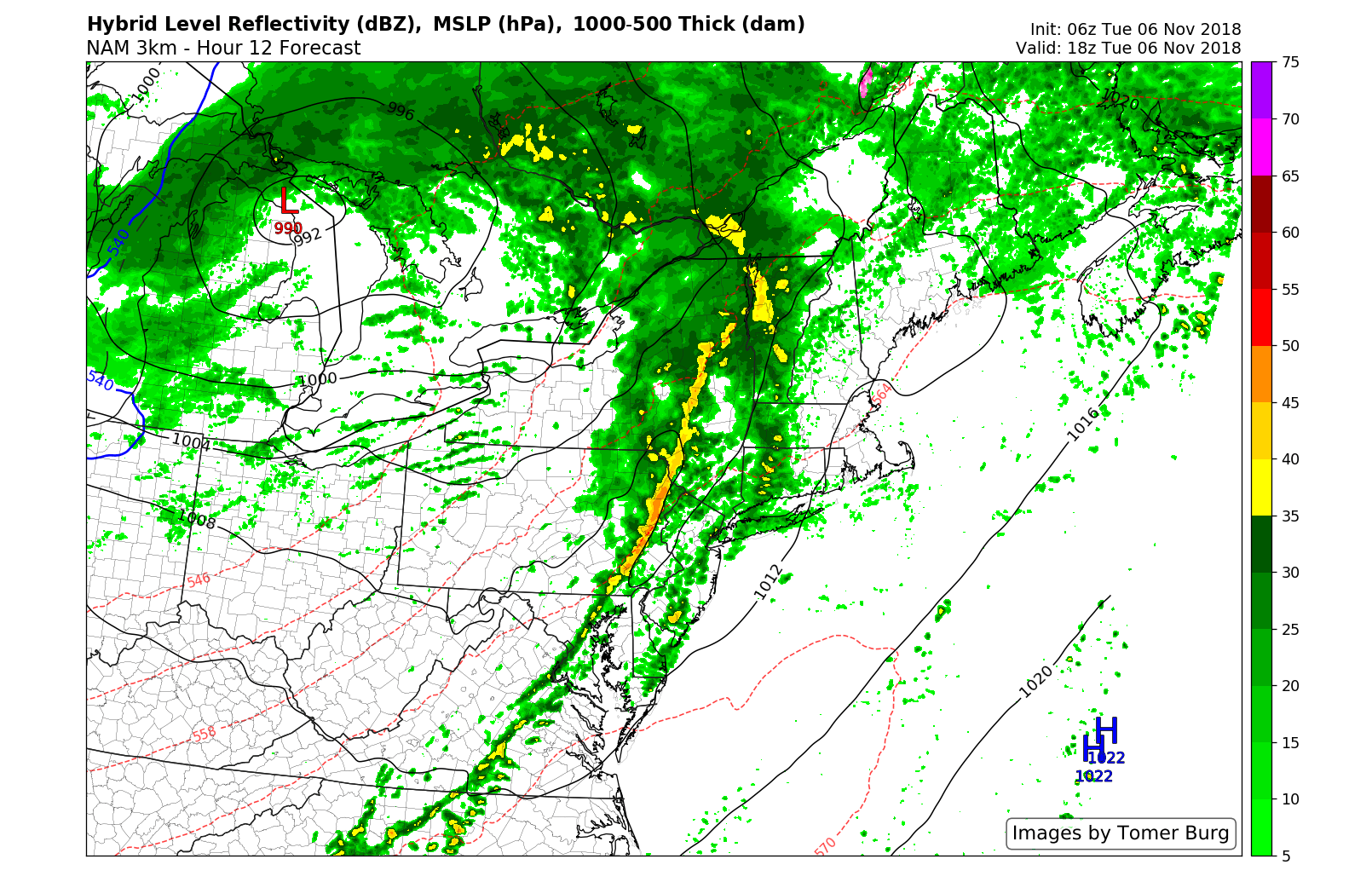
NAM model suggesting a line of stronger storms later on Tuesday afternoon.
Luckily, much less instability exists across the East Coast and the juxtaposition of instability and atmospheric dynamics (wind shear and lift aloft) is expected to be much less intense. Still, the development of a few stronger thunderstorms appears a distinct possibility later this afternoon. This will be especially true across the Mid-Atlantic States.
Accordingly, the Storm Prediction Center has issued a “Slight Risk” for severe thunderstorms across the Mid-Atlantic states, more specifically in parts of Maryland and Delaware. Forecast models suggest that stronger instability will develop here, and as the front moves through the region, storms may become more intense and capable of strong wind gusts.
Further north across New Jersey, strong storm activity should remain more isolated. Still, a “Marginal Risk” of severe thunderstorms has been issued, which suggests the potential for a few storms capable of producing strong wind gusts. Any time we have strong wind shear, it is important to err on the side of caution, as just one stronger storm can produce damaging winds.
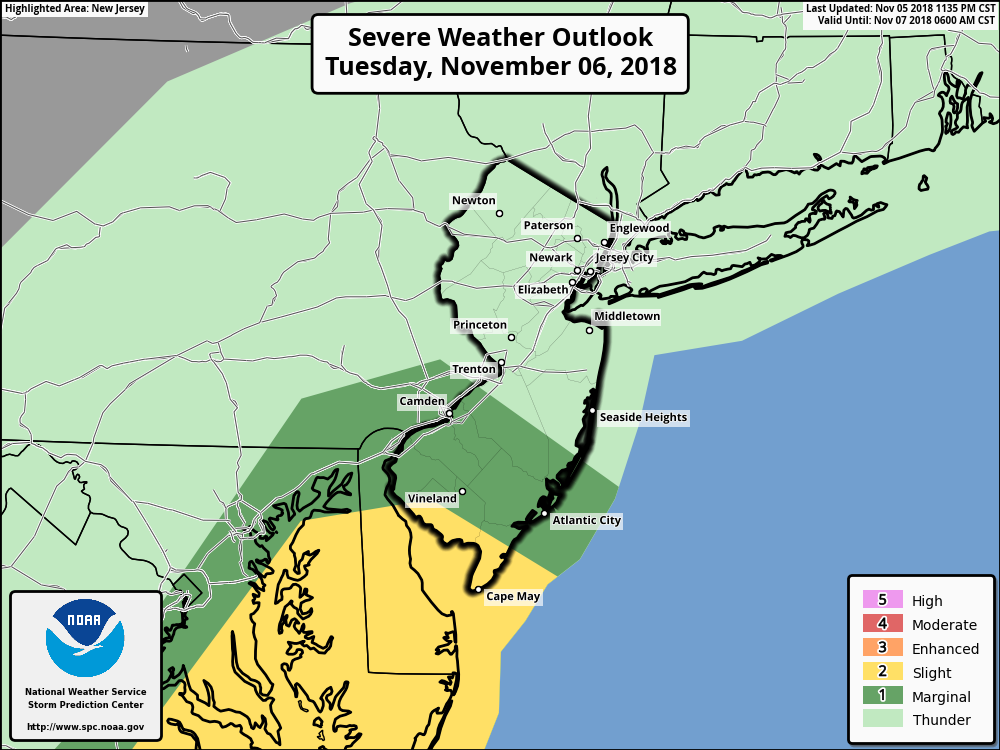
SPC Outlook showing a Marginal and Slight Risk in parts of the Mid Atlantic states.
The front moves offshore later this evening and the storm threat will come to an end across the region. Cooler and more stable air will be ushered in behind the frontal boundary. That will then lead us into a very, very cold weather pattern from late this week into this weekend.
We’ll have more on that in a separate, detailed post later today. Bundle up!
Leave a Reply
Want to join the discussion?Feel free to contribute!