-2")

NYC Area Forecast: Calm for now, heavy rain likely again Friday
Calm, pleasant, and warmer than normal weather is expected to persist for another day or two across the Northeast states. It comes as a welcomed relief to an active and soggy weather pattern that has plagued the Eastern United States as a whole over the past few weeks. The reprieve also won’t last long, as another storm system is expected to approach on Friday. This one will feature relatively impressive dynamics, and so the potential for heavy rain will exist (again) on Friday.
Today and Thursday | Not bad!
High pressure is generally expected to remain in control for the next 24-36 hours. This high pressure has built southward into New England, and the airmass source isn’t necessarily cold at all. In fact, it’s expected to get quite warm later today across a large majority of the East Coast. Temperatures are expected to move above normal for this time of year, with highs in the upper 50’s and lower 60’s.
These temperatures may be even warmer on Thursday, as winds shift to southerly and the storm system begins to organize back to our west in the Mississippi River Valley. As it begins to get its act together, though, clouds are expected to increase in coverage Thursday Night and Friday. The low pressure area will then begin to lift northward into the Ohio Valley.
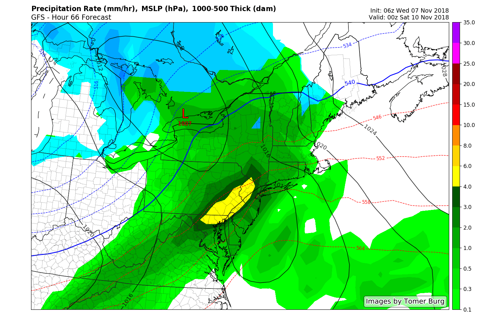
GFS suggesting the development of very heavy rain on Friday evening and Saturday morning.
Friday and Saturday AM | Bad
The chance of rain will increase steadily from Friday morning into Friday afternoon, first through the Mid-Atlantic and then into New England. In NYC and NJ, rain appears likely to become more steady after midday. During the afternoon and evening hours, an increasingly notable low level jet will approach. These low level jet streams help to increase low level winds and transport of moisture – as well as lift in the atmosphere.
As a result, models suggest a period of heavy/torrential rain is a distinct possibility from Friday evening into early Saturday morning, essentially from Eastern PA into NJ, NYC and New England, not coincidentally closest to the developing low level jet. Localized flooding will be a possibility in this region, depending on exactly where the heaviest rainfall does indeed develop.
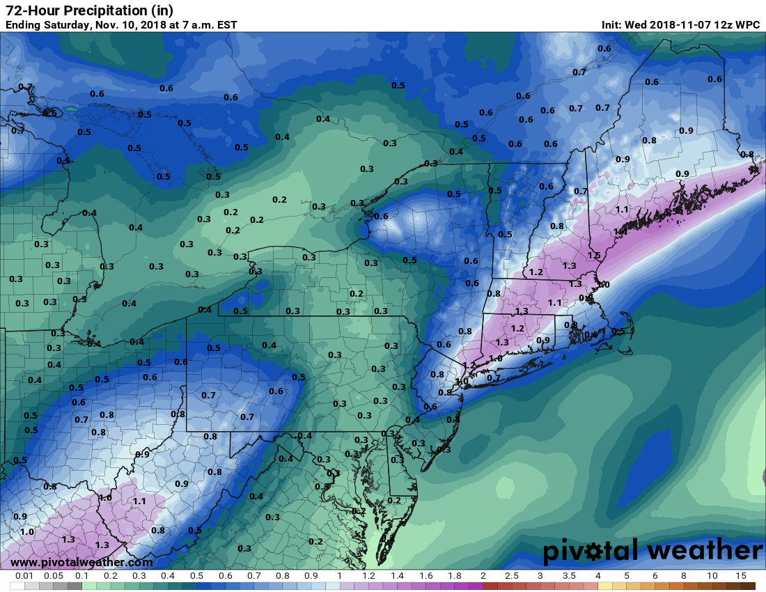
WPC forecasting an inch of rain or more from Northern NJ into New England through Saturday morning.
Weekend | Actually Good!
The good news in all of this mess? The system clears the region by Saturday morning. Low pressure will strengthen into Southeast Canada, but colder and drier air will be tugged southward behind it. This will lead to a colder than normal, but mainly dry weekend – which is a welcomed sight after several weekends in a row that featured at least one day lost to rain and dreary conditions.
Another storm system looks to be waiting in the wings, however, as forecast model guidance has begun to converge on the idea of rain (and perhaps wintry precipitation in the higher elevations of New England) by next Tuesday. More to come on that shortly. Have a great Wednesday morning, friends..
Leave a Reply
Want to join the discussion?Feel free to contribute!