-2")
NYC Area Forecast: Record cold expected on Thanksgiving
The well-advertised cold ending to November appears likely to continue this week, and it may very well reach its most impressive point yet on Thanksgiving, when temperatures are expected to fall nearly 30 degrees below normal in parts of the Northeast states. A deep trough is expected to surge into New England, and north/northwesterly winds will usher in colder air from Northern Canada.
The National Weather Service is already forecasting record low maximum (and minimum) temperatures in many places throughout the Northeast on Thanksgiving, with low temperatures in the single digits and teens and high temperatures in the 20’s and lower 30’s.
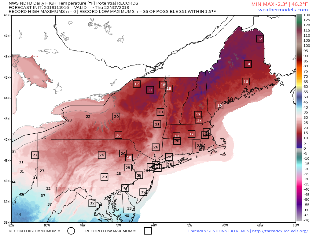
Perhaps most notable about the cold? The direction of the winds. North-northwesterly winds tend to bring much more impressive cold into the NYC Area when compared to west-northwesterly. The slight change to a more northerly wind component aids in the transport of pure, cold Canadian air into the NYC Area, whereas a westerly wind tends to become more modified on its path here. The bottom line? Bundle up on Thanksgiving. This could very well be one of the coldest you’ve experienced.
The weather until then will be largely transitional and generally non-impactful. Despite some very odd warnings of winter weather tonight in NJ and NYC, there is, in fact, no threat for winter weather tonight (did somebody at NJ Transit press the wrong button?). Instead, showers are likely in parts of Northern NJ and Southeast NY overnight, and then move through NYC in the morning. Much further north, in New England, wintry precipitation is likely in areas like Northern NY, VT, NH, MA and ME.
The cold air comes surging down on Wednesday Night into Thursday as a strong shortwave trough moves through. This trough may act to fire off a few snow showers and squalls, especially in Northeastern PA and Northern NJ. During these snow squalls, very light accumulations are possible and visibility may be reduced. The squalls will be more likely the further north one travels in New England.
Beyond Thanksgiving – Winter’s early arrival continues
Colder than normal weather is expected to continue after Thanksgiving, both on Black Friday and then again into the early part of December. In fact, the weather pattern is expected to remain continually supportive of colder than normal weather and perhaps additional snow/winter weather events as well.
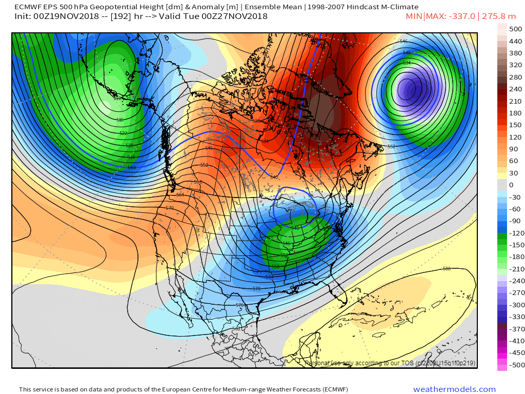
The culprit is high latitude blocking, which is developing this week some thousands of miles away in Scandinavia, Iceland, and Greenland. These “blocking” ridges of high pressure over North Atlantic, Canada and Arctic are huge harbingers for cold and snowy weather in our region during this time of year, as they help displace arctic air and slow down the atmospheric flow.
Not surprisingly, forecast model guidance and our best analog packages are all pointing to prolonged colder than normal temperatures well into the second week of December. With multiple disturbance emanating from the Pacific Ocean, and a few of them likely to cut underneath the blocking ridges to our north, the potential for wintry weather appears notably heightened during the period after Thanksgiving.
Hopefully the roads will be properly treated this time.
Trackbacks & Pingbacks
charles town races
3redhead
Leave a Reply
Want to join the discussion?Feel free to contribute!