-2")

NYC Area Forecast: Cold today, rain chances return this weekend
A deepening storm system in New England has done an effective job at tugging in some very cold air from Canada – and temperatures are well below normal throughout much of the Northeast states today. The movement of cold air, known more affectionately as cold air advection, will continue throughout the day today. Along with the cold temperatures will come blustery winds as the storm system deepens to our north and east.
Accordingly, the National Weather Service has issued Wind Advisories across parts of the Mid Atlantic, including Southern New Jersey. These Wind Advisories are placed where the strongest atmospheric pressure gradient is expected to be, where wind gusts will likely be the most impressive this afternoon. The Wind Advisories run until the very late afternoon, when stronger winds are expected to decrease in intensity.
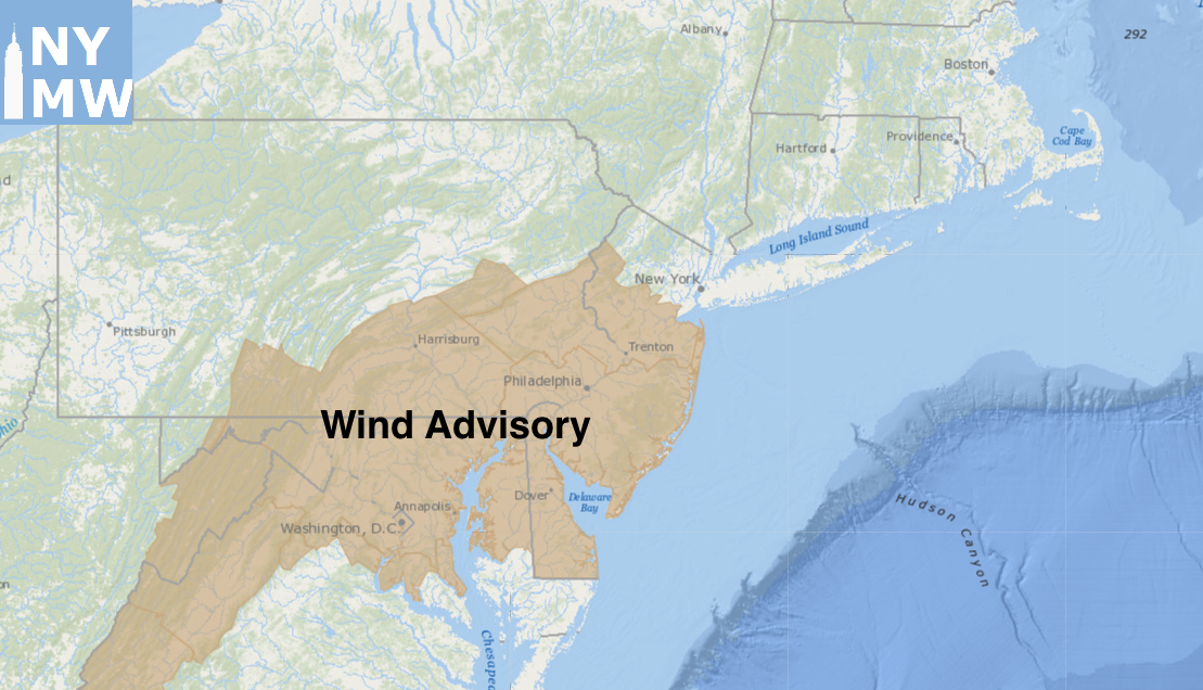
Wind Advisories valid through tonight.
For most other areas, it will simply be very cold and blustery. Bundle up if you’re headed out – this is a truly cold airmass and the wind isn’t going to help. The weather begins to transition as we head towards the latter half of the week and into the weekend. Multiple disturbances will head into the Western United States, and the very cold airmass that is overhead will be dislodged.
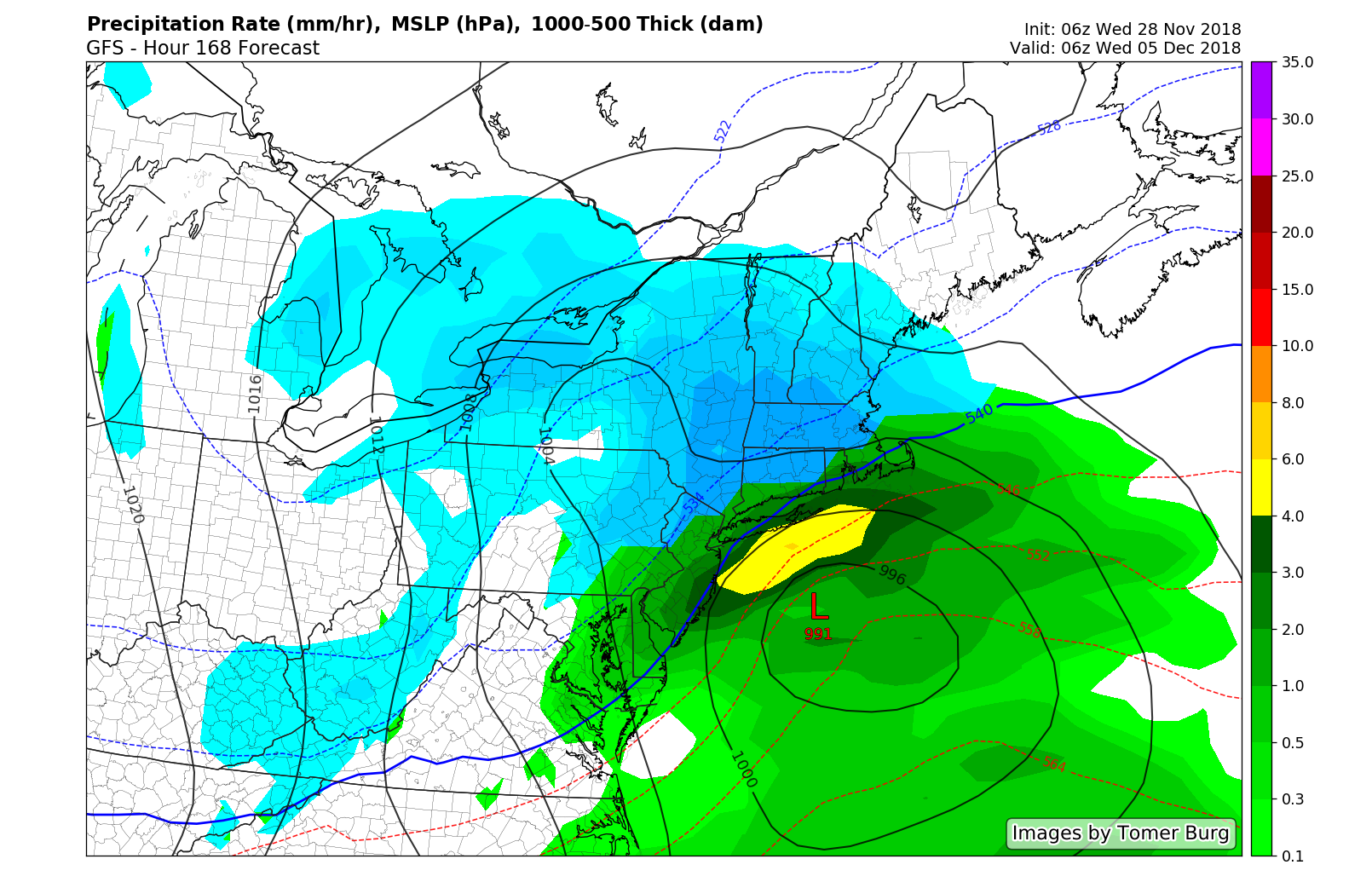
This will lead to a gradual moderation in temperature from Thursday through Saturday. An organized storm system approaches again this weekend, tracking into the Great Lakes. As a frontal system approaches, moisture will increase from late Saturday afternoon into Saturday evening, leading to – you guessed it – more rain. Periods of heavy rain are possible through Sunday morning, and with most areas still soaked from the past several rain events, localized flooding will again be a possibility.
For what its worth, before the cold frontal boundary truly passes the region on Sunday, the weather looks quite warm. In fact, temperatures could average 10 or more degrees above normal in parts of the Mid Atlantic and Northeast, including New York City, on Sunday. So break out the shorts! Kidding, but really, it does look quite enjoyable.
A system with wintry impacts appears possible next week.
Winter returns thereafter
As far as Sunday goes, don’t take the bait. The weather will snap right back to reality as soon as the frontal boundary crosses the region on Sunday Night, and it looks increasingly likely that the weather pattern will feature the potential for multiple storm systems again next week. This time, plentiful cold air will be present across the Northern 1/3 of the United States and Southern Canada.
In addition, a strong ridge is expected to build into the Pacific and parts of the Western North American shores. This spells bad news – and will likely heighten the opportunity for winter weather in the Northeast states some time during the middle and/or end of next week. Stay tuned as we draw closer..
Trackbacks & Pingbacks
1bloggers
Leave a Reply
Want to join the discussion?Feel free to contribute!