-2")
NYC Area Forecast: Cold, sunny weather dominates this week
Dense fog advisories were posted overnight for a large majority of the Tri-State area, including much of New Jersey, the NYC Metro Area, Long Island and even parts of Southeast New York and Connecticut. Warm air had settled into the region with plenty of moisture trapped near the surface. Visibilities have been reduced as a result, and we expect this mornings commute to be a little slower than normal. Leave yourself some extra time out there.
As a frontal boundary sweeps through the area this morning, most of the moisture in the lower levels of the atmosphere will gradually be displaced out of the region. This will reduce the threat for fog by mid morning, and conditions are expected to become mostly sunny by the afternoon hours. It’ll be a generally nice Monday after the fog clears.
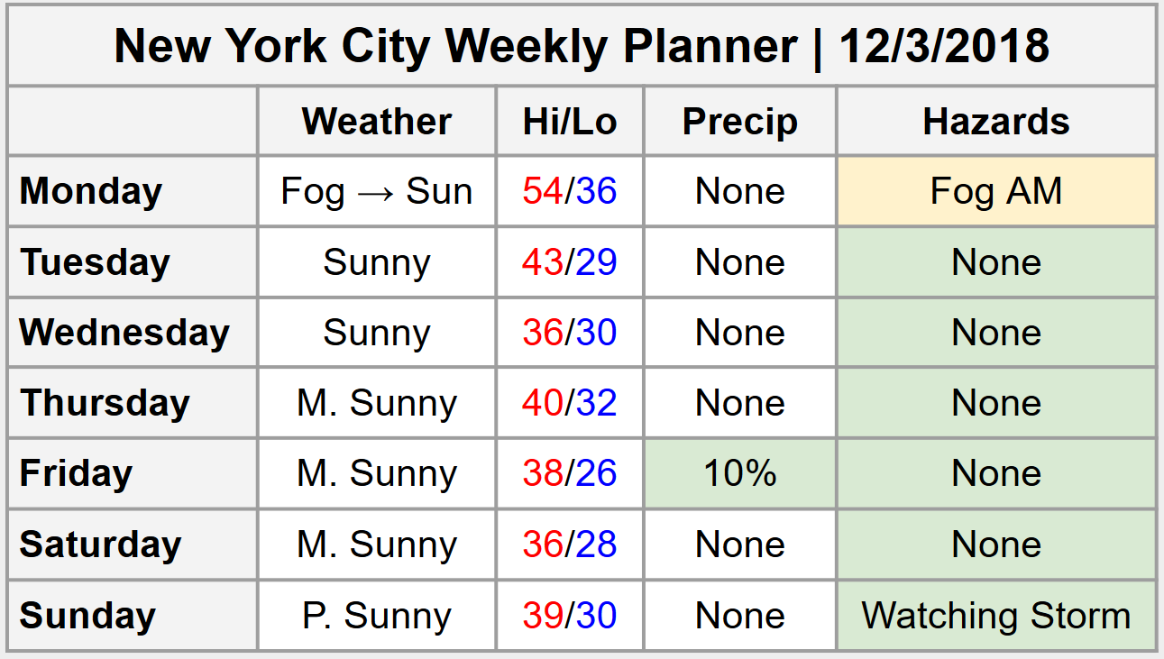
Weekly Planner issued 12/3/2018
The rest of the week looks similarly calm, which is a welcomed development to both us here on the forecasting team – and probably you as well. These past few weeks have been filled with stormy conditions and new hazardous weather every few days, so this respite from the active pattern is welcomed in with open arms.
Still, it won’t come without some excitement. A storm system slides barely offshore during the middle of this week, and what follows is some seriously cold air. Forecast model guidance suggests that temperatures will fall well below normal once again during the latter half of the week as air associated with the polar vortex moves overhead.
This development will lead to temperatures in the teens and 20’s for lows overnight and only in the upper 20’s to middle 30’s for highs during the day from the middle to the back end of the week. The brutal cold will be temporary, however, as the polar vortex-associated air begins to slide out of New England by Friday and Saturday.
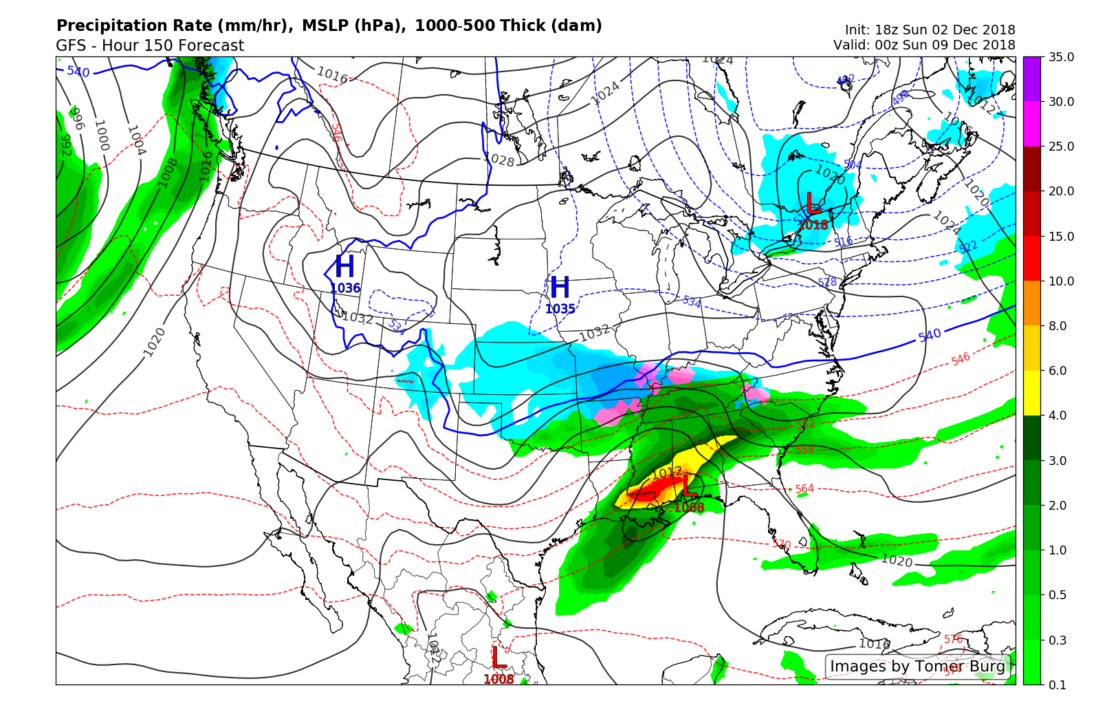
A notable storm system develops this weekend, and the track currently looks to take the system well south of the area. But we’re closely monitoring for any potential changes.
The forecast turns interesting once again this weekend. A strong disturbance is forecast by most reliable guidance to eject into the Southern United States. A low pressure system will develop in the Deep South and then move towards the Southeast States. What happens thereafter remains a major question.
Currently, most forecast model guidance suggests that troughing and cold air will remain present across the Northeast, essentially shunting the storm to the south and off the coast of the Mid-Atlantic. However, the timing of the interaction between the disturbances remains uncertain. A change in timing could result in the system having more room to move northward, which would obviously result in more notable impacts in our area.
We’ll be keeping a close eye on the potential for the next few days. For now, enjoy the upcoming stretch of sunny weather. Have a great Monday!
Trackbacks & Pingbacks
3vagaries
Leave a Reply
Want to join the discussion?Feel free to contribute!