Dry and cool conditions give way to a potential heavy rain threat this weekend
Good evening!
As we promised last week, much of the Northeast is now firmly entrenched in a cool and relatively quiet pattern that looks to stick around until at least the later half of this week.We kicked off the work week fitting that mold quite well as area of weak high pressure began to build in from Canada and over into portions of New England. This high pressure system ushered in a reinforcement of very dry lower to mid-level air that originated all the way from portions of the Arctic. With this very dry airmass in place, virtually the entire day has been clear across the Northeast, with the exception of a few spotty clouds further off to the north and west of the city. Given the already cold airmass in place, we saw high temperatures once again come in below the climatological average for this time of year, with highs ranging from the middle to upper 30’s during the afternoon hours. This evening will be yet another in a long-running series of cold nights as light winds and a dry/cold airmass allow for very efficient radiational cooling to take place.
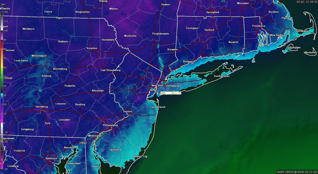
Lows should be able to sink down into the middle to upper 20’s for most of Northeast NJ, Southern New York, and portions of Connecticut -with locations well to the north and west possibly slipping into the teens tonight.
Otherwise, lows in the city and along the coast should be a little warmer, with temperatures staying in the upper 20’s to lower 30’s

This evenings hi-res NAM model showing lows getting well-below freezing once again tonight for much of the area
Cold and dry conditions once again dominate the Northeast
Those waking up for the AM commute Tuesday morning should expect more of the same, with very clear but also cold weather expected. Morning temperatures in and around the New York City area will likely be in the middle to upper 20’s-with lower 30’s likely in the city.
Yet another moisture-starved shortwave trough will be moving through portions of southeast Canada during the early afternoon hours, which should help to keep very dry/stable conditions over the Northeast. This dry air will allow for much of the region to stay mostly sunny, with the usual spotty clouds expected well off to the north and west over portions of New York state and Pennsylvania. Highs tomorrow afternoon will be quite similar to today, with temperatures staying in the middle 30’s for the majority of the region. Some readings closer to the coast may approach the lower 40’s, but it will still feel quite cool. As we head into the early evening and overnight hours, the weak shortwave trough that was previously located over portions of southern Canada will quickly move through the Great Lakes and into the Northeast. While this system is very dry and limited in its precipitation potential, there may be an outside chance at some flurries or light snow showers for locations to the north and west of the city. Lows tomorrow night will once again range from the middle to upper 20’s for the majority of the area, with the typical colder readings for locations to the north and west.
Wednesday should be another uneventful day across the Northeast as the area of high pressure that has been in control of our weather begins to gradually head to our east over eastern Canada. Stout northwesterly flow will be in place for the morning and afternoon hours which will allow for the same mostly sunny and cool conditions. Highs will likely be somewhat warmer during the day Wednesday when compared to Monday and Tuesday, but should still be slightly below-normal for this time of year with middle to upper 30’s likely for much of the area. The area of high pressure located over eastern Canada will begin to sink to the south and over New England on Wednesday night, which should provide another great chance at substantial radiational cooling. Expect lows dip down into the middle to upper 20’s for the area, which teens for inland locations.
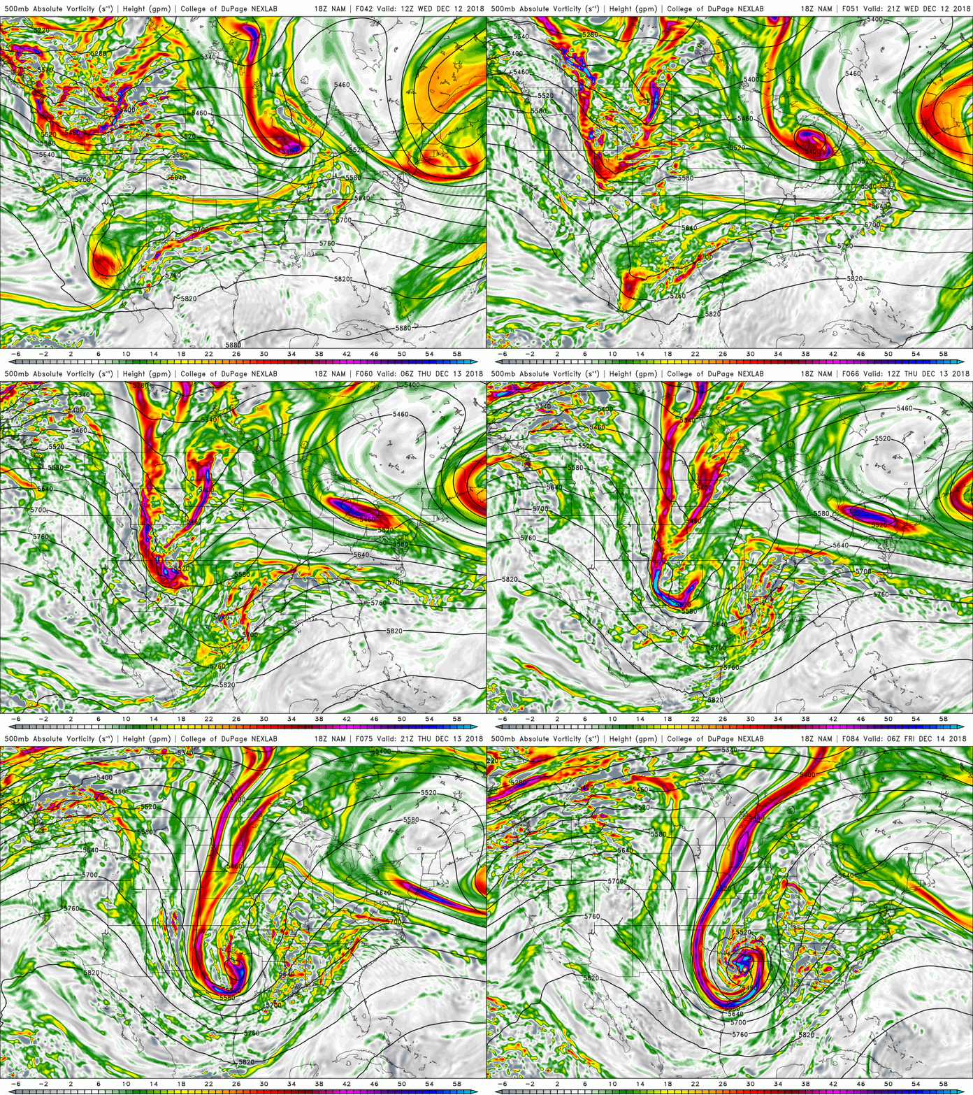
As high pressure continues to sink to our east Thursday morning, another sneaky shortwave trough will be rapidly moving through the Great Lakes and into the Northeast. While this shortwave trough is relatively small and dry compared to its surrounding environment, the high pressure edging off the New England coast may be able to give this system a “boost” as the mid-level flow will be coming from the Southeast US instead of Canada. This could allow enough warm air advection to creep into the Northeast/Mid-Atlantic and interact with the dynamics of this shortwave to produce some light rain/snow showers (or even graupel) over the area on Thursday afternoon/evening.
Right now this solution isn’t set in stone and will have to be reviewed, but it’s something to keep an eye on in an otherwise boring pattern. With the aforementioned return flow coming from the south during the day on Thursday, we should see temps finally get into the upper 30’s and lower 40’s area-wide, though if the shortwave trough trends stronger/more moist, we could really put a cap on just how “warm” temperatures get Thursday afternoon.

This evenings NAM model showing the small, but energetic “clipper” system approaching the Northeast on Thursday followed by a larger system taking shape in the South
Heavy rain threat growing for this weekend
As we head into late Thursday/Friday, a shortwave trough from the Pacific Northwest will drop into the Rocky Mountain region and begin to phase with another piece of energy over northern Mexico. The overwhelming majority of this afternoons model guidance indicates that the result of this interaction of these two systems will yield another large area of rain breaking out over the South just in time for this weekend. As this system continues to the east during the day on Friday, it will likely “cut off” from the main jet stream, which will allow it to slowly make progress over the Southeast US while dumping very heavy rainfall. Things get interesting on Saturday as we see a similar pattern to this past weekend, with confluence in southeast Canada, and a storm to the south.
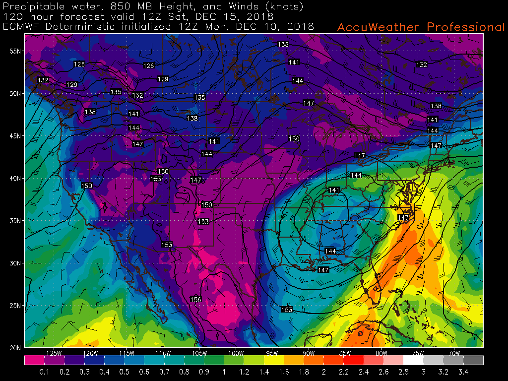
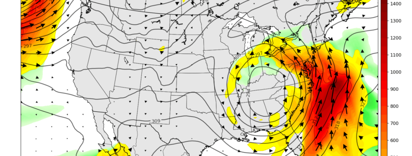
However, this time around there is no injection of cold air ahead of the storm and the confluence over Canada isn’t nearly as strong as it was this past weekend. This should allow for the upper-level low to very slowly move to the east and cause an impressive low-level jet streak to develop over the Southeast US and extend into the Northeast by Friday night. This low-level jet will be capable of transporting a very moist maritime tropical airmass from the Caribbean along the East Coast by Saturday morning, which will likely result in very heavy rainfall-and possibly even some flooding concerns. The evolution of the storm then becomes a bit more uncertain as we head into late Saturday and Sunday-with the potential for this upper-level low to linger in the East, which could prolong the rain/shower threat until Sunday.

12z ECMWF model showing a very healthy and moist low level jet extending from the Southeast US and into portions of the Northeast (AccuWx Pro)
We’ll be keeping an eye on this potential system over the next few day’s to monitor any potential hazardous weather that may accompany it, so make sure to check back soon for further updates!
Have a great night!
Steve Copertino


Leave a Reply
Want to join the discussion?Feel free to contribute!