-2")

NYC Area Forecast: Weekend rain looks likely
Weekend Forecast Rating: Rain is increasingly likely this weekend, both on Saturday and Sunday, with dreary and damp conditions expected. 2/10
Light snow fell throughout the area today, and most of it has ended this afternoon. Some areas of light snow may continue through the evening hours residual moisture and lift in the atmosphere meander over the area. Near the coast, this will fall mostly as a mix of rain and snow/ice pellets. Accumulations aren’t expected in most areas, and even in the interior we are only anticipating a coating on some colder surfaces.
By Friday, the atmosphere will be transitioning as warm air advection increases in intensity. A departing high pressure in New England will allow the warmer air to move in to the area unabated, with some drizzle and showers possible throughout the area during the morning hours ahead of a larger and complex storm system.
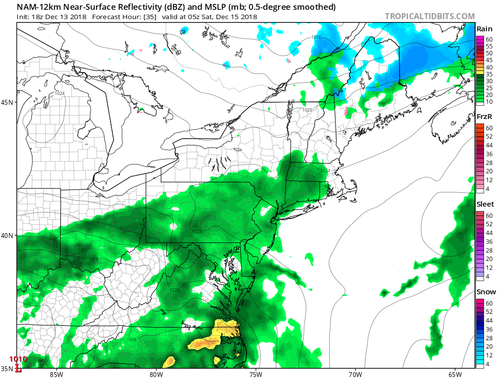
Rain will move into parts of the Mid Atlantic and Northeast as early as Saturday morning.
A low pressure area develops into the Ohio Valley later on Friday and is expected to begin to redevelop off the East Coast on Saturday morning. This will allow showers to spread northward through Saturday morning into the Mid-Atlantic and Northeast – although the northward extent of the steady rain is still in question.
Nevertheless, steady rain will push northward from Washington, D.C. towards New Jersey and New York City by Saturday afternoon and evening. As the low pressure system redevelops off the coast, it will begin to slow down in response to additional energy in the mid/upper levels of the atmosphere.
The result will be continually dreary conditions, particularly from Saturday afternoon into Sunday morning. The secondary low pressure area will not truly begin to pull away from the region until Sunday evening, when precipitation will begin to shift eastward off the coast of the Northeast states.
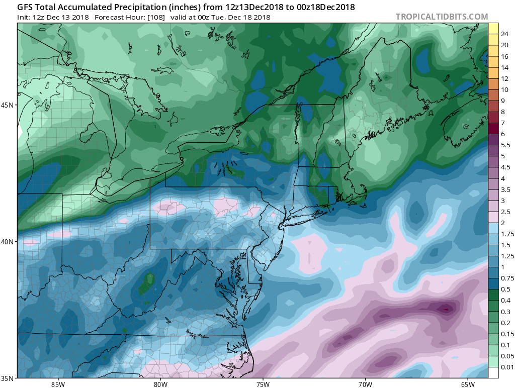
1-2″ of rainfall is possible across the area through Sunday Night.
The end result of all of this? A dreary, unsettled and rainy weekend appears increasingly likely. Temperatures will be warm enough to preclude any wintry precipitation – so this is just a cold rain – but it won’t be pleasant at all.
The weather looks to improve during the early part of next week, and the next step in the forecast will be eyeing a longer range trend toward the return of colder and stormier conditions. More on that this weekend! Enjoy the rest of your Thursday!
Leave a Reply
Want to join the discussion?Feel free to contribute!