-2")
NYC Area Forecast: Storm departs tonight, calm start to the week
Weekly Weather Rating: Cold to start, but at least it’s dry. Trending milder as the week goes on, with rain likely on Friday. 6/10
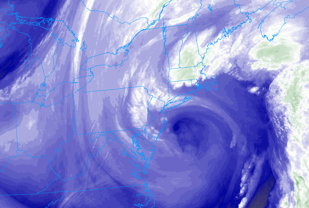
Period of rainfall and temperatures in the 30’s and 40’s made Sunday a real bummer, and the rain is wrapping up this evening. The low pressure system off the coast of New Jersey will begin its trek eastward and out to sea, bringing the dreary weather with it. We expect rain to continue for a few more hours tonight before calmer and more benign weather moves in.
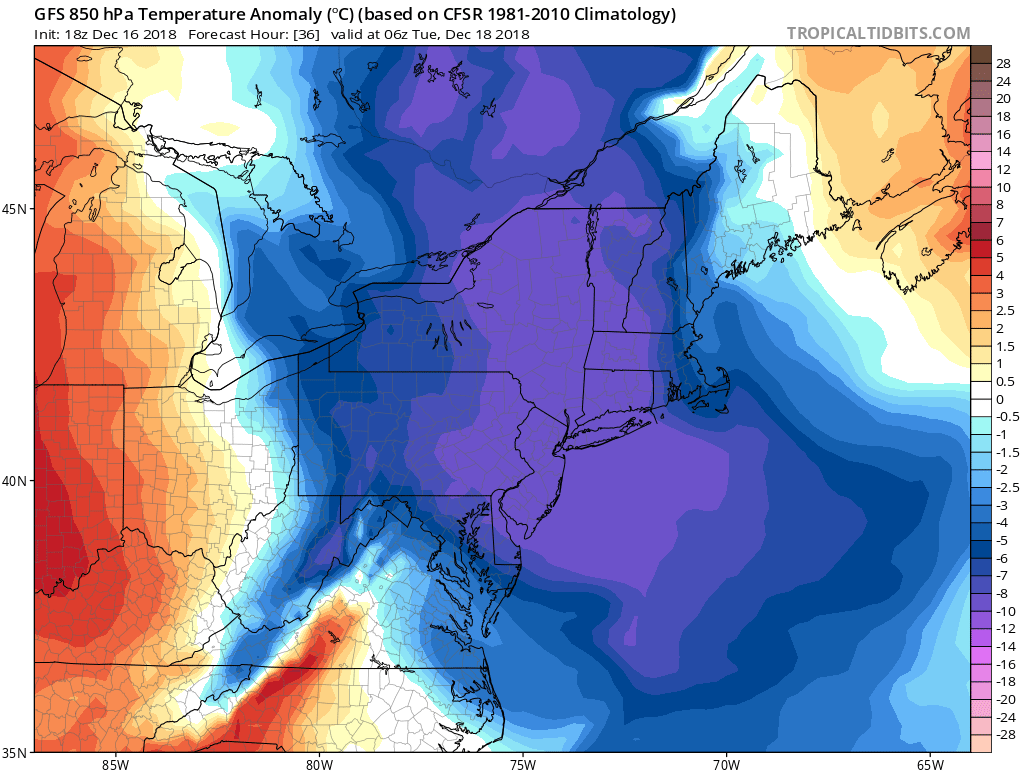
Cold air moves into the Northeast on Monday and Tuesday with a shot of polar air.
With the departure of the storm system will come a brief shot of anomalous cold. A trough emanating from Canada will slide southward into New England from late tonight through Tuesday, and it will be marked by a cold frontal passage on Monday with the potential for a few snow or rain showers. Still, the main story with the trough itself will be cold air, and temperatures are expected to run a few degrees below normal through Tuesday.
Moderating trend and a late week rainer
As the cold air from early in the week begins to lift out, the atmospheric pattern will trend milder throughout the Mid Atlantic and Northeast. A zonal flow will mark the presence of maritime, Pacific air, which is expected to invade the country this week. Temperatures will bump up a few degrees each day as we move through the middle and toward the back half of the work week.
The good news? The large majority of this week is expected to be quiet. It will trend warmer each day, but we aren’t anticipating any rain for the better part of Tuesday through Thursday. Temperatures will run above normal by the time Friday approaches.
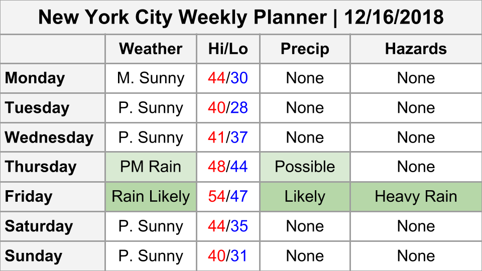
Weekly Planner for the week ahead.
As the late week period approaches, model guidance is in good agreement that a more significant storm system will form. Another large trough will approach, this time from the Mississippi River Valley. Southerly winds will increase late Thursday Night into Friday, and confidence is rather high that rain will again be likely throughout the area on Friday morning and perhaps afternoon.
Behind that storm system will come another shot of colder than normal air (are you noticing a trend here?) for next weekend – with the potential for a few polar disturbances delivering sporadic wintry precipitation next weekend as well.
Much more coming your way this week, including the details on the pattern as we approach Christmas – and a look into the New Year. Have a great Sunday evening!
Trackbacks & Pingbacks
1include
Leave a Reply
Want to join the discussion?Feel free to contribute!