-2")
Clear and cool start to the week, attention turns to Friday
Temperatures were be quite cold to start the day across the vast majority of the Northeast – and they still are! Dry air has moved in to the region from Canada as well. This will keep any clouds at bay, allowing for a mostly sunny day, with temperatures in the lower to middle 30’s for much of the area, with the usual colder readings off to the north and west. A weak area of high pressure will gradually build-in during the course of the afternoon/evening hours which will continue the cool and clear conditions into the overnight hours. With dry air in place, a building high pressure system, and light winds, radiational cooling will be near-ideal tonight. As a result, low temperatures will once again be quite cold area-wide. Reading should easily drop down into the lower to middle 20’s over the immediate metro area, with teens possible just off to the north and west.
Wednesday should start off rather cold again for the AM commute (widespread 20’s), but we’ll see the weak area of high pressure over the Northeast gradually move off the Mid-Atlantic coast by the early afternoon hours. This will allow the northwesterly flow we have been under to be replaced by a more westerly/southwesterly flow. As the mid-lower level flow begins to shift, this will allow slightly warmer temperatures in the upper 30’s to lower 40’s to be common across much of the area on Wednesday. Despite the changing airmass, conditions should remain relatively dry and cold for the overnight hours on Wednesday, with lows coming in around the upper 20’s to lower 30’s.
Things will then begin to shift quite a bit as we head into Thursday, as our next storm system takes shape over the deep south. Mid-level flow will begin to strengthen out of the southwest during the day, ushering in a warm/moist airmass that should lead to increasing clouds during the day. Despite the increasing mid-level temperatures, increasing clouds should limit any real warmth until later in the period. Accordingly, highs will still be relatively “cool”, with widespread lower to middle 40’s likely. Moisture will steadily increase from the south during the evening/overnight hours on Thursday in conjunction with a strengthening upper-level jet, which will allow for widespread showers to develop, with steadier rain moving in overnight.
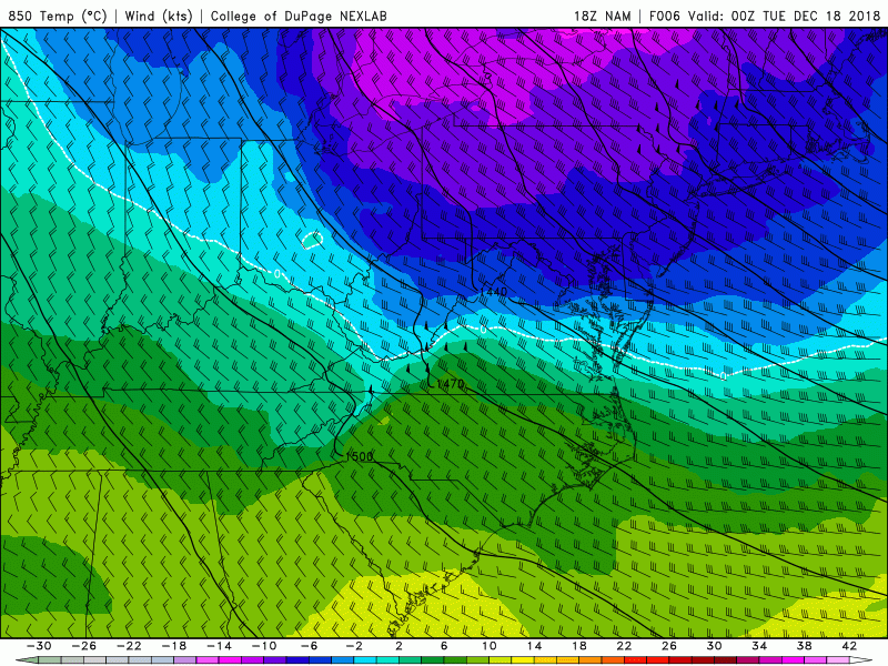
This afternoons NAM model showing the gradual chance from a cool northwesterly flow, to a relatively warmer and more moist airmass from the southwest.
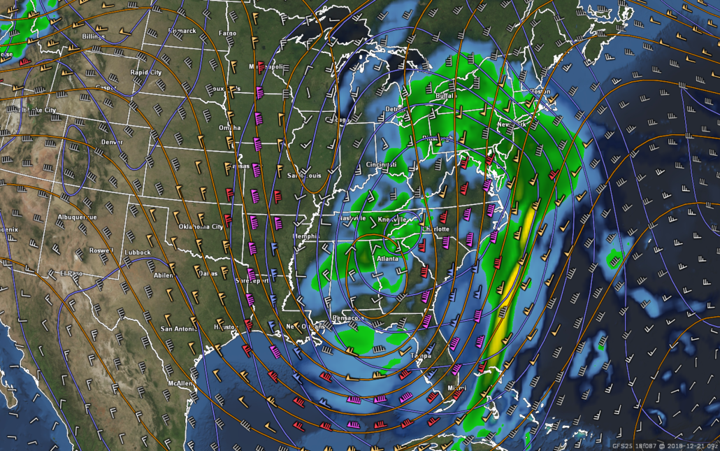
Impact storm likely by Friday over much of the East Coast
A large piece of energy originating from the Pacific Ocean will begin to interact (phase) with another area of energy to its north over the Southern Plains on Thursday evening, creating yet another large area of low pressure developing over the Southeast US. Unlike the past two weekends/storms, this system will not have confluence or any incoming shortwaves moving down from Canada to potentially shunt any precip off to our south. As this system matures and deepens during the day on Friday, an impressive area of rain and isolated thunderstorms should be ongoing over the Southeast and Mid-Atlantic states. This batch of heavy rain should have a strong low-level jet feeding it moisture-rich air that will be originating from the Caribbean/Bahamas.
Heavy rain and isolated thunderstorms could move into the NYC area as early as Friday morning, though there is some disagreement among the reliable model guidance at this time concerning the exact timing. Regardless, we expect a period of heavy rain to move through during the day on Friday with the potential for heavy downpours and gusty winds. The bulk of the heaviest rain should tapper off by Friday night as the occluding surface low quickly heads into southern Canada. There is a chance that we could see some wrap-around precipitation last into Saturday, but the exact timing and track of this system will dictate the duration of this systems precipitation. While the exact details will need to be ironed out over the next few days, this system could significantly impact the holiday travel for a large section of the country so check back for updates!
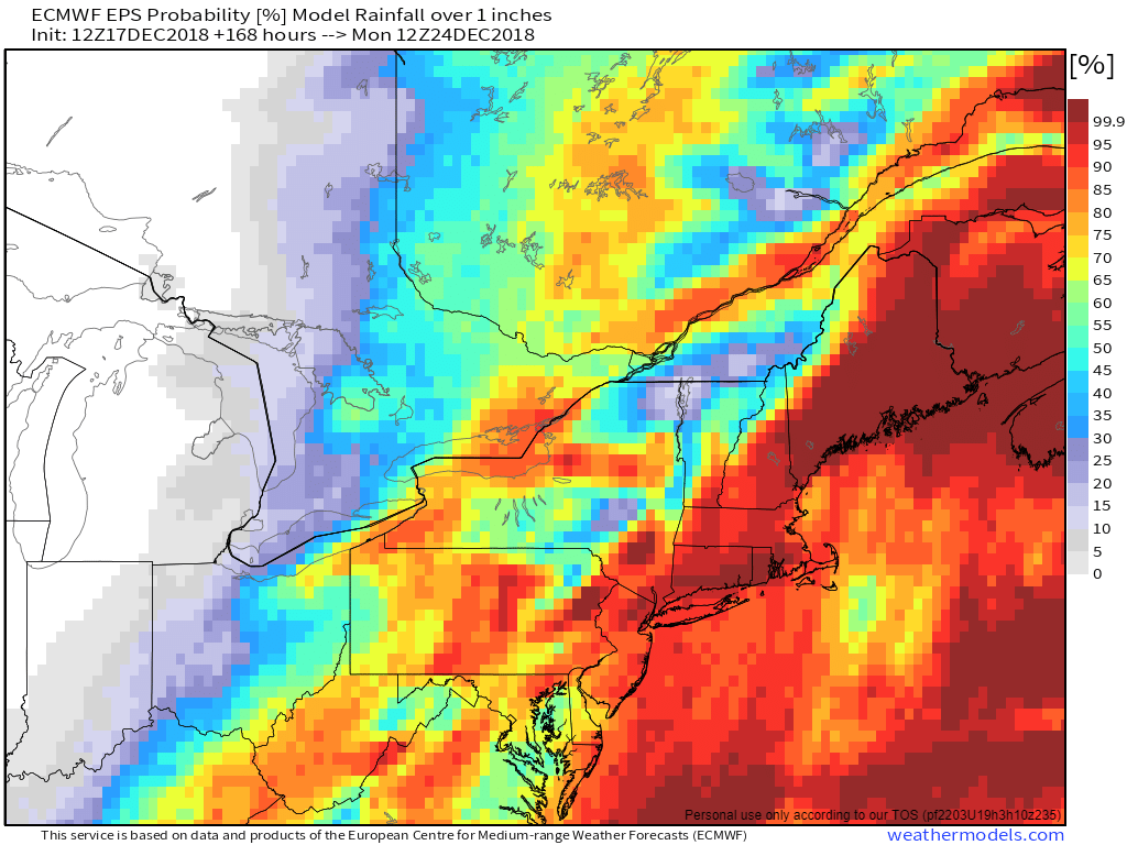
This afternoons 12z European Ensembles showing a very high probability of 1″ or greater of rain on Friday for the Northeast
We’ll have an update on this potentially impactful system by Wednesday! Stay tuned!
Have a great night!
Steve Copertino
Leave a Reply
Want to join the discussion?Feel free to contribute!