-2")
Flooding rains likely to impact holiday travel Friday
Briefing: Heavy rain and possibly flooding concerns Thursday/Friday, colder and calmer pattern will follow…
This morning (Thursday) will start off quite cool with temperatures in the upper 20’s to middle 30’s across much of the New York metro area with a few passing mid to high-level clouds for the AM commute. Calm, clear, and cool conditions should last throughout the majority of the day as a large and highly-anomalous upper level trough amplifies over the Southeastern states. As this system amplifies and strengthens off to our south, the low-level flow will gradually shift from southwest to due south, causing a much warmer and increasingly moist airmass to creep northward. Overcast and some spotty showers will be possible by the PM commute, especially for locations south of the city.
Things really begin to go downhill by 8-10pm tonight as a large shield of moderate to heavy rainfall overspreads the entire Mid-Atlantic and Northeast. This area of heavy rain will be fed by an extremely impressive low-level jet that will originate all the way from the Caribbean. In fact, the moisture being transported into our area will likely break precipitable water values for this time of the year by nearly three-hundred percent!
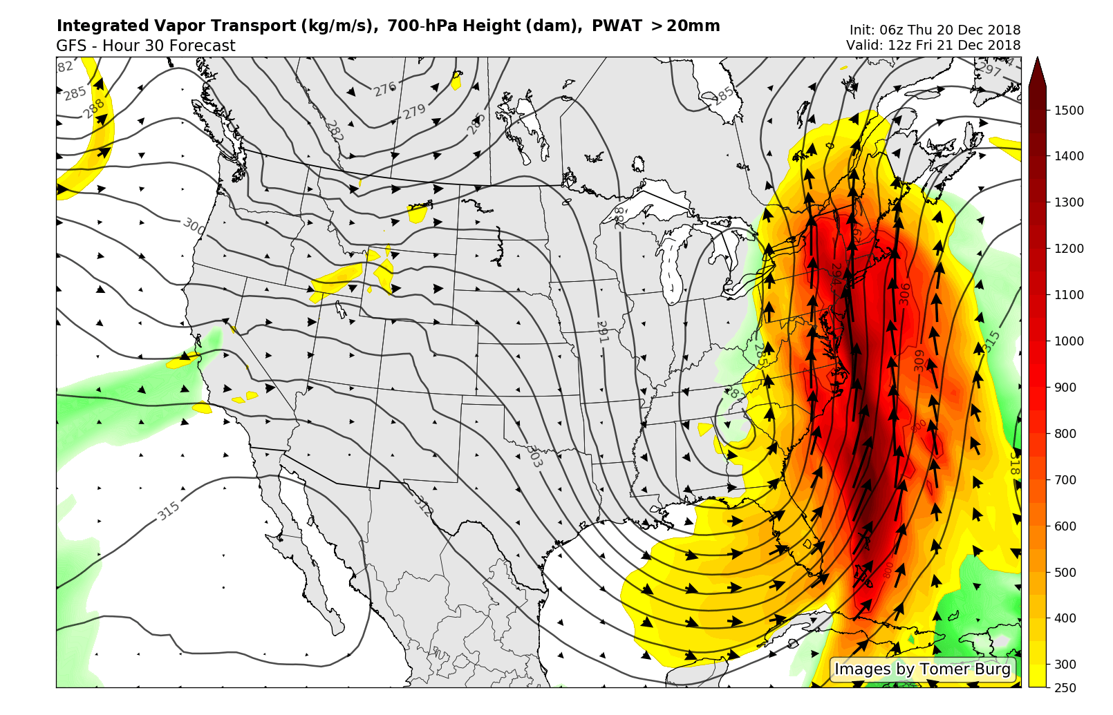
GFS showing moisture transport from the Carribbean with Friday’s storm system.
The first push of heavy rain will likely last throughout the overnight hours and into the early morning hours of Friday, with a chance at some low-topped thunderstorms moving over portions of Eastern Pennsylvania, New Jersey, and portions of Long Island. Rainfall amounts could close in on 1-1.5 inches by the Friday morning commute, possibly leading to some flooding issues for areas with poor drainage.
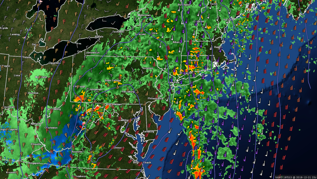
Heavy rain and potentially a thunderstorm or two will continue through the morning hours and into the early afternoon on Friday. Moisture transport and dynamic support for heavy rain will be maximized during this period, possibly leading to pockets of heavy rain and thunderstorms producing rainfall rates of up to 1-2″ per hour. As a result, the threat for flash flooding will quickly grow during the morning/early afternoon hours, especially for urban and low-lying locations. Moderate to heavy rain should then extend through the afternoon hours and into the early evening hours on Friday before finally tapering off from south to north. At this time, it appears likely that rainfall amounts of around 2-3″ will be prevalent over a large portion of the New York Metro area, with locally higher amounts possible for locations that see prolonged training of heavy rain/thunderstorms.
While flooding is quite possible for our area, winds will be very strong just a few hundred feet above the surface on Friday morning. Thankfully it does not appear that these winds will be able to mix down all the way to the surface due to a small temperature inversion just above the surface. However, gusty winds of around 40-45 mph could be possible in the heaviest areas of rain and potentially with any convection that is able to develop.
*The National Weather Service has issued Flood Watches for the entire region until Saturday morning*
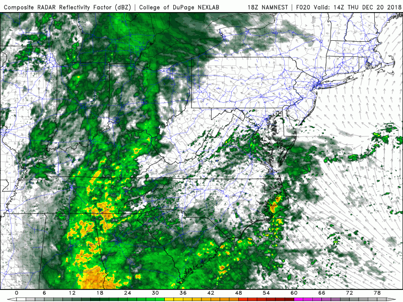
This evenings hi-res NAM model showing a very impressive area of heavy rain impacting much of the Northeast Thursday night and into Friday afternoon.
Improving conditions this weekend, eyes on a potential Christmas Clipper system
The bulk of the heavy rain should begin to lift out of the region early Saturday morning as the surface low moves off to our west and occludes over New York state. There is a small chance that there could be some residual clouds and showers on Saturday morning, but this depends on the exact timing and track of the low pressure system. Regardless, northwesterly flow will quickly move in behind Fridays system which will introduce a much cooler airmass into the region. Highs on Saturday will likely occur during the early afternoon hours before temperatures begin to fall into the lower 40’s by the late afternoon hours.
Stout northwesterly flow will remain in place for the rest of the weekend, with the potential for a weak and moisture-starved shortwave to move through the Mid-Atlantic states late Sunday/Monday morning. This system could produce an area of very light snow for the Mid-Atlantic/Northeast, but confidence regarding this weak system is very low at this time.
Yet another shortwave trough will possibly be moving through the Ohio Valley and Northeast on Christmas Day. This afternoons model guidance was somewhat more interesting for this feature as they showed the available moisture and dynamics to be a little more impressive than Sun/Mon system. There is an outside chance that this system could produce a swath of light snow over portions of our area on Christmas night, but we will definitely need to revisit this system once Friday’s heavy rain threat is out of the way.
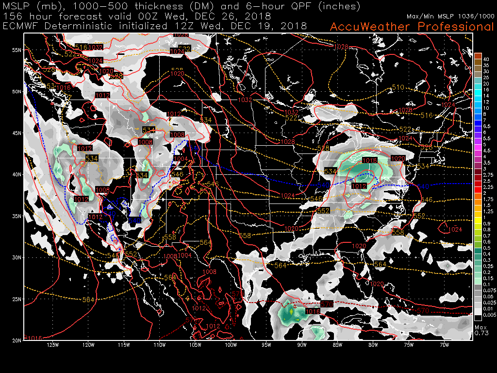
This afternoons European model showing an area of light snow moving over the Ohio Valley on Christmas day
We’ll have more on the potential flood threat and conditions for the upcoming holiday week on Friday!
Have a great night!
Steve Copertino
Trackbacks & Pingbacks
d
2demoralization
Leave a Reply
Want to join the discussion?Feel free to contribute!