Light Mix Moves Through, Watching This Weekend
Good evening!
Today has been a rather cold and clear day over the entire Northeast, especially when compared to the past week or so. Stout northwesterly flow has ushered in a much more cold and dry continental Arctic airmass over the entire area, which has kept high temperatures in the upper 20’s to lower 30’s-with some mid 30’s over SNJ and Long Island.
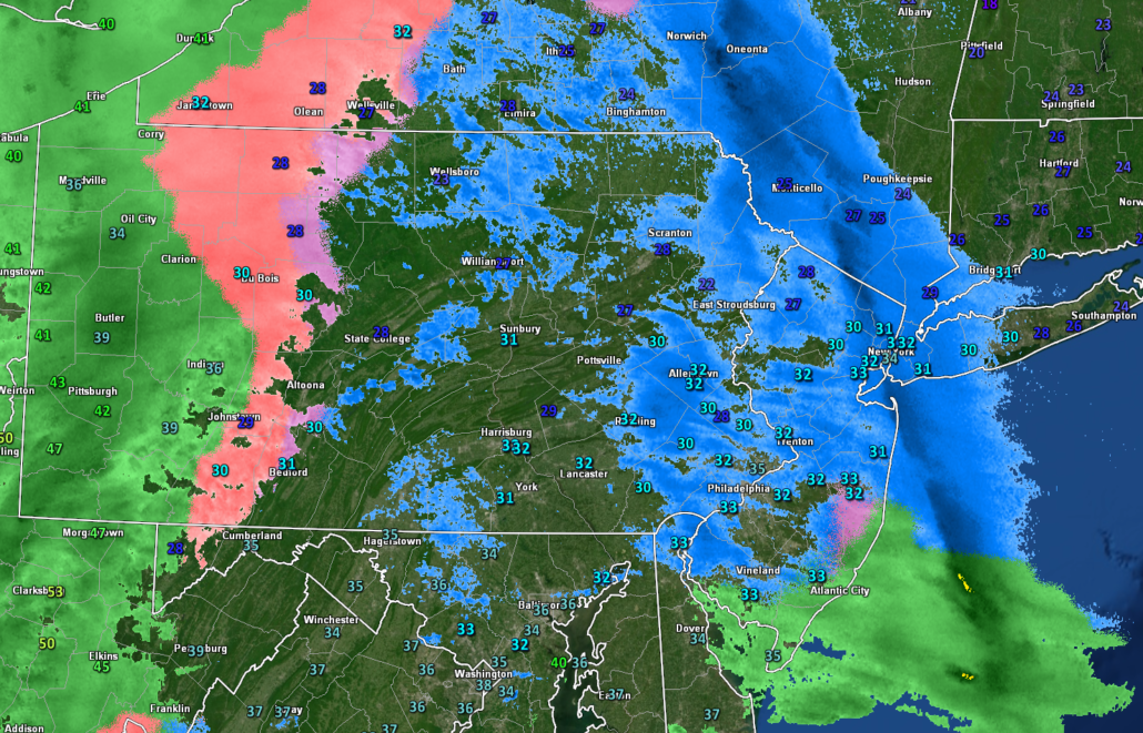
The large, but disorganized mid-level system that we have been going over for the past week has begun to gradually edge into the Northeast this afternoon and has been producing some very light sleet and snow across portions of Pennsylvania and New York. This area of precipitation looks rather impressive on radar, but surface observations confirm that there has been barely any precipitation reaching the surface-even under the heaviest of radar echoes. This is mainly due to the very dry and dense Arctic airmass still in place through the lowest ~500 feet of the atmosphere. As the snow falls towards the ground it is evaporating in addition to transitioning to sleet. Since radar beams gradually increase with height the further out from the radar site you go, these beams are hitting this area of transitioning precipitation, causing the precip to look more intense than whats being observed at the surface.
Regardless, the narrow band of mixed precipitation will continue to gradually head east over the next few hours–likely impacting the metro area just in time for the evening commute. Due to the very unimpressive forcing and low level dry air in place, mainly sleet and freezing rain is expected for the immediate metro area with a few broken flakes mixing in at times. As we head into the NW suburbs and into portions of SNY, there could be more of a snow/sleet mix, with some very light accumulations on colder surfaces.

This evenings latest hi-res radar showing an area of light mixed precip working its way into the area
Light Mix Lingers Into Tuesday Morning
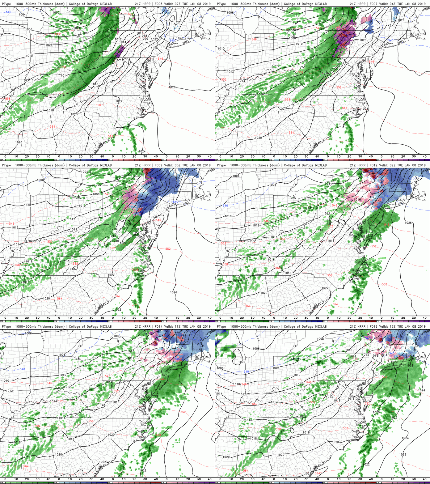
Continue light mixed precipitation mainly in the form of sleet, freezing rain, and rain will be possible as we head into the late evening and overnight hours of Tuesday as the area of high pressure currently situated over New England shifts offshore. This will cause low level winds to become more southerly in nature and will lead to an increase in available moisture. As always, a shift to more southerly winds also means an increase in surface temperatures over the entire area.
Locations over SNJ will be the first to really feel the effects temps rising above freezing, which will cause a changeover to all rain before 5 am. Since this current airmass has been rather stubborn, it may take some time for the warmer air to make its way north of NYC, but the changeover will continue through the overnight hours and into the very early morning hours tomorrow. At this time, locations north and west of the New York City area have the best chance at seeing prolonged periods of light sleet and freezing rain lasting through 5 am. Any accumulations with this system will be quite minimal, with the potential for some slippery roads by the time we reach the AM commute.
Temperatures will then quickly rise to above-freezing for the entire area around 8 am tomorrow morning as the last of the precipitation swings through. Though some dry air is expected to develop aloft as the main upper level system moves through tomorrow afternoon, skies should remain mostly cloudy with a chance at some light rain showers or drizzle lasting into the evening hours. Highs will likely reach into the lower to middle 40’s for the entire forecast area as cloudy conditions and mild low-level temps take over.
Things get a little more interesting towards the overnight hours of Tuesday as strong mid-level energy and residual moisture move through the Northeast with an associated cold front. This will create the potential for some increased precipitation to breakout after midnight. Given the steep changes in temperature with height and weak instability, there may even be some heavy spots of sleet and graupel that develop over portions of Pennsylvania and New Jersey. Otherwise, tomorrow night will be another mild night, with lows only getting down into the upper 30’s to lower 40’s with winds picking up significantly after the cold front moves through.

This evenings HRRR model showing the light area of mixed precipitation impacting our area later this evening and into the overnight hours
Attention Turns Towards This Weekend
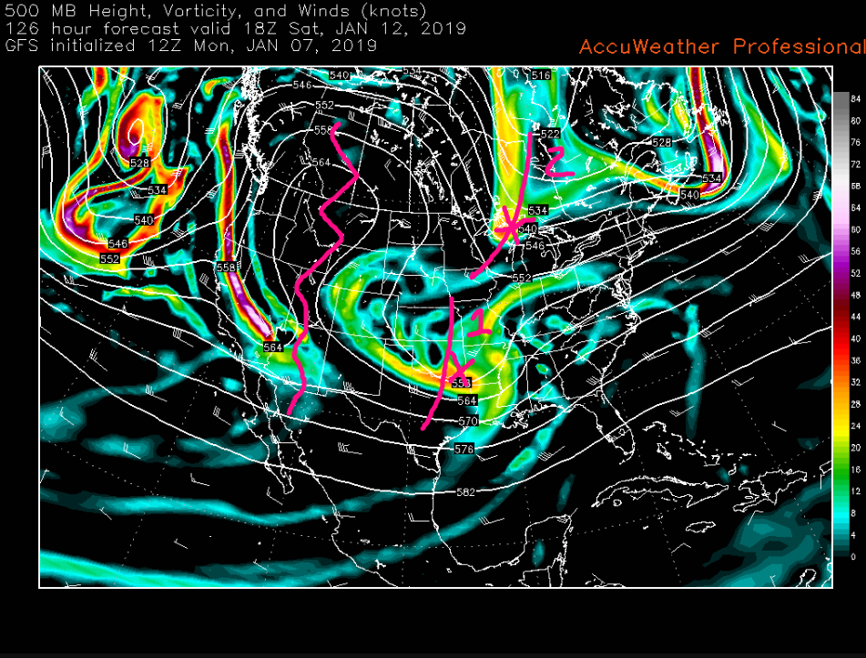
Mainly calm and cold conditions will remain in place across much of the east for the rest of this week and lasting into this weekend. Northwesterly flow will be in place during this time, leading to below-normal temperatures and mainly dry weather. However, there are signs that we may have to watch a system coming out of the Southern Plains by Friday afternoon. The past few runs of the reliable computer models and their ensembles have shown that this piece of energy may try to interact with an incoming strong piece of energy from Canada. As of right now there are two scenarios being shown with this setup:
–The first (and least likely as of now) is that the shortwave trough over the Plains will phase with the incoming Canadian shortwave trough on Saturday. This would cause a large area of heavy snow to develop from the Midwest to the East Coast on Saturday/Sunday with significant impacts.
–The second (and most likely as of now) is that the shortwave over the South is not able to cleanly phase/interact with the incoming shortwave over Canada. Instead, the Canadian shortwave acts to suppress this system and the vast majority of the precipitation stays to the south of the NYC area, causing little to no impacts.
It is very important to note that we are still quite a while out, and significant changes are likely to occur between now and Friday. The overall evolution of this system will depend on the exact timing and location of each system and we will have to watch how these systems behave over the next four days.

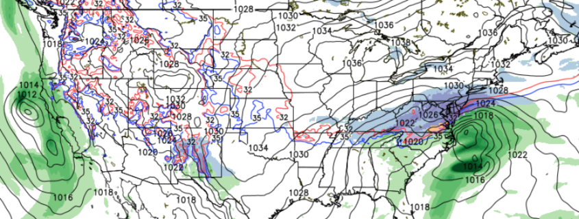
This mornings GFS model which was the most aggressive model at the time. This model was phasing both the feature over the Plains and over Canada to produce a large snowstorm for the Northeast
Thanks for reading and have a great night! We’ll have an update on Wednesday!
-Steve Copertino


Leave a Reply
Want to join the discussion?Feel free to contribute!