-2")
Bitter Cold Gives Way to Heavy Rain on Thursday
Good Evening!
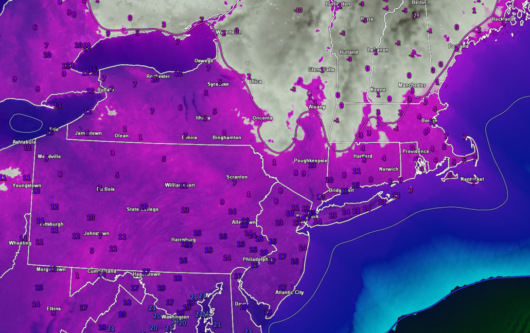
Today has been a brutally cold day across much of the East Coast as an impressive Arctic airmass blasted into the country on Sunday. Additionally, the messy storm system that affected the area this past weekend is now rapidly intensifying off to our northeast. This intensifying system is creating an impressive pressure gradient with the Arctic high pressure currently located over the Ohio Valley. The result has been strong, gusty winds of up to 40 mph creating wind chills anywhere from five to ten degrees below zero across the New York City area today. The extremely dry airmass in place has cleared out virtually any remaining clouds over the Northeast, which made for a classic frigid January day. High temperatures were only able to rise into the teens and single digits across the forecast area, with Central Park getting to around 14F, which is twenty-four degrees below normal!
Winds will gradually begin to diminish this evening as the area of low pressure off to our northeast begins to drift further away weakening the pressure gradient over the area. With clear skies and diminishing winds, radiational cooling will take over, causing temperatures to fall back down into the single digits for the immediate NYC area, and likely in the 0-5 degree range off to the north and west. Elevated locations of NW NJ and SNY may even drop back below zero tonight. Even with weaker winds, wind chills will likely still be 5-15 degrees below zero tonight, so definitely bundle up if you’re planning to head outside tonight!
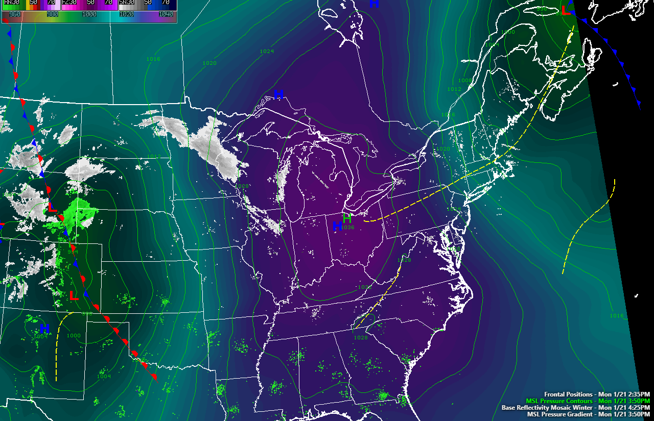
Surface map from this evening showing the Arctic high pressure system moving through the Ohio Valley.
Tomorrow (Tuesday) will start off as another bitterly cold morning for the AM commute with temperatures in the teens and single digits for the immediate metro area. High pressure will likely be overhead at this time, so winds will be substantially weaker than the previous 24 hours. As the surface high and mid-level ridge passes overhead tomorrow afternoon, the cold northwesterly flow will be replaced with westerly and eventually southwesterly flow. This change in source region will allow temperatures to moderate a bit during the day. Highs will likely still be cold, with temperatures likely getting into the lower to middle 20’s for the majority of the NYC area. Mostly sunny skies and cold temperatures will last into the evening and overnight hours, making for a cold but pleasant day. Radiational cooling will once again take over Tuesday night, causing lows to drop back down into the teens and lower 20’s for the entire area, which is around 10 degrees below normal for late January.
Wednesday will be a day of transition as a large mid level trough moves into the Central United Sates. As this trough digs in an amplifies, a ridge will build over much of the East, allowing for much warmer temperatures to move in. A weak surface low will cut off to our west during the morning and afternoon hours on Wednesday, leading to a warm front passing through the Northeast. This warm front will aid in the development of some scattered showers during the day on Wednesday, with the potential for some light freezing rain during the onset for elevated locations well off to the north and west of the city. Once the warm front moves through, highs will likely rise into the upper 30’s to lower 40’s for the entire area, which will be 10-15 degrees above normal!
The aforementioned mid level trough will gradually shift east during the evening on Wednesday causing a deep area of moisture to begin to stream up through the Southeast and into the Northeast. The scattered light to moderate showers will eventually give way to more steady rain overnight and into Thursday morning. A wave of low pressure may try and develop along the frontal boundary draped over the Northeast, which could introduce a round of moderate to occasionally heavy rainfall during the morning and afternoon hours of Thursday. This frontal system will finally shift off to our east Thursday evening, bringing an end to the precipitation from west to east. Highs on Thursday will be quite mild, with temperatures reaching into the middle 40’s before dropping back down into the 30’s by Thursday evening.
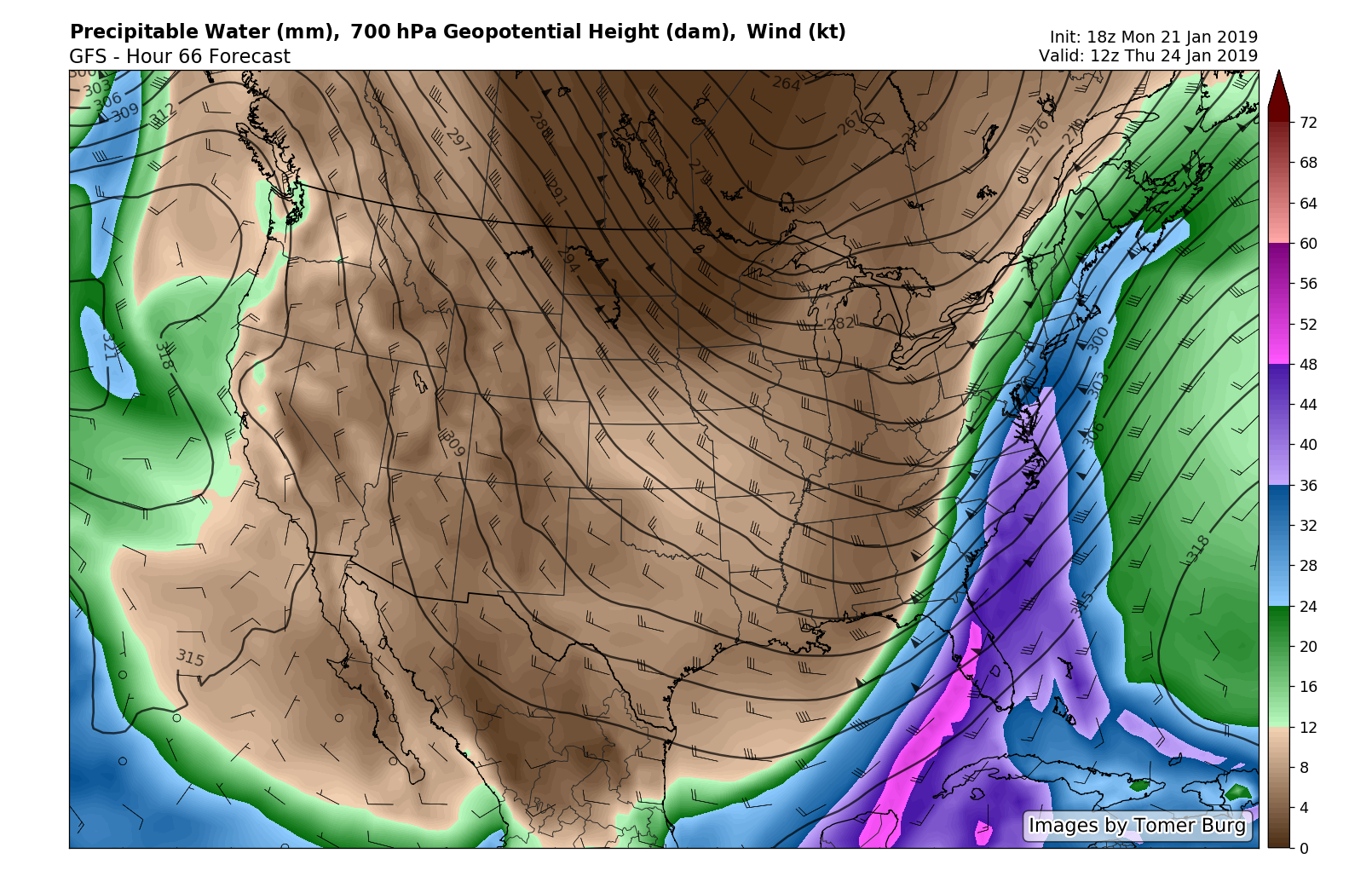
This evenings GFS model showing an impressive plume of moisture aimed at the Northeast on Thursday.
Temperatures look to drop back down to seasonable levels on Friday as a cold front moves through the Northeast. These seasonable temperatures are expected to last through this weekend, with the potential for some snow showers on Sunday as an energetic upper level system moves through the Great Lakes and into the Northeast.
There are some indications that we may have to monitor the East Coast next week for our next storm threat as an abundance of energy drops into a trough located over the Central United States. While we will likely still be lacking any kind of blocking for this time period, we are quickly approaching a time period that is traditionally favored for increased storminess across the east!
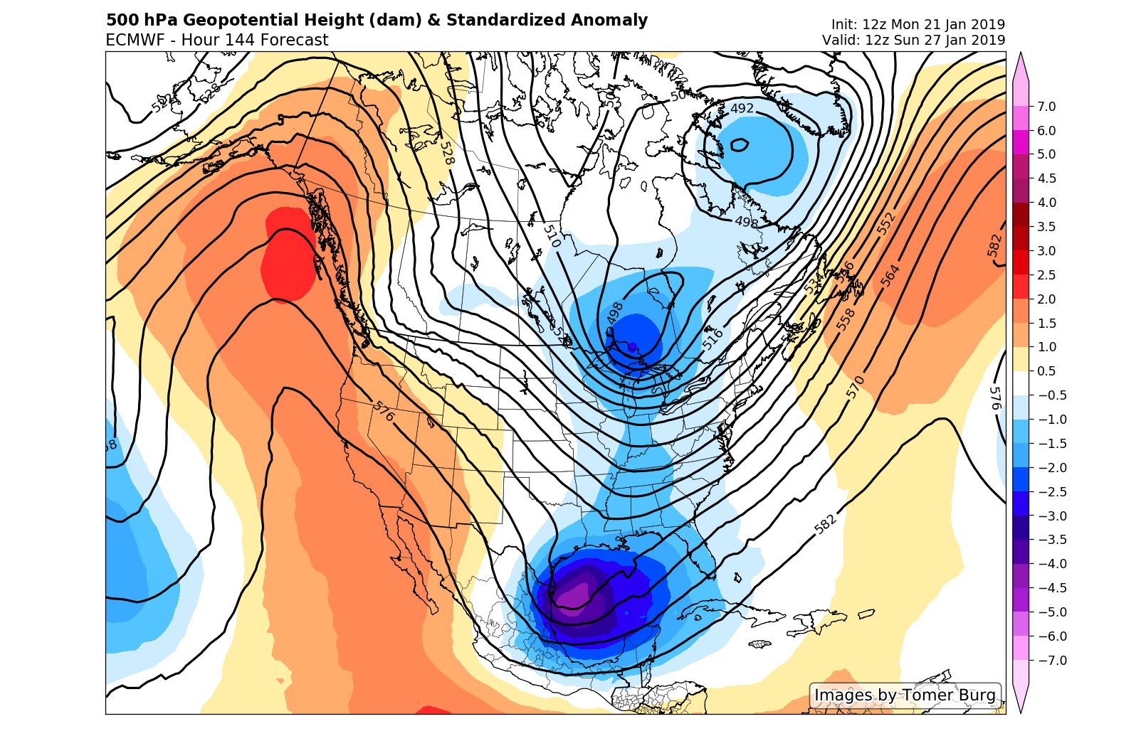
The ECMWF model showing a period of increased troughiness across the eastern half of the country (courtesy of Tomer Burg)
Thanks for reading and we’ll have an update on Wednesday!
-Steve Copertino
Trackbacks & Pingbacks
2masturbating
Leave a Reply
Want to join the discussion?Feel free to contribute!