-2")
Updated: Heavy rain likely today, cold and calm weekend
Soaking Rains Likely on Thursday
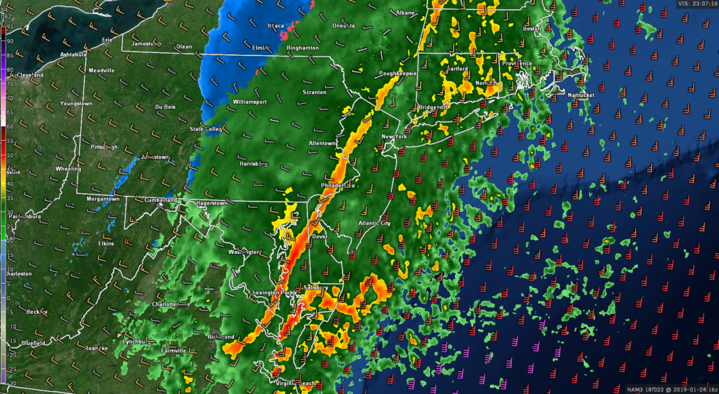
High-resolution model guidance has been consistent in the suggestion that an area of heavy rain associated with an area of low pressure moving along a cold front will be located near the area for the rest of the morning. A strong upper level jet streak will be positioned just off to our north and west. This will provide ample lift for pockets of moderate to occasionally heavy rainfall during the early afternoon hours. In fact, there may even be a line of heavy showers and thunderstorms within this main area of rain that could produce some gusty winds of up to 30-45 mph and flash flooding–especially for locations with poor drainage. Accordingly, the National Weather Service has issued a Flash Flood Watch for the entire NYC metro area through 6 pm.
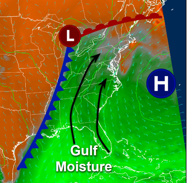
Diagram showing a the setup leading to deep moisture from the Gulf of Mexico overspreading the East Coast
The bulk of the steady rain should quickly end around 1-3 pm from west to east over our area. While the main batch of rain will be moving offshore this afternoon, the aforementioned upper level jet positioned to the north will provide some pockets of continued lift. This lift and residual moisture could be just strong enough for some light showers to linger over the area ahead of the fast-approaching cold front to our west.
Gradually clearing skies, gusty winds, and falling temperatures will be likely as we work our way into the evening hours tonight, as the cold front to our west finally moves through. Temperatures will likely fall into the middle 20’s to lower 30’s for the entire forecast area during the overnight hours, with wind chills in the lower 20’s-which will be right around normal for this time of the year.
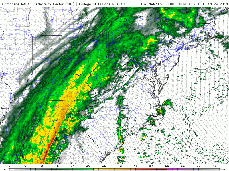
This evenings high resolution NAM model showing the evolution of the area of heavy rain for tomorrow morning and afternoon (COD Weather)
Cold and Relatively Dry Pattern Takes Hold Through the Weekend
Conditions will once again turn dry and relatively cold across much of the Northeast by Friday as deep northwesterly flow from Canada sets up shop. Highs will likely stay into the lower to middle 30’s on Friday, with lows dropping back down into the lower 20’s to teens. A large upper level trough will then work its way into the East on Saturday and Sunday, causing highs to drop into the lower 30’s to upper 20’s and lows in the teens. An energetic upper level low will be dropping into the Great Lakes on Sunday morning/afternoon that could potentially produce some scattered snow showers across the area, especially for locations off to the north and west.
A northern stream shortwave looks to quickly dive to the south of this energetic upper level low on Sunday afternoon, likely sparking an area of precipitation to develop off the Southeast coast by the evening hours. While model guidance from a few days ago showed this system potentially phasing and coming up the coast, the lack of blocking to our north will keep the overall pattern very progressive and making it extremely unlikely for this to occur. However, the potential for some light snow showers looks to extend into the evening hours of Sunday as this energetic upper level system passes to our northwest.
Our attention then turns to another northern stream shortwave moving into the Central United States on Monday. This system could potentially cause the development of an area of low pressure over the Great Lakes by Tuesday, which may bring another mixed-bag of precipitation to the Northeast.
Finally, most of the reliable model guidance and their ensembles show that we may see another impressive period of cold weather towards the middle of next week as the tropospheric polar vortex looks poised to drop into the Northern Plains.
We’ll have an update on this weekend’s weather as well the potential for much colder conditions across the eastern half of the county next week on Friday!
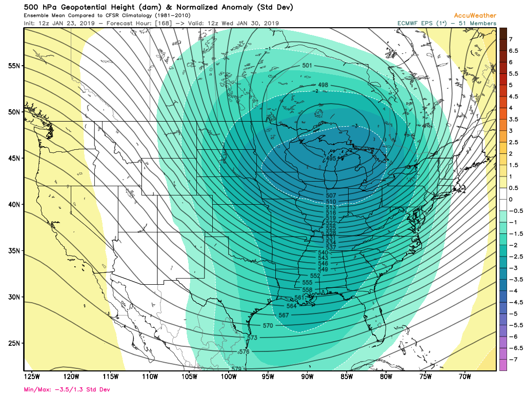
This afternoons European Ensemble Mean showing a potentially much colder pattern shaping up for the middle of next week across much of the East (AccuWx)
Have a great night!
-Steve Copertino
Leave a Reply
Want to join the discussion?Feel free to contribute!