Potential midweek storm & major Arctic outbreak expected
Calm Conditions Persist Through the Weekend
High pressure will continue to build to the east during the early morning hours of Saturday, causing any remaining gusty/breezy conditions to subside significantly. Partly cloudy skies and cooler temperatures are expected to prevail into the afternoon hours, with highs likely getting back into the lower to middle 30’s for the entire forecast area. By Saturday evening, a large upper level low situated over portions of southern Canada is expected to begin to move to the south. This will set up a more southwesterly flow over the area into the overnight hours. While the mid level airmass source region will be different than this evening’s, clearing skies and relatively dry conditions throughout much of the lower to middle levels of the atmosphere should allow for robust radiational cooling to take place. This will still cause lows to drop into the upper teens to lower 20’s Saturday night-which will once again be below normal across the area.
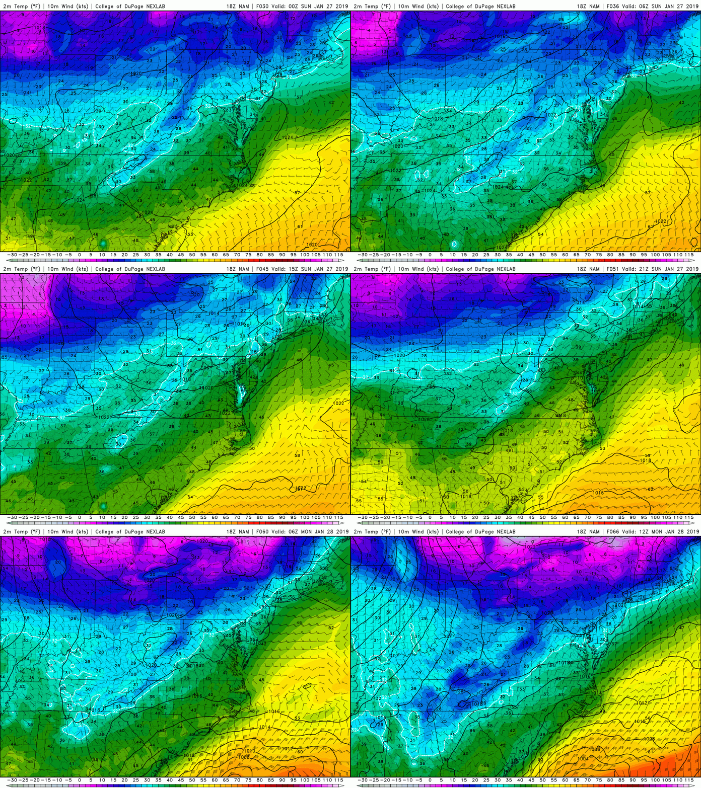
By Sunday morning the large and impressive upper level system just to the north of the Great Lakes will continue to shift to the south and east, spawning a surface low pressure system well to the north of our area. While direct impacts in the form of precipitation are unlikely from this low pressure area, it will help to increase low to mid level clouds over much of the Northeast. Additionally, this surface low to our northwest will also increase southerly winds over the area, leading to slightly warmer highs during the day. Temperatures should be able to reach back into the lower to middle 40’s across much of the NYC area, with upper 30’s likely across the interior-which will be on the order of 5-10 degrees above normal. Finally, a cold front associated with the area of low pressure to our north will move through during the evening and overnight hours of Sunday. At this time it appears that the cold front will likely be significantly lacking in moisture, making this frontal passage a dry one. The front will also usher in colder middle to lower level temperatures once again, bringing lows back down into the lower to middle 20’s.

This evenings NAM model showing the progression of warmer surface temperatures into Sunday, followed by another cold front Sunday night (COD Weather)
Potentially Messy Storm System and Major Arctic Blast Set to Impact the East Next Week
As we highlighted back in our last update, another northern stream shortwave trough will be heading into the Northern Plains by Monday morning that bears watching.
This system will be pushed well to the south by Monday evening as a deep upper level system that is directly associated with the tropospheric polar vortex makes its way into Southern Canada. As this deep and highly-anomalous system continues it’s push into Southern Canada on Tuesday, precipitation will likely break out over portions of the Southeast and extending up into the Ohio Valley along a frontal boundary. As this boundary approaches the Northeast by Tuesday night, large scale upper level divergence will be on the increase over much of the East Coast. This would support the development of a quickly intensifying low pressure system near or over the Northeast late Tuesday and into early Wednesday morning-but this is where the reliable model guidance begins to diverge.
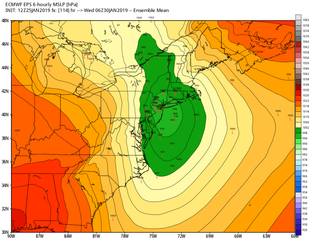
This afternoon’s European model showed a substantial amount of energy swinging through the Mid-Atlantic states, causing the development of a rapidly intensifying surface low that moves inland over portions New England by Wednesday morning. Such a solution would bring some light rain/snow during the onset, with a quick flip to more significant mixed precipitation as the low pressure rapidly strengthen and drags in much colder air from the northwest. The rest of this afternoons guidance does indeed show a low pressure system forming along the frontal boundary, but disagree on the exact location and magnitude of deepening of this potential system. Needless to say, these factors will play a major role in determining the overall outcome of this system.
At this time, even a compromise of these solutions (weaker vs. stronger) would bring the potential for some impactful weather to the area Tuesday/Wednesday AM. We will need to closely monitor this system over the next few days as new data comes in.

12z European Ensembles showing a significant amount of members developing a strong secondary area of low pressure over the Northeast on Wednesday AM (WxBell)
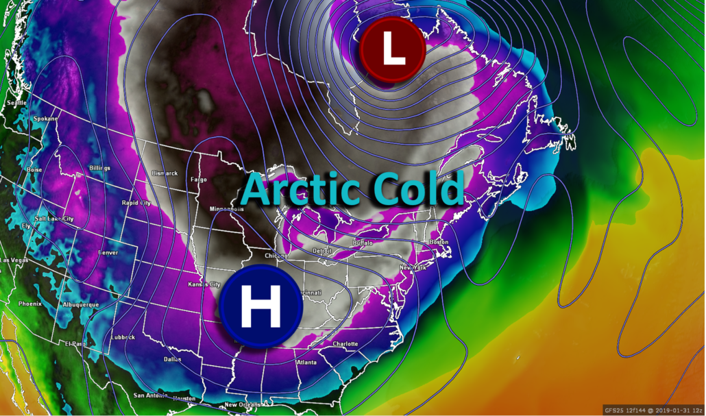
Regardless of what the Tuesday/Wednesday system does, virtually all available model guidance and their respective ensembles agree that the westernmost lobe of the tropospheric polar vortex will swing into the Northern Plains and Great Lakes by Wednesday night. This will cause a very impressive Arctic airmass to blast its way into the northern tier of the country-with potentially record breaking temperatures for the Great Lakes region. As this Arctic airmass heads into the Northeast, early indications are that it may begin to moderate just enough that portions of the Northeast are spared from record cold. However, the potential will certainly be there for an extremely cold end to next week with high temperatures struggling to break out of the single digits, in addition to dangerous wind chills well-below zero.

Diagram showing an Arctic high pressure system moving into the Central US during the middle of next week, dumping extremely cold temperatures into the CONUS (White colors denote areas that are below 0F)
We’ll continue to update you on this Arctic outbreak as well as the potential storm system for mid-week!
Have a great weekend!
-Steven Copertino


Leave a Reply
Want to join the discussion?Feel free to contribute!