-2")
The worst of the cold is over (for now)
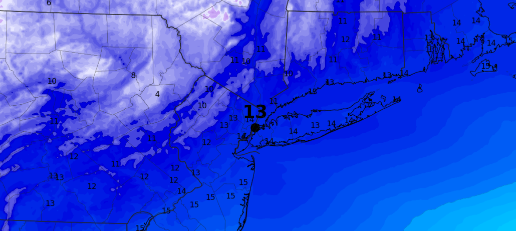
The periphery of a piece of the polar vortex (an important distinction) made its presence felt in the New York City area on Wednesday and Thursday, with intense snow squalls and bitter cold temperatures. The low temperature in New York City dropped to 2 F on Thursday morning, the coldest of the season thus far and the coldest since February of 2016.
The airmass will remain bitterly cold over the next 24-36 hours, as arctic air remains overhead. It will begin to shift out of the region by the weekend, however, and the airmass will feel downright tropical by the time we approach Saturday. High temperatures will swing back towards normal by that time, a far cry from the 30 or more degrees below normal which we’ve been basking in.
The atmospheric pattern across the country is set to undergo major, albeit temporary, changes from late this weekend into next week. As the brutal cold returns from whence it came, the pattern which brought it here will be breaking down in the Western USA. This will allow milder, Pacific air to flood the country early next week.
A few disturbances are expected to track well to our north and west, over the Great Lakes and into Southeast Canada. These will help even further to vacate the arctic air, with south/southwesterly winds expected to usher in above normal temperatures by Monday and Tuesday. The weather will likely be a bit unsettled during that time, with the best chance of showers coming on Tuesday morning.
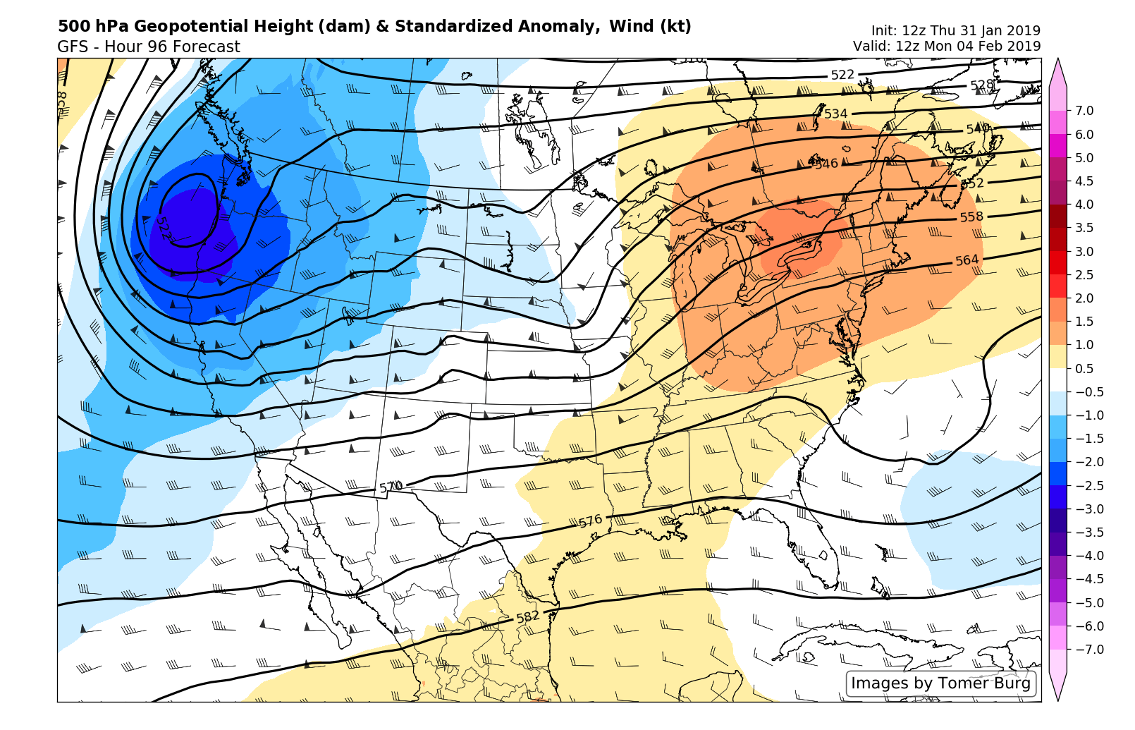
A warmer pattern takes hold next week as a large ridge moves into the Eastern USA.
As it currently stands, model guidance suggests that a more significant system will approach the region by next Thursday, about a week from today, with more significant rainfall. While the exact details are still far from certain, the general pattern does not support wintry weather next week – so we at least feel comfortable stating that there won’t be any major winter weather threats.
After those disturbances pass, however, the pattern will snap back once again. Colder air will begin to seep southward and an active string of disturbances will continue to eject towards the Eastern United States from February 10th onward. Enjoy next weeks warmth and lack of wintry weather while it’s here.
Trackbacks & Pingbacks
3venereal
Leave a Reply
Want to join the discussion?Feel free to contribute!