-2")
Mild conditions likely next week
Good evening and happy Friday!
Today has been a much-improved, but still rather cold day across much of the Northeast. The western lobe of the troposperhic polar vortex continues to depart well off to our northeast, which has allowed the airmass in place to moderate. High pressure has been building in over much of the East Coast during the past 24 hours, which has all but eliminated any remaining windy conditions. Highs today managed to limp back into the lower to middle 20’s across much of the immediate NYC metro area, with teens being reported over elevated portions of NW NJ. Despite the continued cold, there are strong indications that conditions turn much more mild next week!
A weak northern stream disturbance quickly made its way into the Northeast and Mid-Atlantic states this morning/afternoon, producing some light to moderate snow across portions of Maryland and Southern New Jersey. The bulk of this activity has and will continue to stay to the south of the NYC metro area, with most of the precipitation moving off the coast within the next few hours. Mainly calm and cold conditions will continue into the evening and overnight hours, with just mostly clear skies expected. Lows this evening will still be rather cold, but not as cold as the past two nights. Expect lows to fall back into the teens for most of the area, with single digits once again off to the north and west of the NYC metro.
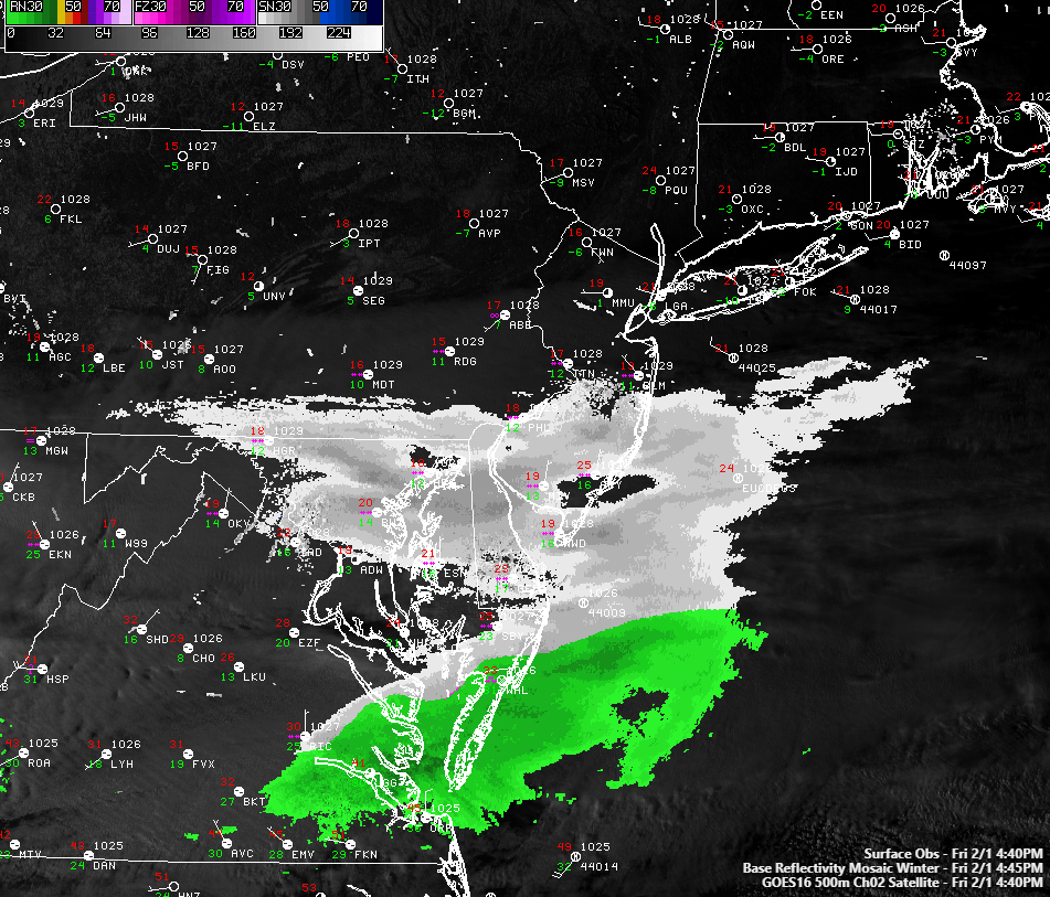
This evenings latest regional radar mosaic, surface observations, and visible satellite. Light snow will be quickly ending from west to east this evening across SNJ
Calm and relatively cool Super Bowl weekend ahead
The colder pattern that we’ve been in for the past few days really begins to break down on Saturday as zonal flow (west to east) sets up across the country. Mid level flow will gradually shift from northwesterly, to a more westerly component during the day, leading to yet another increase in temperatures. Any residual clouds will quickly give way to mainly clear skies by tomorrow afternoon, allowing temperatures to reach into the upper 20’s to middle 30’s across much of the NYC metro area. These calm and mostly clear conditions will continue into the evening and overnight hours, with lows “only” falling into the middle to upper 20’s.
Sunday looks like a great day across the board, with mostly sunny skies, calm winds, and much more mild temperatures in place. Continued westerly/southwesterly flow aloft will allow highs during the day to rise into the lower to middle 40’s, with upper 30’s likely over the typically cooler locations of Southern New York and Northwest New Jersey. Calm and seasonably cool conditions will be in place for the evening and overnight hours of Sunday, with lows expected to be in upper 20’s to lower 30’s for the entire NYC metro area- a far cry from the single digits and sub zero lows we had just a few days ago!
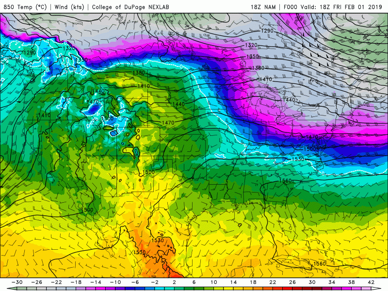
NAM model showing the persistent cold, northwesterly flow giving way to a much warmer airmass from the south
Mild Pacific airmass invades the East next week
The previous cold pattern will be all but a memory by the beginning of next week as a large trough carves out the West Coast. This will result in an impressive area of mid level ridging setting up over the East Coast, flooding much of our area with well-above normal temperatures. A weak storm system looks to cut into the Norther Plains on Monday, which would put much of the Northeast into the “warm sector” of this system. Temperatures on Monday could potentially shoot into the upper 40’s to middle 50’s across much of the NYC area-with mainly dry conditions expected. There may be a chance at a couple of showers Tuesday and Wednesday with a system passing to our north, but the forecast period looks to remain free of any significant precipitation until the middle of next week. Another reinforcement of well-above normal temperatures looks possible towards the end of next week as another strong Pacific shortwave digs into the West.
Indications are that we may return to at least a seasonably cool airmass by next weekend, so we’ll have to enjoy this brief period of warmer weather while it lasts!
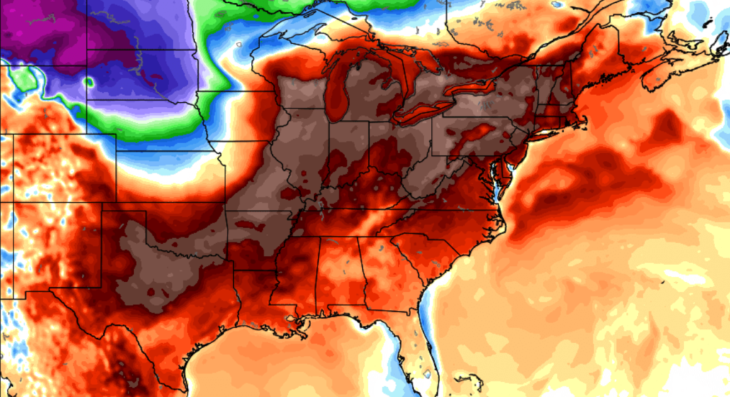
This afternoons GFS model showing deep southwesterly flow overspreading the eastern half of the CONUS by late next week
We’ll have an update on the medium to long range on Monday afternoon!
Have a great weekend!
-Steven Copertino
Leave a Reply
Want to join the discussion?Feel free to contribute!