-2")
Unsettled conditions exit Friday, calm and cool weekend ahead
Good evening!
The beautiful spring-like conditions of the past two days have quickly come to an end, and have instead been replaced with a cool and rather unsettled pattern.
An area of light rain is currently moving to the east across portions of Pennsylvania that is associated with a rather weak area of low pressure working it’s way to our south. Light rain will overspread the entire New York City metro area during the course of the next few hours. Both the mid-level flow and surface flow will be coming out of the south/southwest tonight, which will help to keep lows above normal, with temperatures only dropping down into the middle to upper 30’s for the NYC metro. Locations off to the north and west may drop to around freezing, but all precipitation over the next 12 hours is likely to stay as plain rain due to the very marginal airmass in place.
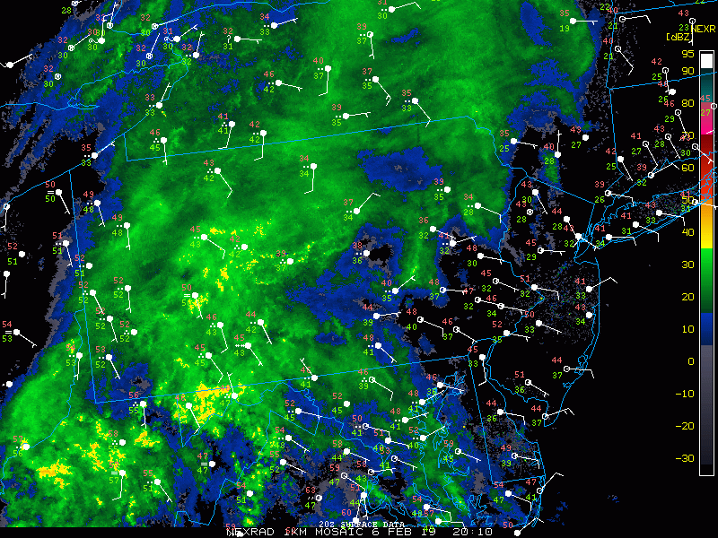
This evening’s regional radar mosaic showing an area of light rain showers moving in
Unsettled conditions through Friday afternoon
Rain should quickly end from west to east during the early morning hours tomorrow (Thursday), likely just in time for the AM commute. Another large and impressive storm system will be cutting into the Great Lakes by tomorrow afternoon, bringing another surge of southwesterly mid-level flow to the area. Though most of the Northeast will be firmly entrenched within the “warm sector” of the system off to our west, mainly cloudy conditions are expected. Temperatures will be on the rise tomorrow afternoon, but the clouds will really work to put a cap on just how warm it can get. Most of the area should easily see temperatures rise into the middle to upper 40’s, with the immediate NYC area getting to around 50 degrees by the afternoon. Any chance of precipitation should hold off until the late evening or very early morning hours of Friday as some weak energy ahead of the main trough axis moves through the area. Lows will once again remain relatively mild, with readings likely staying in the lower to middle 40’s for the vast majority of the area.
Friday will likely start off quite unsettled as the surface low pressure area with this impressive system quickly moves into Southeastern Canada by 8 am. This will put the cold front just off to our west, likely over portions of Pennsylvania by the AM commute. Areas of light to occasionally moderate showers will gradually work into the area during the late morning and early morning hours, before quickly moving off to the east by mid-afternoon.
Temperatures will likely rise into the lower to middle 50’s ahead of the cold front on Friday afternoon, which will be much-above average once again for this time of year. These mild temperatures will unsurprisingly be quite short-lived as the colder airmass behind the front works it’s way into the area by the early evening hours. Winds will also be increasing as the front passes through, with gusts up to 30-40 mph possible at times. The colder air and gusty winds will make for a rather cold end to the week as lows drop back to more seasonable levels. Expect temperatures to fall back into the lower to middle 20’s for the entire area, with slightly warmer conditions for coastal locations.
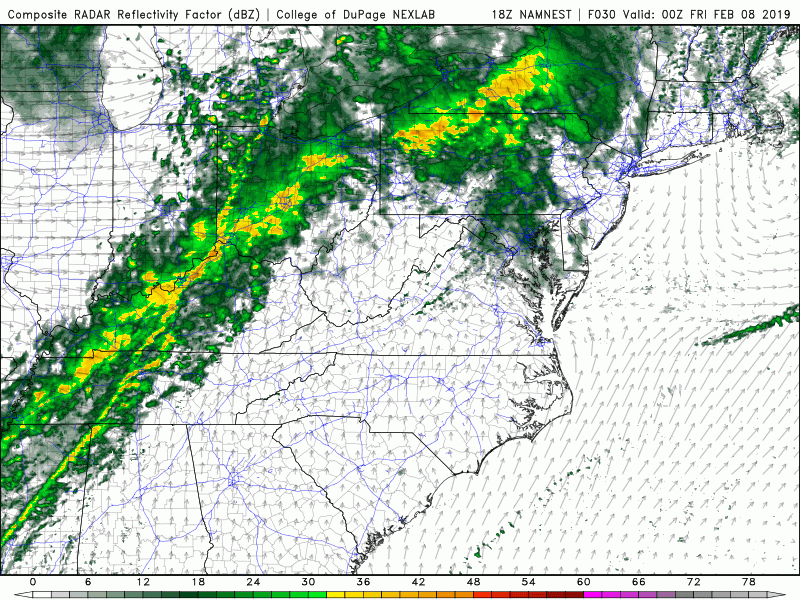
This evening’s high resolution NAM model showing the cold front approaching the area on Friday morning
Calm weekend ahead, watching the middle of next week for our next system
An area of high pressure will dive into the Plains by late Friday night, gradually putting an end to the gusty winds over the Northeast. Cold northwesterly flow will be in place over the Northeast on Saturday and Sunday, likely keeping highs right around normal for early February. Clear conditions should prevail for both days as the high moves to our south by Sunday afternoon.
Another storm system will be crashing into the West Coast by Monday morning, sparking the development of yet another in an endless series of low pressure systems off to our west. At this time it appears that this system will cut into the Great Lakes/Northern Plains by Tuesday, but there has been some uncertainty with the overall evolution of this system. An area of high pressure will likely be located over portions of southern Canada at this time, and some models have hinted at a secondary low pressure system developing somewhere off the Northeast coast by Tuesday night. While it is much too early to talk about any specifics at this range, this system does have the potential to bring some impactful weather conditions to the Northeast, so we’ll certainly be keeping an eye on it over the next week!
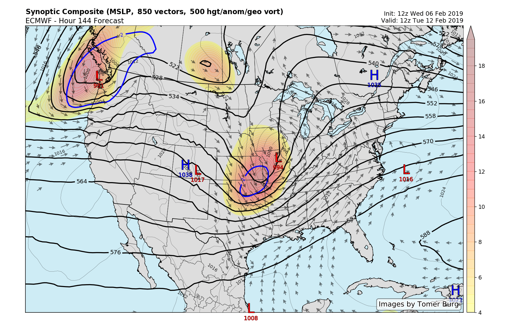
The ECMWF model showing an energetic shortwave trough cutting into the Midwest next week, with an area of high pressure located over portions of Southeast Canada
Have a great night!
Steve Copertino
Trackbacks & Pingbacks
3property
Leave a Reply
Want to join the discussion?Feel free to contribute!