-2")
Very insignificant winter storm expected Sunday Night
You probably aren’t going to remember this one.
A weak disturbance slides into the Northeast United States on Sunday, and will bring light and intermittent precipitation with it. Forecast model guidance is in good agreement that the system will strengthen modestly as it moves through the Mid Atlantic states, eventually redeveloping off the coast and into the Atlantic Ocean.
Precipitation is expected to develop through the Ohio Valley and then toward the Mid-Atlantic and Northeast. The suggestion on almost all forecast guidance is that it will be rather intermittent and unimpressive. A snow and sleet mix will shift northward through Pennsylvania, while light rain will move into Washington, DC and toward Southern and Central New Jersey.
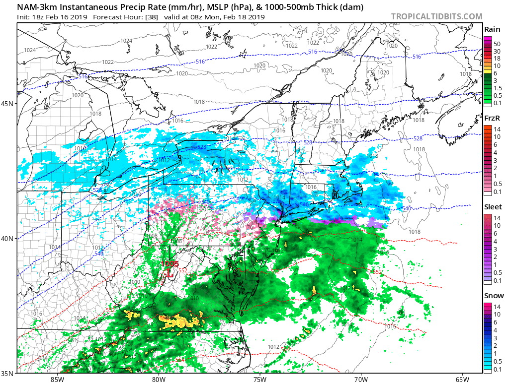
NAM model showing intermittent snow, sleet and rain in Northern NJ and NYC on Monday morning.
Wintry precipitation will be more common further north, with light snow expected Sunday Night into Monday across Northeastern Pennsylvania, Northern New Jersey, New York State and all of Southern New England. In New York City and on Long Island, light and intermittent snow is also likely, but it may mix with sleet at times as well.
If steadier snow or wintry precipitation will occur, it is most likely to occur from Northern New Jersey into Southern New England early on Monday morning, with periods of steady snowfall possible should banding and dynamics trend a bit stronger than current modeling suggests.
Technical Stuff: Forecast soundings on all model guidance show very intermittent lift and dry air in the snow growth zone. This suggests that snow flakes will be of mixed type (little pure dendrites) with very low snow ratios. Light precipitation amounts, light precipitation intensity, and poor snow growth suggests limited accumulation overall.
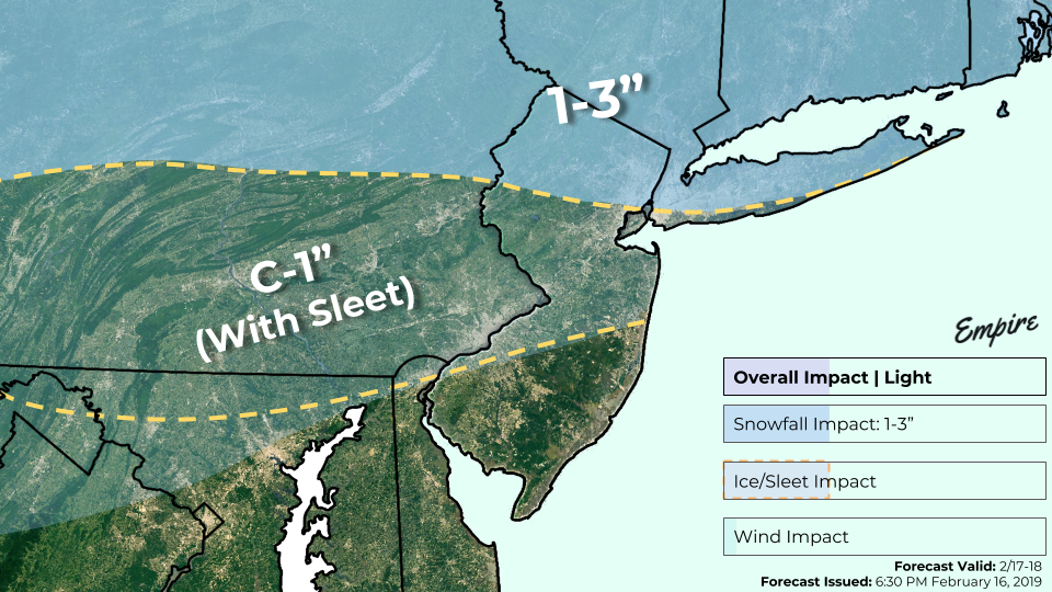
Storm Total Snowfall Forecast through Monday.
Here’s the briefing on what we are expecting:
What: Intermittent light to moderate snow from late Sunday Night into Monday
Where: Northern NJ, NYC, Long Island, and Southern New England
Hazards: Slick roadways and some slowed travel
Accumulations: Generally 1-2″ at most, with many areas (especially NYC) on the lower end of that. Closer to 3″ possible in some isolated areas of Northern NJ and New England
The system will shift seaward by Monday afternoon, with snow wrapping up area-wide by the evening. Another system looks likely to impact the area by the middle of the week – with wintry precipitation possible again. We’ll have the details on that one in the next 24 hours!
Trackbacks & Pingbacks
1imprison
Leave a Reply
Want to join the discussion?Feel free to contribute!