-2")
Clear but cold weather takes hold in the Northeast
Good evening!
The winter storm that impacted portions of the New York City metro area with heavy snow just 18 hours ago is now all but a memory as clear and cold conditions begin to move into the region!
Conditions rapidly improved this morning across much of the Northeast as the area of low pressure associated with yesterday’s snowstorm moved rapidly off the coast and into the North Atlantic. Dry air behind this system quickly moved over our area which helped to clear out any remaining clouds throughout the morning & afternoon hours. Clear skies and a residual stale Arctic airmass allowed temperatures to rise into the middle to upper 30’s across the entire forecast area. Conditions are expected to stay mostly calm and clear throughout the rest of this evening and into the overnight hours as a much colder airmass begins to work into the Northeast. Lows tonight will likely drop well into the 20’s for the immediate NYC area, with locations off to the north and west likely dropping down into the teens. Some stray flurries and light snow showers will be possible overnight, but these will likely not have an significant impact at all.
Clear skies, temperatures above freezing, and the increasing March sun angle has resulted in a rather rapid melting of snow cover across the area, leaving some slick spots this evening. With temperatures dropping 10-15 degrees below freezing tonight, there is the possibility that any areas of standing water on untreated surfaces could quickly refreeze tonight-resulting in some icy patches for the AM commute.
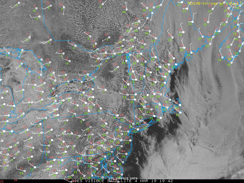
Visible satellite imagery showing some low level clouds moving over portions of the Northeast this evening
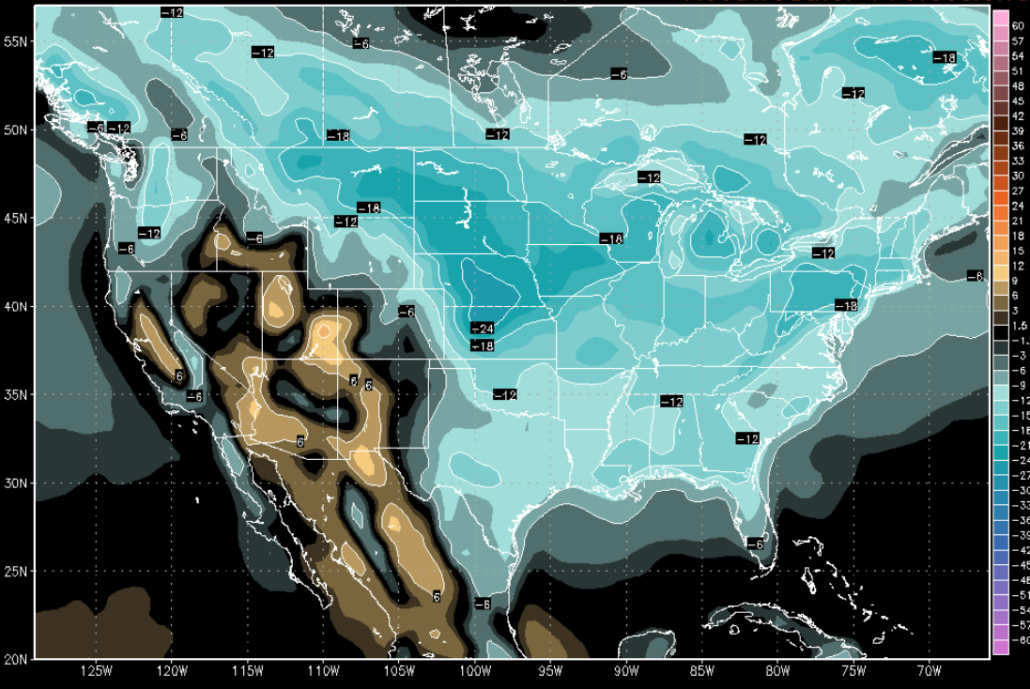
Tomorrow morning (Tuesday) will start off rather cold and clear as a large upper level low near the Great Lakes moves to our north. Highs tomorrow will be hard-pressed to rise above freezing across the area, with readings likely coming in around the middle 20’s to lower 30’s. A few pockets of upper level energy associated with this large upper level system to our north may try and swing through during the afternoon hours tomorrow, which could result in some scattered snow showers developing. Any snow shower activity will likely remain quite light and should be focused primarily off to the north and west of the city. Deep northwesterly flow will again overspread the area tomorrow night, which will lead to another unseasonably cold airmass. Low temperatures will once again fall into the lower 20’s for the immediate NYC area, with locations off to the north and west getting well into the teens-which will be 5-10 degrees below normal for this time of year.
Another batch of upper level energy will be swinging to our north during the day on Wednesday, which will continue the general theme of cold northwesterly flow from Canada. Unseasonably cold and clear conditions will continue into the afternoon hours as highs are only able to reach the middle to upper 20’s across much of the NYC area. Tranquil and cold will be the theme across the region as we head into the evening and overnight hours. The coldest lows of the week will likely be reached on Wednesday night as excellent radiational cooling sets up. Temperatures should drop well into the teens across the entire forecast area-with single digit lows possible for elevated locations off to the north and west!
Calm conditions persist through the end of the week, changes likely by this weekend
Fortunately (or unfortunately) there really isn’t much to write home about with regards to our sensible weather through the end of this week. A weak shortwave trough may try to dive into the Ohio Valley by Friday and produce a stripe of light snow into the Mid-Atlantic states, but this system will be moving very quickly and will have little moisture to work with. Significant impacts from this system appear unlikely at this time, but we’ll provide updates as we get closer!
A much larger system may impact the Central United States by the later half of this weekend as an energetic trough moves through the Northern Plains. This system will have to watched for eventual impacts down our way by around Sunday, but the overall pattern in place would support more of a rain threat as the surface low cuts into the Midwest and Great Lakes. In general, look for a period of unsettled conditions around the later half of this weekend with a brief warm-up possible around that time.
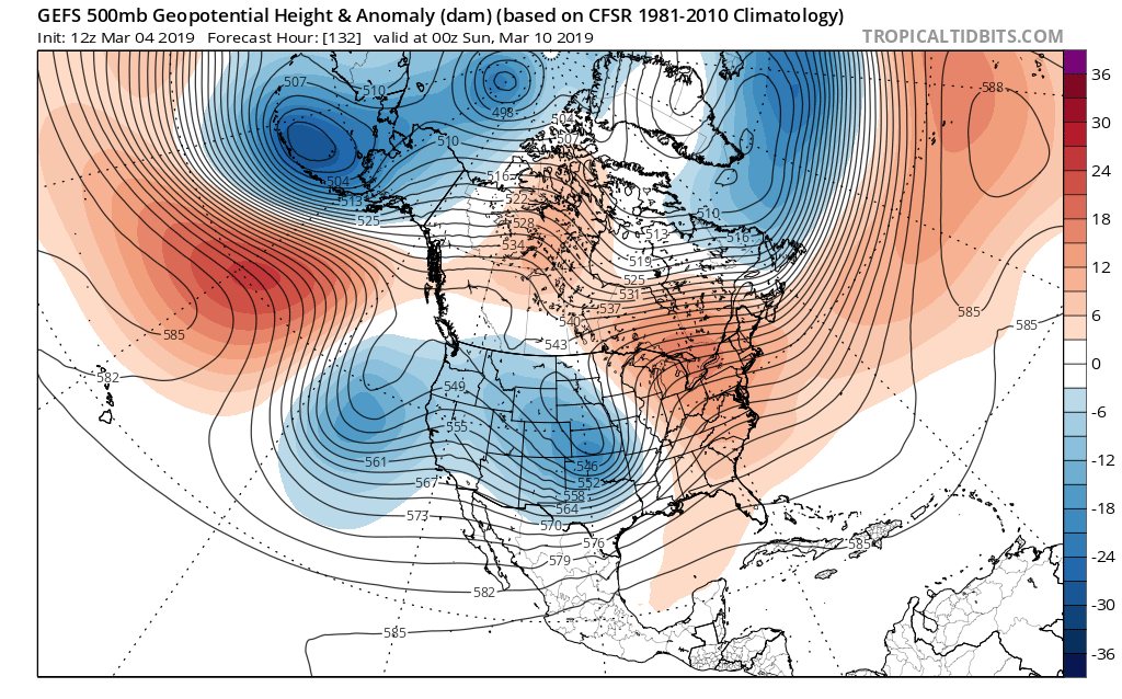
This afternoon’s GFS ensembles showing a deep and negatively tilted trough over the Rockies with a ridge building over the East. Such a setup could bring a brief warmup and some unsettled conditions around next weekend!
Have a great night!
Steve Copertino
Trackbacks & Pingbacks
1related
Leave a Reply
Want to join the discussion?Feel free to contribute!