-2")
Unseasonably cold conditions continue through Friday
Good evening!
Unseasonably cold and relatively calm conditions have dominated through the first half of this week. Temperatures look to rise only a few degrees through Friday before we have to watch for our next rain threat later on this weekend!
Today has been the coldest in a series of unseasonably cold days across the Northeast this week. As of 4 pm, all stations in the New York City metro area were in the middle to lower 20’s with wind chills only in the lower to middle teens! In addition to the cold, some very light snow showers and flurries developed across portions of the Northeast as some residual energy from an upper level system to our north moved through. Otherwise, deep northwesterly flow allowed for mostly sunny skies and some gusty winds of around 20-25 mph at times. These winds will gradually die-down as we get deeper into the evening hours, which will help set the stage for great radiational cooling conditions overnight. Lows tonight will also be the coldest of the week as temperatures plummet down into the teens for the immediate NYC area, with single digits likely off to the north and west!
These readings will be an impressive 10-15 degrees below normal for early March!
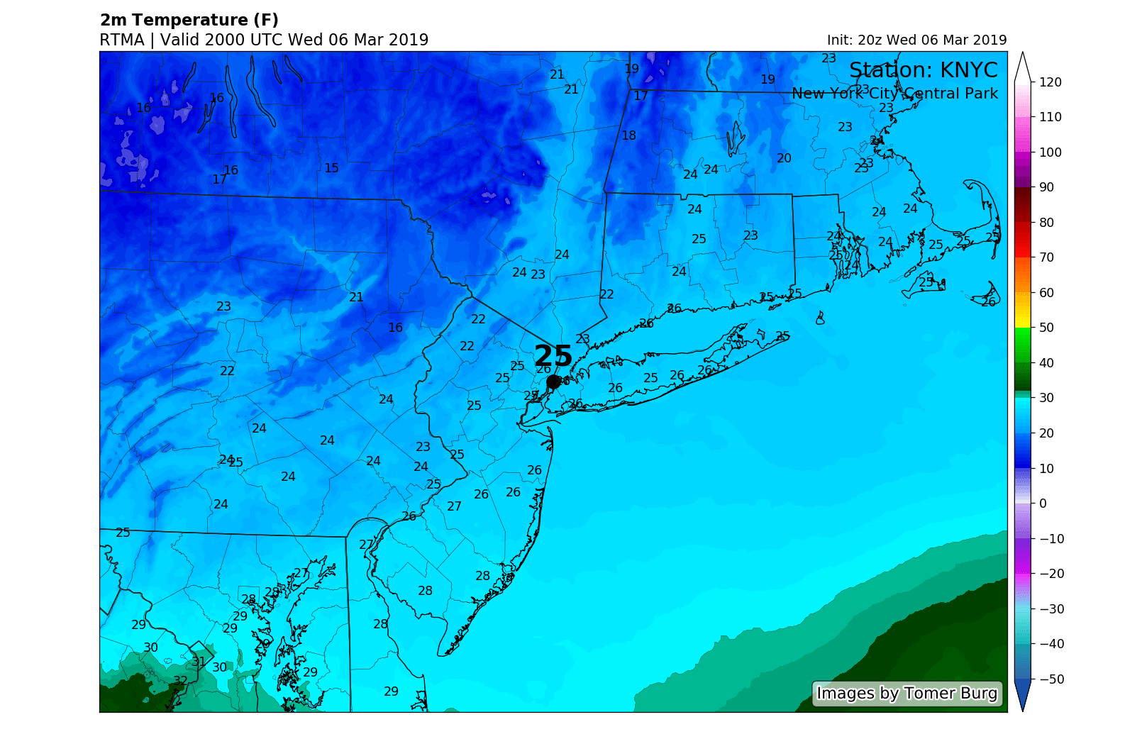
“High” temperatures this afternoon with readings below freezing across the entire NYC metro area!
Cold holds on Thursday, watching a weak system passing through the area on Friday
Tomorrow (Thursday) will likely start off very cold and mostly clear across the NYC area for the morning commute with temperatures mainly in the teens. Deep northwesterly flow from Canada will help make tomorrow another unseasonably cold day across the entire area tomorrow. While temperatures are expected to rise a few degrees compared to today, highs will likely remain in the upper 20’s to lower 30’s (10-15 degrees below normal) across much of the NYC area. Despite the increased temperatures, some renewed breezy conditions will make things feel more like the lower to middle 20’s throughout much of the day. Much of the same will remain in place through tomorrow evening and into the overnight hours as an area of high pressure begins to edge in from the west. Winds will once again die down and skies will likely clear out for the most part. Lows tomorrow night should have no issues dropping back into the lower to middle 20’s for the immediate NYC area-with teens off to the north and west.
High pressure will build overhead as we start off the day on Friday. Mostly sunny skies are likely at least throughout the first half of the day as we close out the week just as we started it-with unseasonably cold temperatures. Highs on Friday will likely be a few degrees warmer once again, but nothing really to get too excited about. Expect temperatures in the lower to middle 30’s during the afternoon hours across the entire NYC metro area, which will still be 5-10 degrees below normal. Our attention then turns to the west as weak and sheared-out system begins to move towards the Mid-Atlantic states during the later half of the day.
This weak and quick-moving system may try and produce an area of light snow from the Mid-Atlantic states and into southern portions of our area by the early evening hours of Friday. Impacts will likely be very limited for a number of reasons; but the speed, lack of moisture involved, and marginal surface temperatures should make this system more of a minor inconvenience than anything else.
Any snow/rain associated with this system will quickly move off the coast by late Friday night, with mostly cloudy skies and lows in the 20’s left in it’s wake.
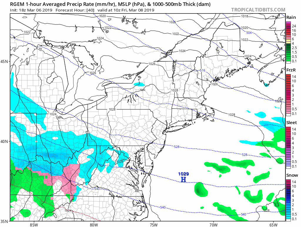
One of the high resolution computer models showing the weak and fasting moving system capable of producing some very light snow on Friday night
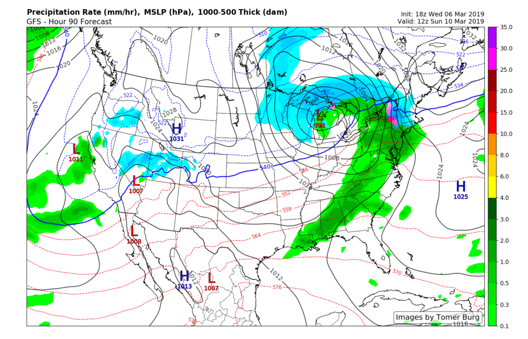
Next system cuts well off to our west this weekend
A potent upper level system will spawn an area of low pressure over the Great Plains during the day on Saturday that has the potential to produce another round of heavy rains and severe weather over portions of the South. This low is then expected to cut through the Midwest and into the Great Lakes early in the day on Sunday, which will likely bring our next chance at precipitation.
While there will be no strong surface high pressure system to our north to help keep cold air really anchored in place on Sunday, some locations well off to the north and west of the city may have to contend with a mix of sleet and rain during the onset of the precip due to some stubborn low level cold air. The stale cold airmass left over the Northeast will likely be swept out during the afternoon hours of Sunday, which will likely be accompanied by a period of moderate to potentially heavy rain. Rain will likely quickly exit the coast during the late afternoon hours of Sunday, with highs reaching the middle to upper 40’s.
After a very minor warmup on Sunday/Monday, things look to turn unseasonably cold again as early as next week as another high pressure system moves into the Northeast!
This evening’s GFS model showing our next system cutting well off to our west with the potential for some moderate/heavy rain on Sunday
We’ll have an update on both of these systems on Friday afternoon!
Have a great night!
-Steven Copertino
Trackbacks & Pingbacks
2peacock
Leave a Reply
Want to join the discussion?Feel free to contribute!