-2")
Rain on Sunday gives way to more dry conditions next week
Good evening!
The same calm, cold, and dry conditions that have dominated the past week continue today. However, these conditions are expected to change by Sunday as an area of mixed precipitation & rain moves into the area along with some slightly “warmer” temperatures!
Today started off relatively cold with mostly clear skies across the New York City area. Weak westerly/southwesterly mid level winds have introduced some slightly increased temperatures into the Northeast, but only by a few degrees. Highs across the metro area were mainly in the middle to upper 30’s, with 40’s located over portions of Southern New Jersey. Clouds began to increase during the late afternoon/early evening hours as a very weak mid level system began to edge into the Mid-Atlantic states. Back on Wednesday we talked about how this system had some potential to produce some very light snow for southern portions of the NYC area. Since that time, this system has trended more to the south and even weaker, which has kept virtually all of the precipitation south of the Mason-Dixon line. This weak system is expected to continue to quickly move off the coast later tonight with virtually no impacts for our area, outside of a stay snow shower or two.
Conditions may be able to clear out enough later tonight for decent radiational cooling to set up once again for the area. Lows are expected to fall into the middle to upper 20’s for the immediate NYC area, with lower to middle 20’s to the north and west.
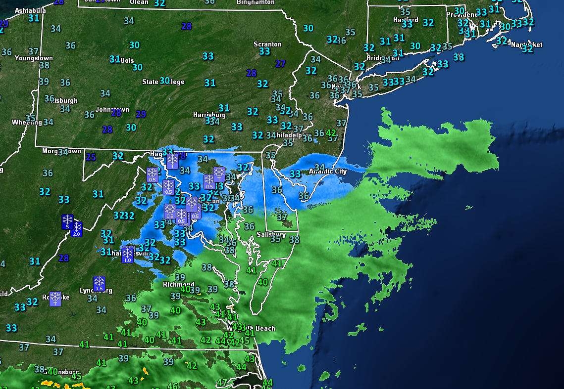
This evening’s latest regional radar mosaic and surface temperatures showing an area of very light snow moving through the Mid-Atlantic states.
Saturday will start off much like the past five or so days, with cold temperatures, sunny skies, and light winds. Surface high pressure will be moving to the north over portions of Canada during the day, so continued calm and clear conditions will be likely well into the day. Increasing mid level flow from the southwest ahead of an approaching storm system will usher in some slightly warmer temperatures into the region, with highs likely getting into the lower to middle 40’s. Conditions will remain generally calm and cool into the overnight hours as the upcoming storm system cuts into the Great Lakes region. Lows will be in the upper 20’s to lower 30’s across much of the NYC metro area, with locations off to the north and west likely a few degrees colder.
Precipitation will likely move into the area by around 4-6am on Sunday morning. Some stale leftover cold may allow some of the initial precipitation off to the north and west of the city to start off as a mix of snow/sleet/rain, with primarily rain expected in and around the city. Areas that do see mixing likely won’t see much in the way of impacts across portions of NNJ and SENY. There may be some slick conditions early Sunday morning on colder surfaces, but temperatures will gradually rise into the lower to middle 40’s across much of the NYC area by the afternoon hours. Light to occasionally moderate rain should continue throughout the morning and into the early afternoon hours before tapering off from west to east. Much drier air in the mid levels of the atmosphere will quickly punch into the Northeast during the early evening hours, likely putting an end to any lingering shower activity. Mostly cloudy skies are expected for the evening/overnight hours of Sunday with lows not as cold-with temps in the lower to middle 30’s.
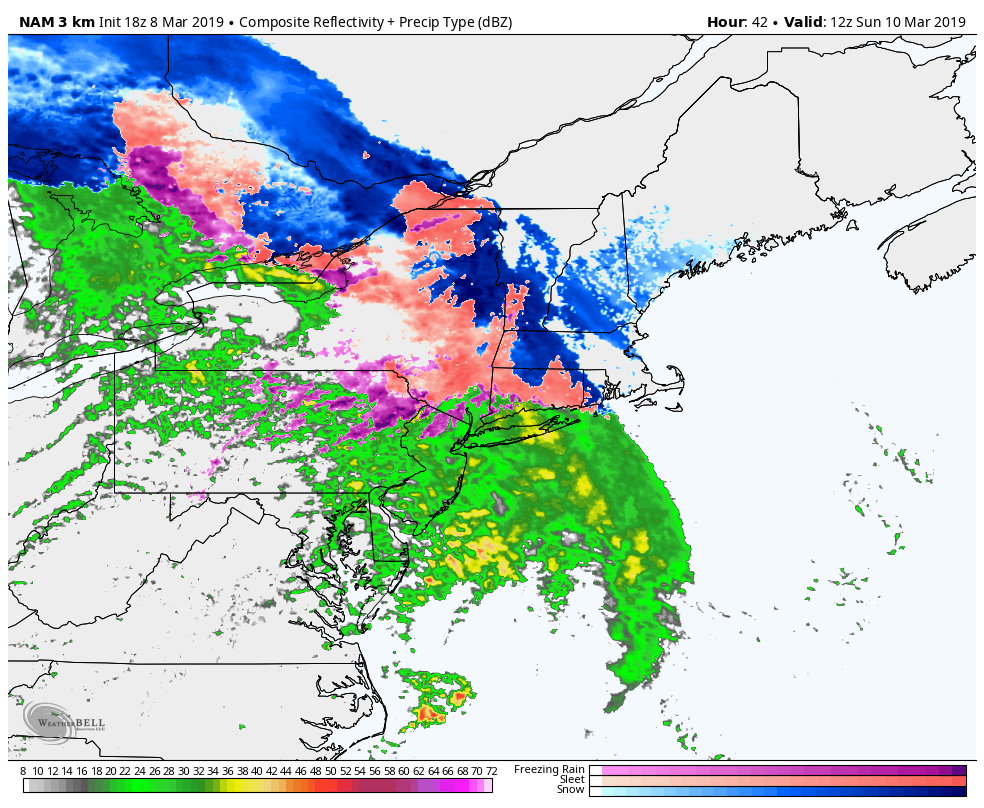
3km NAM showing the potential for some areas of mixing mainly off to the north and west of the city on Sunday morning before switching to rain
Dry and calm conditions likely to dominate once again next week
Dry northwesterly mid level flow will then take over once again on Monday with mainly clear and calm conditions expected. Temperatures will likely be rather “mild” on Monday compared to this past week as much of the colder temperatures remain in Canada. Highs will likely peak in the upper 40’s to lower 50’s on Monday, before dropping back into the lower 40’s on Tuesday as an area of high pressure moves through the Northeast.
The rest of the week looks mainly dry with temperatures slightly above normal into Friday. Highs will likely remain in the middle to upper 40’s each day, with 50’s possible again later in the week. The next chance of measurable precipitation looks to be about a week from now as a large upper level trough sets up over the Western United States. This will likely result in another area of low pressure cutting through the Midwest, with a cold front likely moving through by Friday.
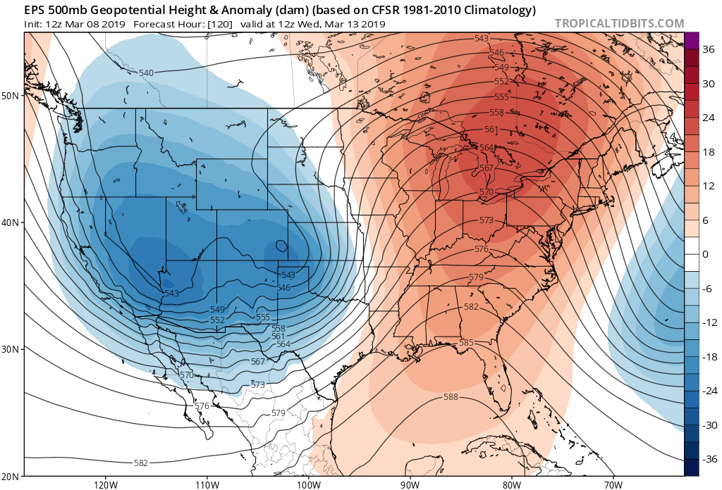
ECMWF Ensembles valid next week showing a large, deep trough over the West and a deep ridge over the East. Such a pattern would increase the potential for storms cutting off to our west, with some increased temperatures later in the week
We’ll have an update on Monday! Have a great weekend!
Steve Copertino
Leave a Reply
Want to join the discussion?Feel free to contribute!