-2")
Calm and seasonable conditions dominate the week
Good evening!
Another string of mainly calm and seasonable days are likely this week as much of the the ‘action’ stays well to our west!
Today was an exceptionally pleasant day across the entire New York City metro area as highs rose into the lower to middle 50’s with mostly sunny skies. Generally calm and mild conditions continue this evening ahead of an approaching cold front located over Pennsylvania. This front will work into the region later tonight, bringing a period of increased gusty winds–especially near the coast. The bad news is that well-below seasonable temperatures will filter back into the region overnight. Lows will fall into upper 20’s to lower 30’s for the immediate NYC metro, with middle to upper 20’s likely off to the north and west. The good news is that this front is quite weak and is severely lacking in moisture. Conditions will remain predominately dry throughout the night, with mostly clear skies expected.
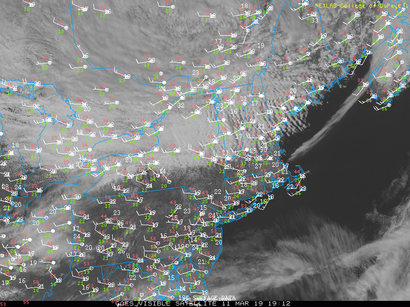
This evening’s high resolution visible satellite imagery showing mainly clear and breezy conditions over the Northeast
Clear and seasonable conditions expected through the middle of this week
Tomorrow (Tuesday) will start off relatively cold and breezy across the metro area for the morning commute. Clear skies and gradually subsiding winds will dominate the rest of the morning/afternoon as an area of high pressure builds into the East. Highs tomorrow will be somewhat cooler than today, but right around seasonable levels. Temperatures should gradually rise into the middle to upper 40’s for much of the NYC area, with some slightly cooler temps to the north and west. High pressure will continue to build into the area during the evening/overnight hours tomorrow, leading to another tranquil night. Clear skies, calm winds, and dry conditions will help create an environment ripe for radiational cooling. Lows will then fall again to well-below seasonable levels, with lower to middle 20’s likely for the entire area.
Much of the same is expected on Wednesday, with a relatively cold start to the day expected. High pressure will gradually shift off to our east during the day, bringing in some weak southerly flow. Temperatures will once again remain right around normal, with highs expected in the middle to upper 40’s for the majority of the metro area. Increasing southerly flow will bring in a slightly more moist airmass Wednesday night, which will lead to gradually increasing clouds for the area. Lows will still drop back below seasonable levels, with upper 20’s to lower 30’s expected for the majority of the area.
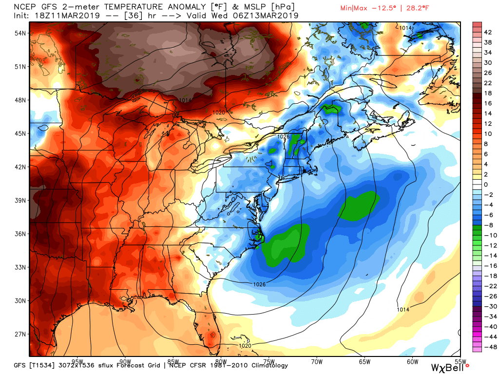
This evening’s GFS model showing below normal temperatures into Tuesday night/Wednesday morning as high pressure moves through the East.
Mild, but damp end to the week likely
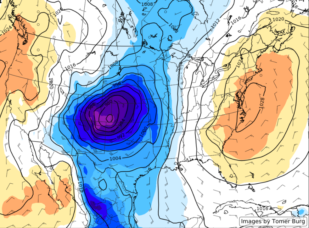
A large and unusually intense cyclone will develop over portions of the Central Plains on Wednesday, leading to a driving snowstorm for the Northern Plains and very heavy rainfall for portions of the Southeast. Thankfully, much of the action will remain well off to our west through Thursday as this system cuts up through the Midwest and into the Great Lakes. As this system moves through the Lakes, the are of low pressure will begin to gradually decay and weaken. Regardless, deep southerly/southwesterly flow will still overspread the Mid-Atlantic and Northeast by Thursday, with temperatures rising above seasonable levels.
Friday looks to be a wet, but potentially very mild day (by March standards) as highs could potentially reach into the lower to middle 60’s ahead of an approaching cold front. At this time it appears that the rain on Thursday night/Friday will be more on the light to moderate side, thus reducing overall impacts and hazards. Rain looks to clear out during the early morning hours of Saturday, with a mostly clear and pleasant weekend looking likely!
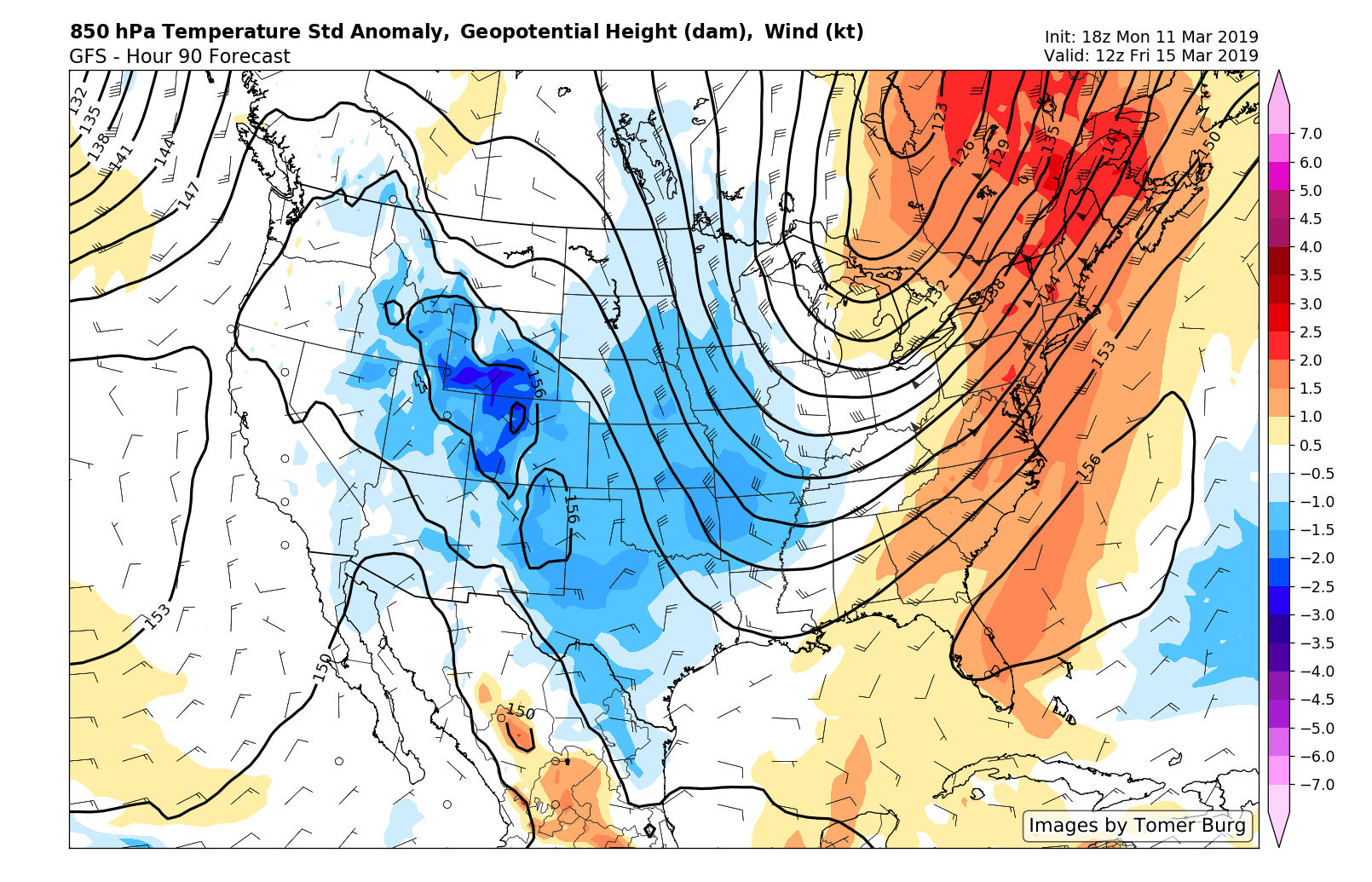
GFS model showing an impressive surge of warmer air into the area for Friday!
We’ll have an update on Wednesday! Have a great night!
Steve Copertino
Leave a Reply
Want to join the discussion?Feel free to contribute!