-2")
Showers move out, breezy and cool conditions to start the weekend
Good evening and happy Friday!
Today has been a transitional day across the Northeast as rain and snow showers continue to shift out of the area. Cool and breezy conditions have now taken over, with periods of light rain/snow showers still possible tonight!
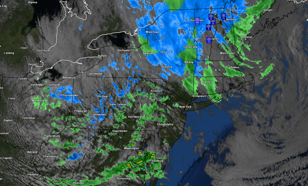
The area of low pressure that moved through our area late last night which delivered periods of moderate to heavy rain is now located in the Gulf of Maine. Since that time, the surface low has undergone a period of impressive strengthening, dropping from 994mb to around 979mb in around 18 hours. This has caused an impressive pressure gradient to set up over our area this afternoon, with winds gusting to 20-40 mph. Deep northwesterly flow has also begun to filter in from Canada, bringing in some drier mid level air. These patchy areas of dry air have allowed skies to gradually clear over the NYC metro area this afternoon. Highs were able to rebound into the middle to upper 40’s, with sporadic 50’s being reported.
The warming surface temps along with falling mid level temperatures have allowed for steep lapse rates (changes in temp with height) to set up over the Northeast. These steep lapse rates have resulted in the development of some scattered rain/snow showers to move through portions of Pennsylvania and Maryland this afternoon-with even some graupel being reported. Mainly breezy and partly cloudy skies will remain through the evening and overnight hours, with a slight chance at a rain/snow shower or two. Cool temperatures will invade much of the area tonight, with lows expected to fall into the lower to middle 30’s-which will be slightly below normal for this time of year.
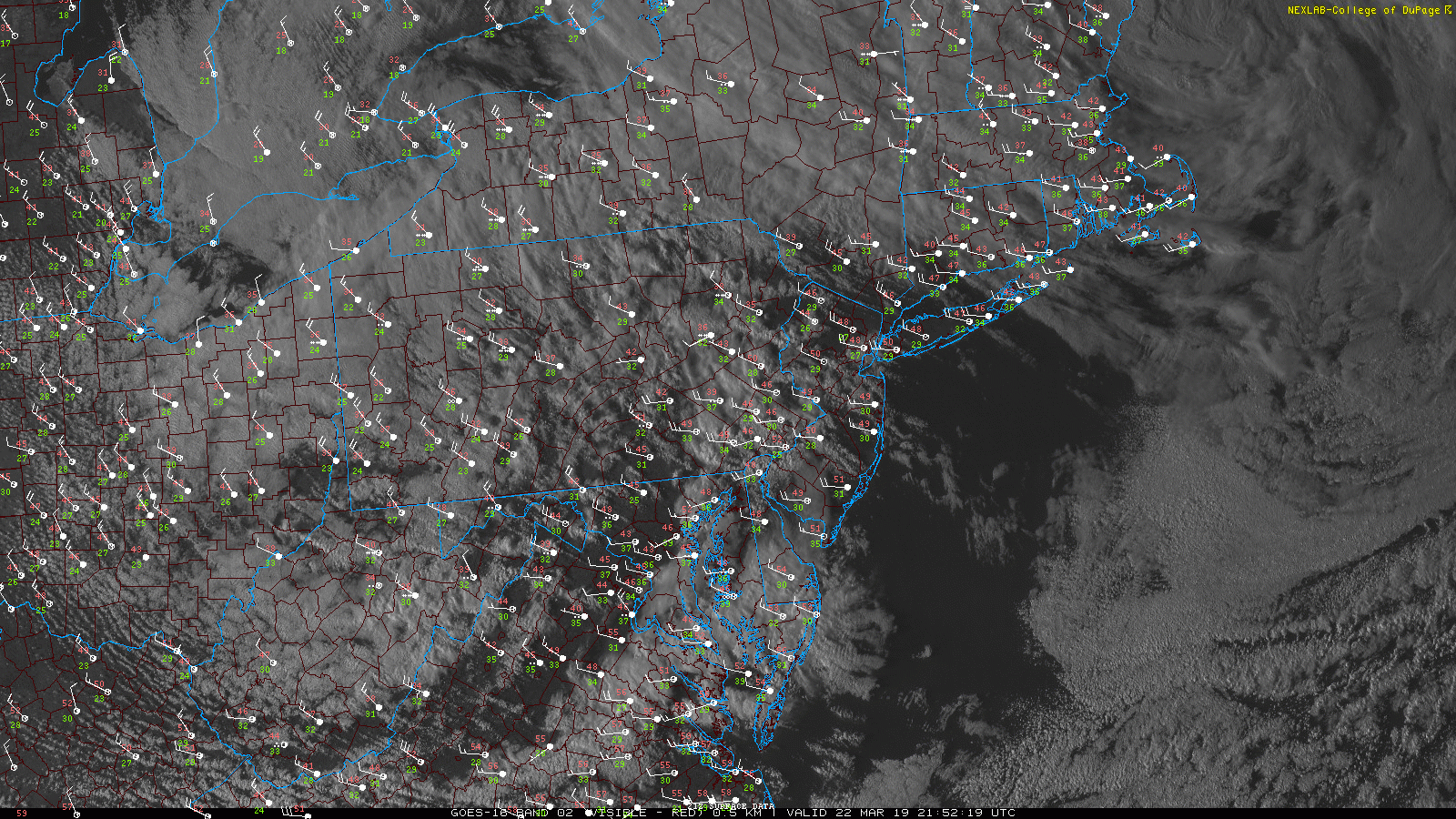
This evening’s latest visible satellite imagery along with surface observations showing a cool and windy afternoon
Breezy and cool conditions through Saturday, much improved weather by Sunday!
Tomorrow (Saturday) will start off quiet cool and partly cloudy once again across the region. Winds will likely gradually subside a bit as the deep area of low pressure exits the Gulf of Maine and heads into the North Atlantic. Deep northwesterly flow from Canada will continue to dominate the region on Saturday with drier air continuing to filter in. Clouds will likely gradually decrease through the afternoon and evening hours tomorrow. Highs will be just around normal for this time of year (but still cool) with temps in the middle to upper 40’s. Winds will continue to die-down as an area of high pressure moves through the Ohio Valley and into the Northeast tomorrow night. The combination of subsiding winds, dry air, and clear skies should bring some decent radiational cooling for our area tomorrow night. Lows will then fall into the middle to upper 20’s, with lower 30’s likely for the immediate NYC area.
Sunday will be the most pleasant day in the forecast period, with clear skies dominating most of the day. At the same time, high pressure will be shifting offshore during the day, which will turn winds from the northwest to southerly. Highs will likely rise into the middle to upper 50’s on Sunday afternoon, with cooler conditions likely over portions of coastal New Jersey and Long Island. Clouds may try to increase during the evening and overnight hours as some mid level moisture from a weak disturbance over the Ohio Valley begins to edge in. Expect cool lows once again on Sunday night with temperatures staying in the upper 30’s to lower 40’s for much of the NYC area.
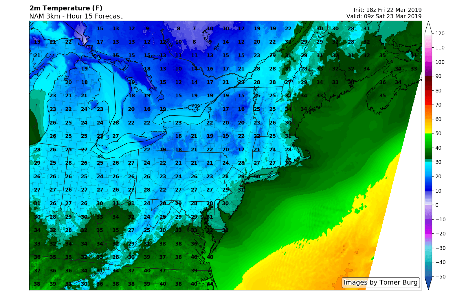
This evening’s hi-res NAM model showing temperatures falling into the 20’s tonight
Cool shot likely for the first half of next week
Latest model guidance indicates that a very weak area of low pressure will move through the Ohio Valley on Monday. This system will then be shoved to the south by a large, and rather impressive high pressure emerging from Canada by Tuesday. At this time it appears that this system is likely to remain to the south, there is a chance that this does trend more to the north and could produce some insignificant rain/snow for the area by early Tuesday morning. This system is then quickly kicked out to sea by the high pressure, which will dominate our weather through the middle of next week.
Highs will likely remain cool and somewhat near normal through Thursday with middle to upper 40’s expected. Temperatures may try and improve later in the week as the high shifts offshore and provides southerly winds to the area!
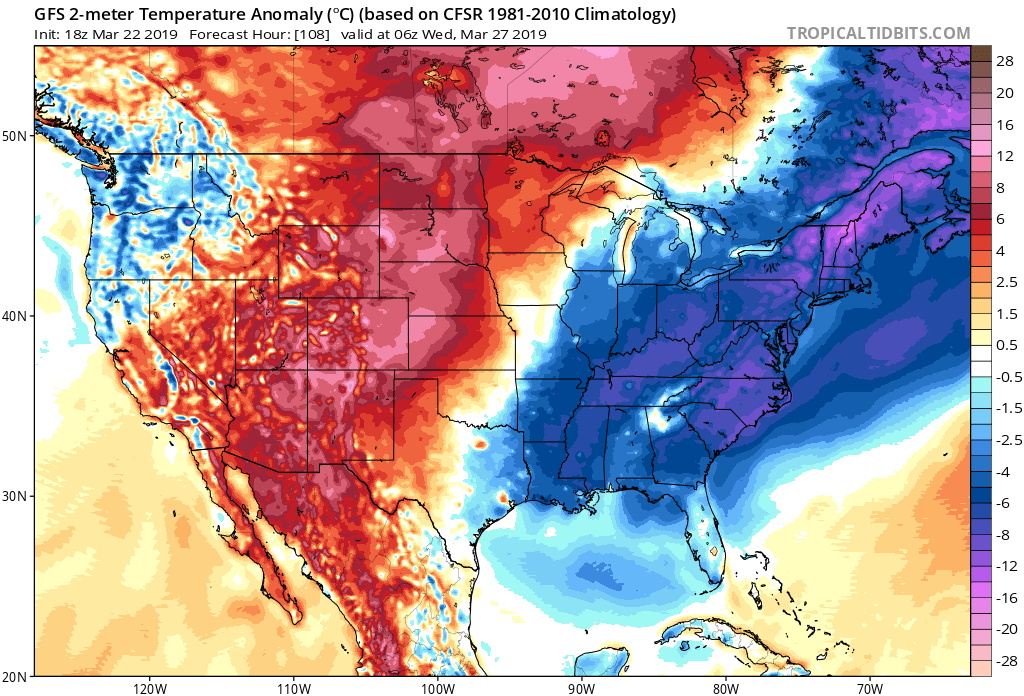
This evening’s GFS ensembles showing an increased risk for below normal temperatures early next week
Thanks for reading and have a great weekend!
-Steve Copertino
Leave a Reply
Want to join the discussion?Feel free to contribute!