-2")
Showers and clouds stick around, temps briefly warm Saturday
Good evening and happy Friday!
During the past twenty four hours we’ve traded cool temps and mostly sunny skies for slightly warmer temperatures with clouds and showers. Conditions look to turn mild Saturday before we begin another switch over to cooler and clear conditions next week!
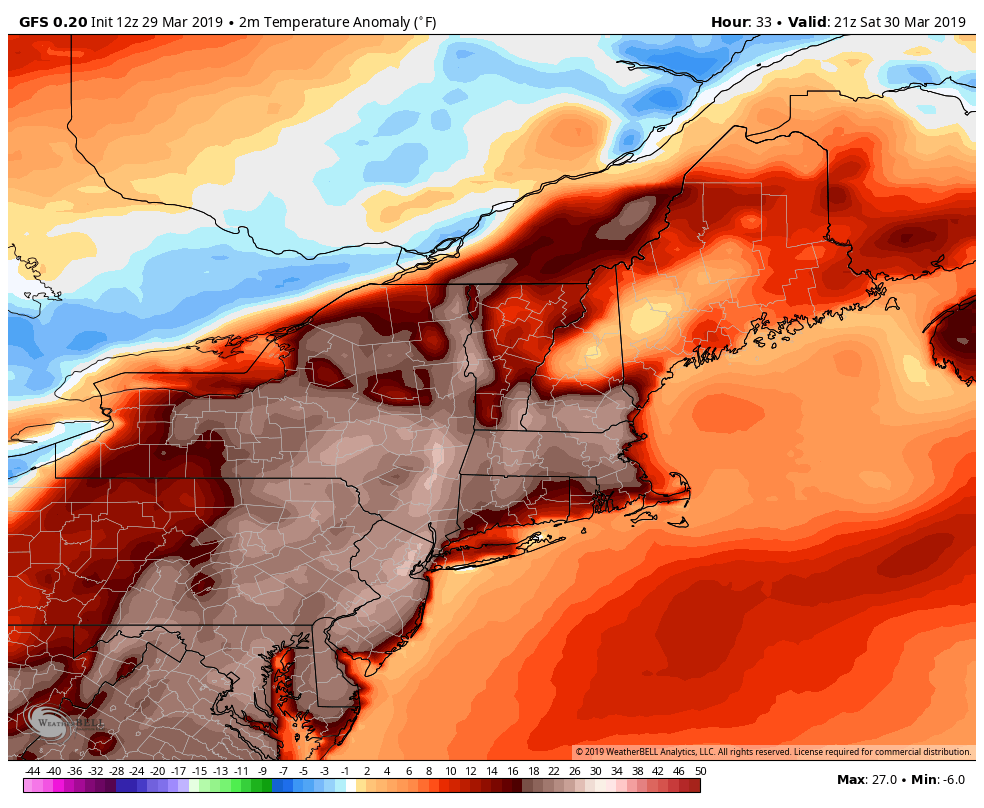
Today has been a rather bleak and gloomy day as a stalled frontal boundary remains to our north. Deep southwesterly flow remain firmly in place, providing a moist/warmer airmass over the area. This has lead to the development of mostly cloudy skies and some light showers over northern portions of the New York City area today. Despite the thick cloud cover and occasional showers, highs today were able to reach into the middle to upper 50’s-which is slightly above normal for this time of year. Much cooler highs were observed over portions of Long Island as onshore flow continues to bring in cooler maritime air.
Little is expected to change into the late evening and overnight hours as the frontal boundary remains to our north. Mostly cloudy skies and the potential for a shower or two will remain in place, but the overall shower threat should be quite low in and around the city. Lows this evening will remain above normal as the thick cloud canopy puts a lid on just how low temperatures can drop. The immediate NYC area will likely stay in the middle to upper 40’s, with slightly cooler temps off to the north and west.
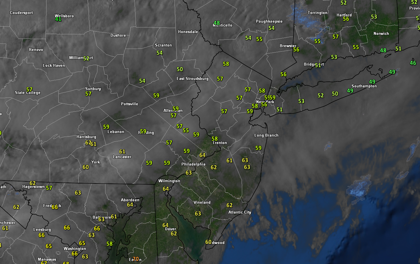
This evening’s latest high resolution visible satellite along with temperatures and radar.
Some residual showers have been noted off to the north and west of the city this afternoon
Mild conditions Saturday, cold front swings through Sunday with more showers
Saturday will likely start off mostly cloudy as an approaching shortwave trough over the Ohio Valley begins to amplify/strengthen. In return, southwesterly flow will increase even further during the morning and into the afternoon hours, making for a complex temperature forecast. While thick overcast is quite likely during the majority of the day, there may be the potential for some brief peeks of sun from 1-4pm. With increased mid level flow aloft and the potential for some help from brief breaks in the clouds, temperatures tomorrow should wind up quite mild. Highs will likely reach at least into the upper 60’s for the majority of the area (sorry Long Island). A few spots of lowers 70’s cannot be ruled out, especially if we do in fact see more sun during the afternoon hours. Regardless, much of the day looks to remain dry as all of the forcing and support for rain/showers will be located well off to our north and west over portions of Pennsylvania and New York. Conditions on Saturday night will be even more mild than tonight as lows struggle to get out of the 50’s for the immediate NYC area!
Conditions look to go downhill during the early morning hours of Sunday as the cold front finally pushes through the area. While this front will not have any significant precipitation associated with it, occasional light to moderate rain will make for a rather unpleasant morning/early afternoon. Highs will likely make it into the lower to middle 50’s before the front moves through, which will still be somewhat above normal. Temperatures then begin to fall as the front and any residual showers passes off to our east during the afternoon/evening hours. Lows will likely be a good 15-20 degree colder than Saturday night, with temperatures in the lower to middle 30’s for the immediate NYC area.
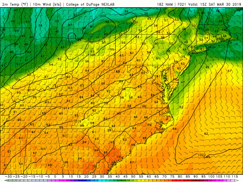
This evening’s NAM model showing the dramatic temperatures change between Saturday and Sunday
Conditions finally clear out, but at what cost?!
The upper level trough associated with Sunday’s system will swing through the Northeast during the early morning hours of Monday morning. Deep northwesterly flow will then set up over the entire area, bringing in a much calmer, but also significantly cooler airmass. Highs on Monday will likely reach the middle to upper 40’s with some breezy conditions making things feel a bit cooler. Below average temperatures and calm conditions will continue into Tuesday before we have to shift our eyes to the Southeast coast.
Model guidance has been hinting at the potential for a small, but energetic shortwave trough interacting with northern stream energy and producing a coastal storm off the Southeast coast by Tuesday night. As it stands right now, the majority of the models show that this system is likely to remain far enough offshore that any impacts for our area would be very limited. Additionally, the overall synoptic pattern does not support this system crawling up the coast. While we will definitely be keeping an eye on this system just in case it decides to shift over the next few days, anything more than a couple of showers form this system seems quite unlikely at this time.
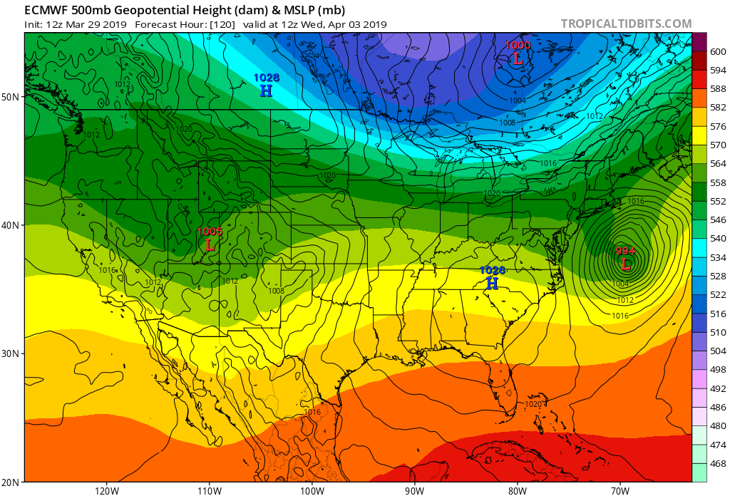
ECMWF model showing the potential for a storm system developing near the Southeast coast and moving out to sea next week
Have a great weekend and we’ll see you on Monday for out next update!
-Steve Copertino
Thanks for a marvelous posting! I genuinely enjoyed reading it, you are a
great author.I will ensure that I bookmark your blog and definitely will come back very soon. I want to encourage yourself to continue
your great posts, have a nice day!