-2")
Spring temperature swings continue, close call Wednesday
Good evening!
The dreary and unpleasant conditions of the past few days have finally moved out of the region and have since been replaced by sunny, clear skies. Unfortunately, things don’t look to stay that way as more temperature swings and periods of unsettled weather are on the horizon.
We started off the work week this morning with substantially improved conditions across the entire region as high pressure edged into portions of the Mid-Atlantic states. Some gusty winds in the 20-30 mph range were recorded across much of the Northeast as this weekend’s departing storm system created a tight pressure gradient with the aforementioned approaching high to our south. Mainly clear and cool conditions dominated the day as light northwesterly flow ahead of an approaching mid level ridge moved to our west. Highs today were once again below normal for this time of year as temperatures struggled to break out of the lower to middle 40’s across the entire metro area. Not much change is expected in the way of sensible weather as high pressure moves just to the south of the NYC area tonight. Cool mid level temperatures, clear skies, and a subsiding winds will provide excellent radiational cooling conditions tonight.
Expect lows to drop into the upper 20’s to lower 30’s for the immediate NYC area, with lower to middle 20’s possible for elevated locations off to the north and west. Needless to say, these lows will be a few degrees below normal.
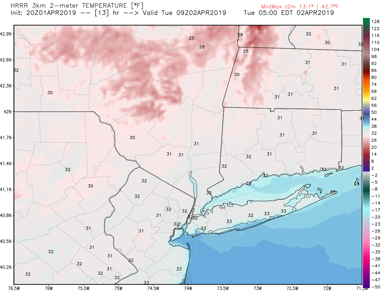
This evening’s hi-res NAM model showing lows dropping into the 20’s to 30’s later tonight and into tomorrow morning
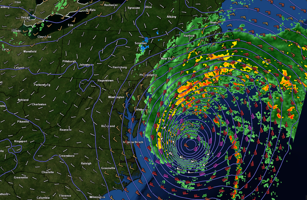
Close call with a coastal on Wednesday AM
Tomorrow (Tuesday) will start off quite calm and relatively cold with temperatures in the lower to middle 30’s for the AM commute. High pressure will be shifting off to the east during the day tomorrow, allowing for another change in air masses. Southerly flow aloft and southeasterly winds at the surface will bring in somewhat improved temperatures tomorrow-but not by much. Mostly sunny skies will help temps to climb into the upper 40’s to lower 50’s across much of the metro area, but this will still be a few degrees below the norm for April. Things then get somewhat more interesting during the later half of the day as an energetic mid level system moves towards the Southeast coast. An area of low pressure will take shape over the Carolinas by tomorrow afternoon and should begin to quickly intensify as it moves briskly off to the northeast. The vast majority of this systems energy will be focused over the open Atlantic, but a sharp increase in clouds is likely for the metro area by the early evening hours. Some areas of light to potentially moderate rain will be possible for coastal sections of southern NJ tomorrow night–especially after 8pm.
This deepening low pressure system will then track off to the ENE during the very early morning hours of Wednesday, possibly bringing some more light-moderate rain showers to coastal NJ and portions of Long Island before 5am. Thankfully this system will be unable to move all the way up the coast, and should be heading out to sea just in time for the morning commute on Wednesday. While impacts for the immediate NYC metro look extremely limited, portions of New England may have to keep an eye on this system for more significant weather impacts. Regardless, a much drier and more mild airmass will move into the area during the day on Wednesday.
Expect highs to rebound nicely with temperatures getting into the lower to middle 60’s for most of the area. Decreasing clouds and temps a few degrees above normal will continue into the overnight/evening hours. Wednesday night will likely be a tranquil night, with clear skies and temps in the upper 30’s to lower 40’s.
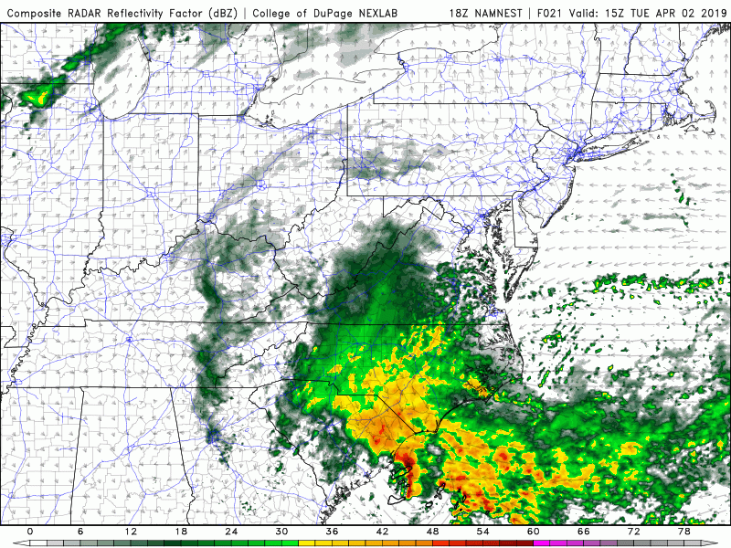
This evening’s NAM model showing the potential evolution of tomorrow night’s coastal low
Wild temp variations continue into the weekend
Things cool down again once we get to Thursday as an area of high pressure moves into the Northeast, dropping highs into the 50’s. A weak frontal system will be quickly following behind this high, with a good shot at some measurable precipitation late Thursday and into Friday. Depending on the exact timing, some wet flakes may be possible very late Thursday night and into the very early morning hours of Friday. Any wintry precip is expected to be very short-lived and will have virtually no chance at accumulating. Regardless, unsettled and chilly conditions in the 40’s are expected during the remainder of the day on Friday.
Another flip to more mild conditions looks possible by Saturday as a warmer airmass moves in from the southwest. Highs may have the chance to rebound all the way back into the middle 60’s by the latter half of the weekend as another storm system gathers over the Central United States.
We’ll continue to keep an eye on tomorrow’s coastal system as well as the system during the later half of the week on our twitter page (@nymetrowx)
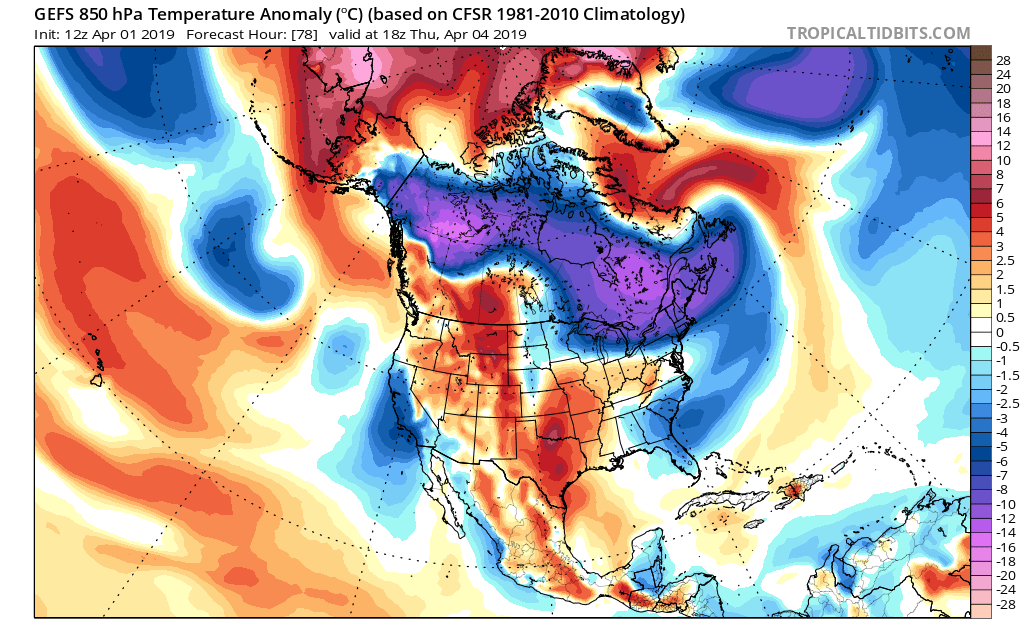
GFS ensembles showing the potential for another quick shot of cooler air later this week
Have a great night!
Steve Copertino
Leave a Reply
Want to join the discussion?Feel free to contribute!