-2")
Early Spring warmth fades, gradual return to unsettled conditions
Good evening!
The wild temperature swings of early Spring look to continue over the next couple of days. A string of weak systems will also impact the region through the week, bringing the threat for some showers and unsettled weather.
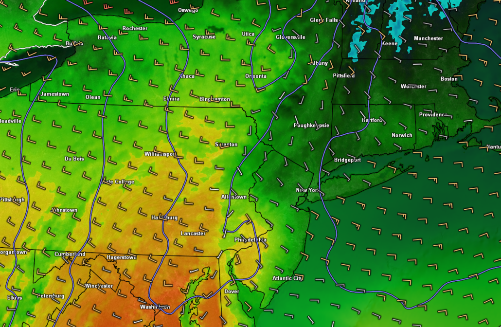
Today started off mostly cloudy with some fog for the AM commute over much of the area with temps in the lower to middle 50’s. As time went on, deep westerly/southwesterly flow overspread much of the Mid-Atlantic and portions of the Northeast. This set the stage for a substantial rise in temperatures over the area as low level clouds began to diminish. Highs were able to shoot into the middle to upper 70’s (with 80F reported at Newark) across much of the New York Metro area.
Highs were severely limited by cooler onshore flow over Long Island, keeping temperatures down into the 50’s to lower 60’s. Periods of overcast and sporadic low level cumulus continue over the northern portion of the area, with more prevalent clearing once you head south of the city. Temperatures will remain well-above normal into the early evening hours tonight as a disturbance to our south ushers in mostly cloudy skies. Some showers will be possible for southern locations, especially over southern New Jersey.
Temperatures during the late evening and overnight hours will be somewhat complex as a frontal system moves in from New England. While temperatures will still be somewhat above normal, expect lows to drop into the middle to upper 40’s for the northern sections of the area–with lower 50’s likely for the immediate NYC area.
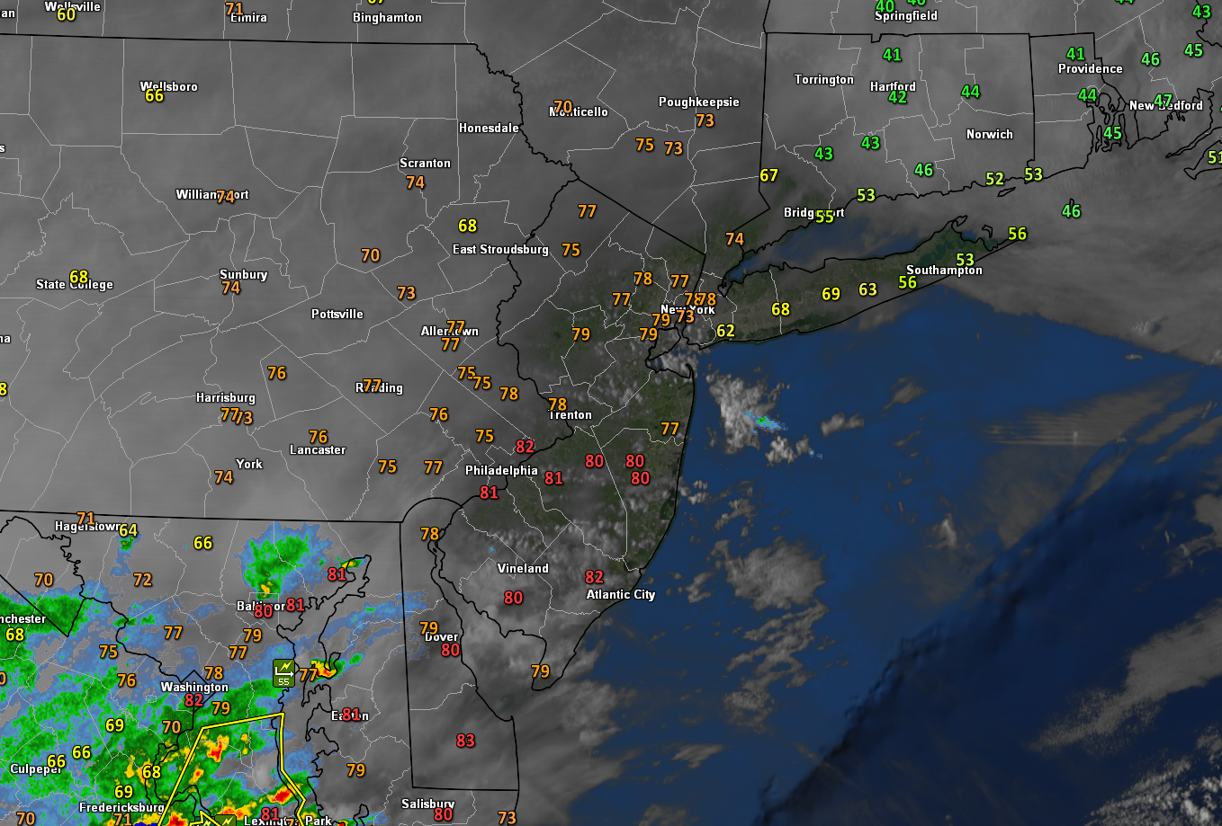
Snapshot of this evening’s current conditions showing generally mild conditions over the area with overcast and some showers increasing to the south and west.
Multiple fronts move through Tuesday, unsettled conditions return
Tomorrow (Tuesday) looks to start off much like Monday did; with mostly cloudy skies and patchy areas of fog-especially over portions of the Lower Hudson Valley and Long Island. Overcast will likely remain in place as the weak frontal system dropping in from southern New England continues to push south through the area. Highs tomorrow will be highly dependent on just how far south this front sinks. Today’s model guidance provides no help whatsoever as there is a significant amount of spread regarding where exactly this front will rest.
At this time it appears likely that highs around the immediate NYC area will likely reach the middle to upper 50’s, with a sharp gradient setting up over the area. Highs to the west of the gradient could reach the middle to upper 60’s, while locations to the east could stay in the middle to upper 40’s. Regardless, overcast will remain quite prevalent for the majority of the day with the potential for some showers during the afternoon/evening hours as weak cold front moves through. Temperatures behind the front tomorrow night will drop into the lower 40’s for much of the area,with middle to upper 30’s likely off to the north and west.
Dry northwesterly flow looks to overspread the entire Northeast on Wednesday behind the cold front. Generally improving conditions with mostly sunny skies will be the theme of the day. Temperatures will be right around normal for this time of year, with highs getting into the middle to upper 50’s over much of the area. Calm conditions look to continue into the evening and overnight hours of Wednesday. Clear skies, dry northwesterly flow, and light winds will make for good radiational cooling conditions during the overnight hours. Expect lows to drop down into the middle to upper 30’s for the immediate NYC area, with slightly colder temps off to the north and west.
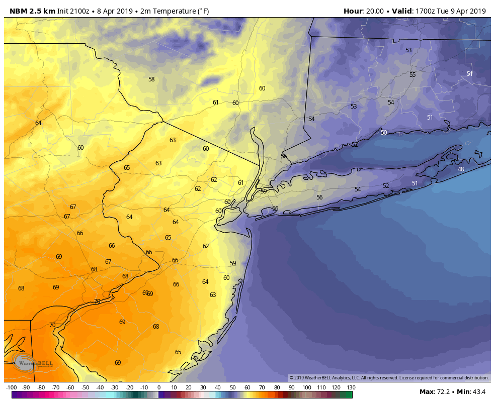
National Blend of Models showing a decent gradient showing up for the NYC area tomorrow afternoon as a weak frontal system works into the area.
Unsettled conditions likely to end the work week
A weak area of high pressure will be moving through the Northeast on Thursday, leaving much of the area with seasonable temperatures and continued dry conditions. At the same time, a large and powerful storm system will be unfolding over the Central Plains. This system will dump a large swath of heavy snow over Northern Plains on Thursday and into Friday as the low cuts into the Great Lakes. Deep southwesterly flow will likely overspread much of the Mid-Atlantic and Northeast on Friday, leading to increasing temps as well as available moisture. Showers will be possible late in the day on Friday and into the overnight hours as the decaying low moves into southern Canada.
While it’s still quite early, indications are that at least the first half of the weekend will remain dry through Saturday night. Another area of low pressure may take shape over the Southeastern states on Sunday, leading to another chance at some rain as the weekend comes to a close.
We’ll be keeping a close eye on all of these systems over the next couple of days as more information becomes available!
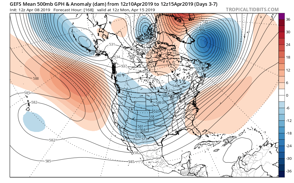
GFS Ensembles showing a continued active storm track from the Central US and into the Northeast over the next 7 days
Thanks for reading and have a great night!
Make sure to follow us on Twitter @nymetrowx for updates!
-Steve Copertino
Trackbacks & Pingbacks
3devising
Leave a Reply
Want to join the discussion?Feel free to contribute!