-2")
Showers continue tonight, unsettled weekend ahead
Good evening and happy Friday!
Multiple periods of rain are likely over the next few days as a series of storm systems move across the country.
Today has been yet another in a series of fickle early Spring days as the low pressure area that affected the Plains with blizzard conditions moved off into the Great Lakes. Mostly cloudy skies were prevalent this morning and early afternoon despite the main frontal system remaining off to our west. Some pockets of drier air were able to thin out the cloud cover a bit as the day went on which allowed some partly sunny skies to develop. Despite the persistent cloud cover, highs were somewhat above normal today for the area with temperatures in the middle to upper 60’s.
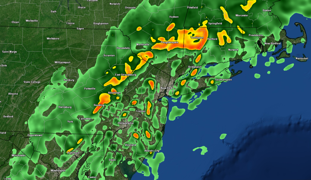
A warm front is currently moving across the area, with some occasional light showers and drizzle. Additionally, temps have also risen a few degrees into the middle to upper 60’s with the frontal passage. Much of the same is expected into the late evening with periods of light rain and drizzle moving through the area. An impressive moisture feed with ties to the Gulf of Mexico should move into the Northeast later tonight as the frontal system sits just off to our east. This will likely promote the development of areas of moderate to heavy rain right around midnight.
Given the weakly unstable airmass in place, there could be a few rumbles of thunder with some of the heavier areas of precip. Rainfall totals will likely wind up in the half-inch to three quarters of an inch range, but localized rainfall may approach or exceed one inch in some of the heaviest activity. Temperatures look to stay quite mild tonight with lows only getting down into the middle to upper 50’s for the entire forecast area.
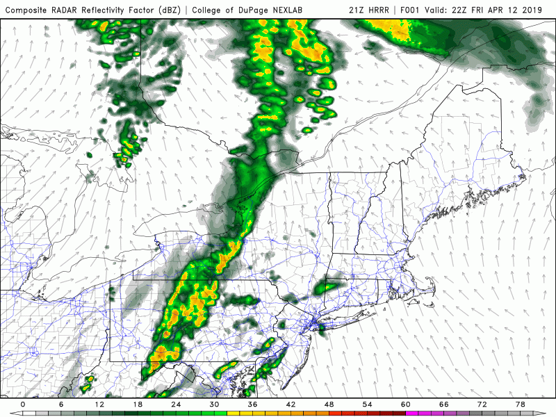
This evening’s HRRR model showing heavy showers and possibly some embedded thunderstorms moving into the area after midnight
Mild but unsettled conditions remain in place for this weekend
Tomorrow (Saturday) looks to start off quite cloudy with some showers possible as the frontal system remains draped just off to our east. Deep southwesterly flow will remain in place during the morning and afternoon hours tomorrow, providing a rather warm mid level airmass. Highs tomorrow will be highly dependent on how much cloud cover can let up over the area during peak heating hours. Temperatures should easily reach into the middle to upper 70’s likely for much of the metro area. Somewhat cooler highs will be likely over portions of Long Island where cloud cover looks to hold on the longest.
A cold front looks to sweep across the Northeast tomorrow night, ushering in a *somewhat* cooler airmass. Mid levels will also dry out tomorrow night, possibly allowing for some radiational cooling to setup. These conditions should help temps to drop down into the upper 40’s to lower 50’s for overnight lows. Depending on the degree of cooling tomorrow night, there may be some patches of fog, especially for inland locations and over Long Island.
Another storm system will be cutting up to our west during the day on Sunday. As this system heads off to our west and evening northwest, most of the area will be placed within the “warm sector”. This will allow very strong mid level flow to overspread the entire area. The vast majority of the day on Sunday will likely remain mostly cloudy with periods of rain possible. Cloud cover will likely stifle temperatures during the day, but highs should be able to reach into the middle to upper 60’s.
Some more substantial and widespread shower activity is likely later in the day and into the evening hours of Sunday. Deep moisture and a relatively unstable airmass will be working into the area during this time, which may allow for some thunderstorms to develop. Given the exceedingly moist airmass, some of these heavier showers and storms may have a flash flood potential lasting into the overnight hours.
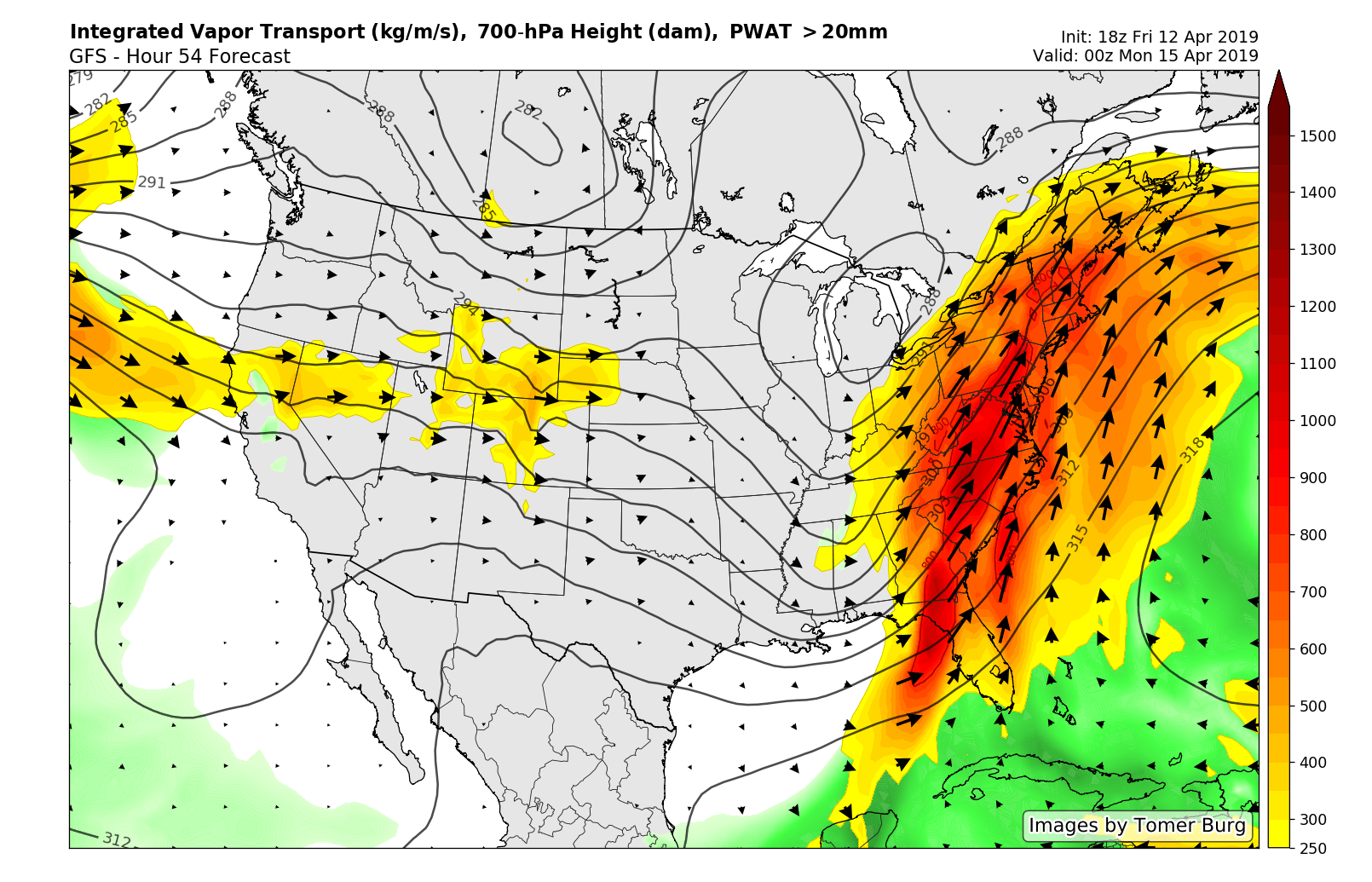
This evening’s GFS model showing a large and very impressive moisture plume overspreading the region on Sunday
We’ll have an update on Monday! Have a great weekend!
-Steve Copertino
Trackbacks & Pingbacks
3vicarage
Leave a Reply
Want to join the discussion?Feel free to contribute!