-2")
Conditions turn unsettled with heavy rain likely Friday night
Good evening!
The brief period of tranquil weather that has been present over the past two days looks to be coming to an end. A large upper level system will move into the Northeast by Friday, creating the potential for periods of heavy rain.
Today has been a welcomed day across much of the Northeast as mainly tranquil and dry conditions remain in control. A mid level ridge is currently sitting over the area, providing temperatures right around normal for this time of year. Highs have been generally in the middle to upper 50’s, with some lower 60’s over the immediate NYC area. Calm conditions are expected to prevail throughout the rest of this evening & into the overnight hours tonight. As time goes on, a warm front will be gradually lifting through the area after midnight, which will bring an increase in clouds. Some drizzle and /or light rain showers may be possible around 12-2am as some weak lift associated with the warm front passes through.
Finally, lows tonight will not have a chance to fall all that much thanks to the increased cloudiness from the warm front. Expect temps in the middle to upper 40’s for much of the area.
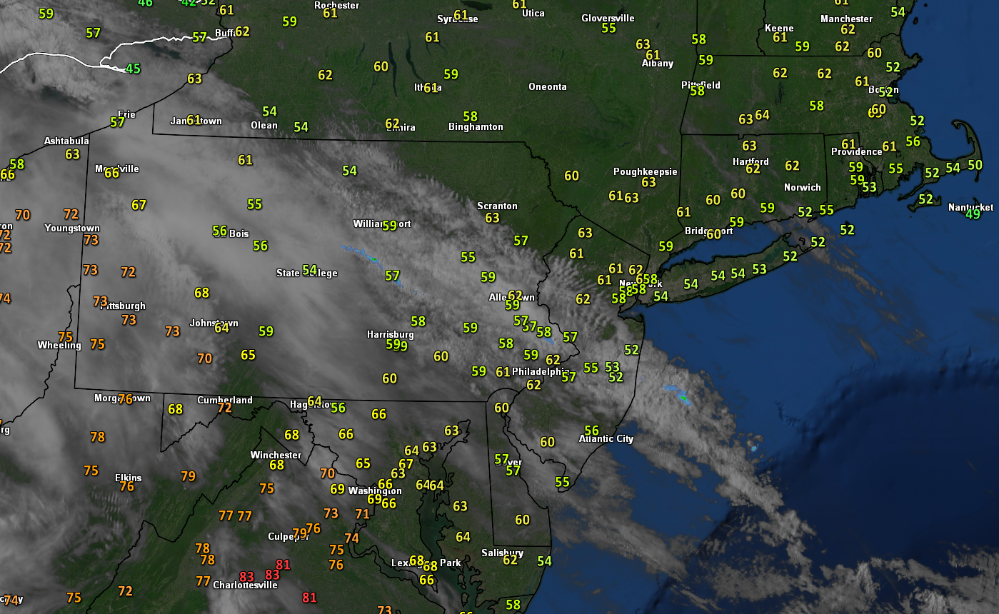
This evenings surface temperatures and regional satellite imagery showing calm conditions and seasonable temps over the Northeast
Conditions gradually turn more unsettled through Friday
Tomorrow (Thursday) will likely start off cool and rather cloudy as the aforementioned mid level ridge moves offshore. At the same time, a mid level disturbance will be moving through the Great Lakes. This will allow deep southwesterly flow to overspread much of the Mid-Atlantic and Northeast with a much more moist airmass. While the majority of the lift associated with this system will remain off to the west, some sporadic light showers will be possible across the area throughout the afternoon hours. Despite the abundance of clouds tomorrow, southwesterly winds will help filter in warmer air aloft. As such, expect highs to recover into the lower to middle 60’s for much of the area.
Drizzle and some sporadic showers will likely continue over the area for the evening/overnight hours as more moisture streams in. In addition to the showers, there will be a decent chance at some fog for portions of the metro area, especially if conditions remain moist/cloudy. Lows Thursday night will remain quite mild for this time of year, with lower to middle 50’s expected.
Heavy rain likely Friday night
Friday looks to turn even more unsettled as a large and deep upper-level trough digs into the Southeast US. This will allow for even more impressive moisture to stream north from the Gulf/Caribbean. Again, most of the support for any sustained rain activity will remain south and west of the area making periods of light to moderate showers possible. Very impressive southwesterly flow aloft will allow for warmer temperatures to move in during the afternoon hours despite extensive cloudiness. Highs will likely climb into the upper 60’s to lower 70’s Friday afternoon-which will be above normal.
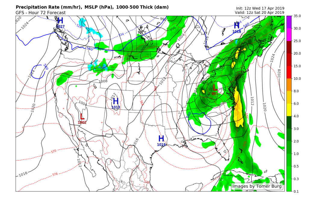
Finally, the large upper level system looks to move close enough to the region on Friday night to support the development of steady rainfall. Very deep moisture, strong forcing, and a very impressive mid-level jet will support a period of heavy rain for the NYC area as we head into the late evening and overnight hours. Additionally, there may even be some embedded thunderstorms that move through the Mid-Atlantic states and into southern portions of the NYC metro area. Some strong/gusty winds will be possible with the strongest showers/storms due to the impressive mid-level jet. While it is a bit early, there is the potential for some flooding to take place very late Friday and into the early morning hours of Saturday. At this time, the threat for flooding is greatest for urban areas with poor drainage.
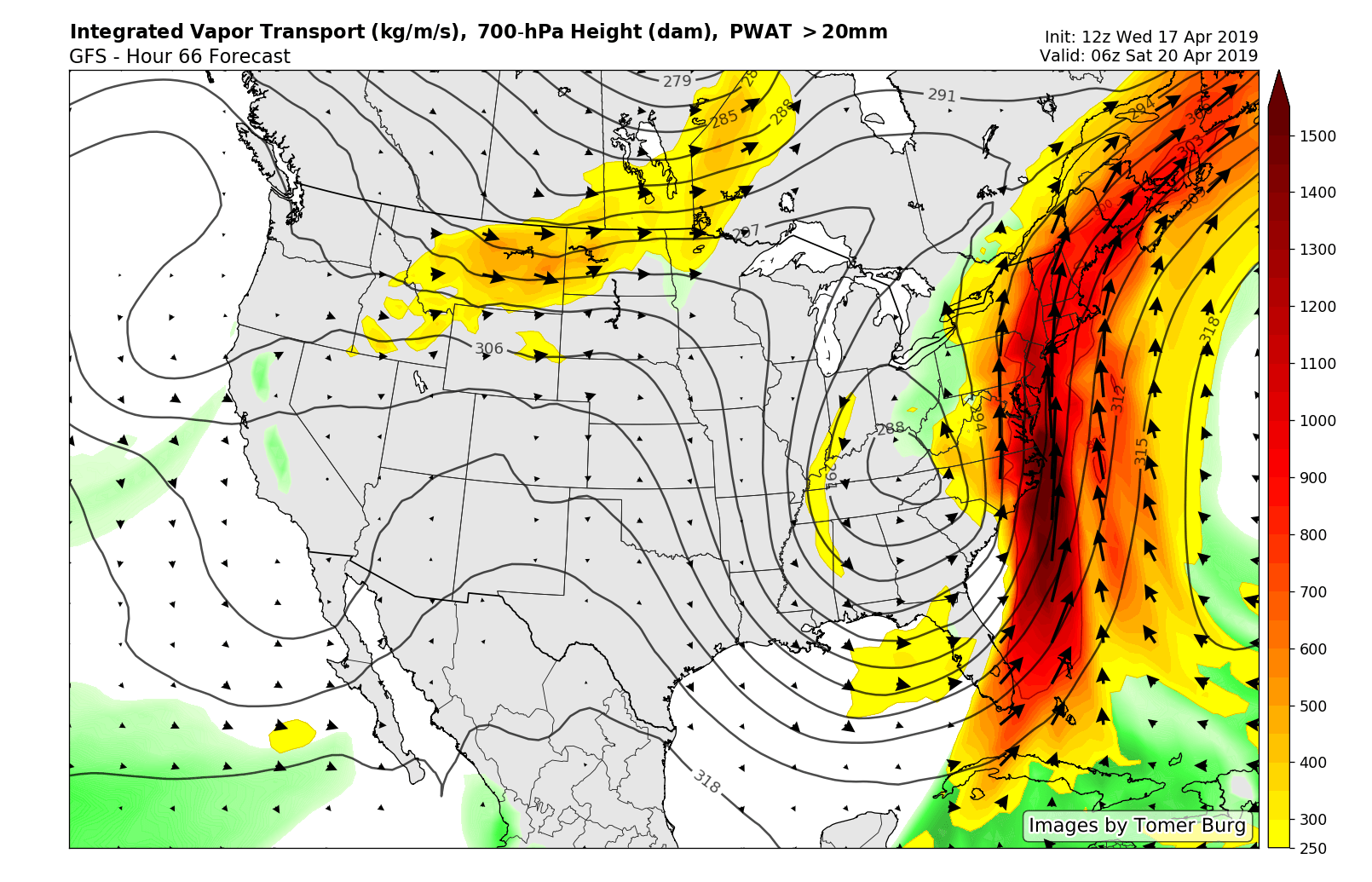
This evening’s GFS model showing a very impressive moisture plume setting up over much of the East on Friday night
Rain and some showers likely to linger into Sunday
Periods of moderate to potentially heavy rain will be possible into the early morning hours of Saturday as the upper level systems remains to the southwest. Some gradually improving conditions appear possible later in the day as the main moisture plume shifts off to the east. Nonetheless, there will still be a decent chance of some showers during the remainder of the day as the upper level low slowly moves over the Mid-Atlantic states. This cutoff low is then likely to move directly over the NYC area during the day on Sunday, providing at least a chance at of some more showers throughout the day. Highs on both days look to stay right around normal, with temps in the lower to middle 60’s.
Conditions look to finally turn more clear and warm as the upper level low finally kicks out of the region by Monday morning!
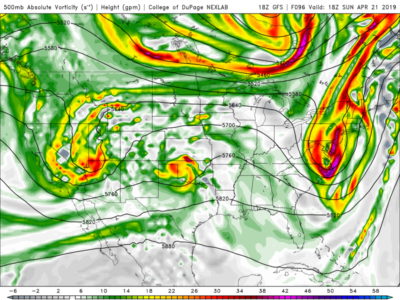
GFS model showing the cutoff upper level system lingering over portions of the Northeast during the day on Sunday
We’ll have an update on the heavy rain threat as well as this weekend’s forecast on Friday!
Have a great night!
-Steve Copertino
Trackbacks & Pingbacks
2related
Leave a Reply
Want to join the discussion?Feel free to contribute!